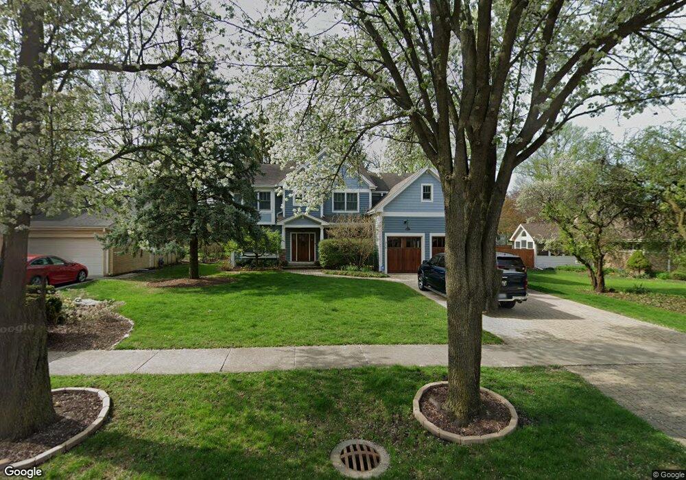
914 Arbor Ave Wheaton, IL 60189
West Wheaton NeighborhoodEstimated Value: $930,289 - $1,073,000
4
Beds
4
Baths
3,510
Sq Ft
$281/Sq Ft
Est. Value
About This Home
This home is located at 914 Arbor Ave, Wheaton, IL 60189 and is currently estimated at $984,822, approximately $280 per square foot. 914 Arbor Ave is a home located in DuPage County with nearby schools including Madison Elementary School, Edison Middle School, and Wheaton Warrenville South High School.
Ownership History
Date
Name
Owned For
Owner Type
Purchase Details
Closed on
Nov 21, 2005
Sold by
S & K Development Llc
Bought by
Hart Edward K and Hart Gail A
Current Estimated Value
Home Financials for this Owner
Home Financials are based on the most recent Mortgage that was taken out on this home.
Original Mortgage
$250,000
Interest Rate
6.17%
Mortgage Type
Unknown
Purchase Details
Closed on
Aug 23, 2004
Sold by
Gentile Frank
Bought by
S & K Development
Home Financials for this Owner
Home Financials are based on the most recent Mortgage that was taken out on this home.
Original Mortgage
$220,000
Interest Rate
4.5%
Mortgage Type
Purchase Money Mortgage
Create a Home Valuation Report for This Property
The Home Valuation Report is an in-depth analysis detailing your home's value as well as a comparison with similar homes in the area
Home Values in the Area
Average Home Value in this Area
Purchase History
| Date | Buyer | Sale Price | Title Company |
|---|---|---|---|
| Hart Edward K | $870,000 | First American Title Ins Co | |
| S & K Development | $275,000 | Atg |
Source: Public Records
Mortgage History
| Date | Status | Borrower | Loan Amount |
|---|---|---|---|
| Previous Owner | Hart Edward K | $250,000 | |
| Previous Owner | Hart Edward K | $650,000 | |
| Previous Owner | S & K Development | $220,000 |
Source: Public Records
Tax History
| Year | Tax Paid | Tax Assessment Tax Assessment Total Assessment is a certain percentage of the fair market value that is determined by local assessors to be the total taxable value of land and additions on the property. | Land | Improvement |
|---|---|---|---|---|
| 2024 | $16,817 | $276,924 | $40,610 | $236,314 |
| 2023 | $16,145 | $254,900 | $37,380 | $217,520 |
| 2022 | $15,922 | $240,900 | $35,330 | $205,570 |
| 2021 | $15,866 | $235,180 | $34,490 | $200,690 |
| 2020 | $15,816 | $232,990 | $34,170 | $198,820 |
| 2019 | $17,508 | $255,550 | $33,270 | $222,280 |
| 2018 | $17,011 | $240,860 | $31,340 | $209,520 |
| 2017 | $19,919 | $274,390 | $30,180 | $244,210 |
| 2016 | $19,676 | $263,430 | $28,970 | $234,460 |
| 2015 | $19,552 | $251,320 | $27,640 | $223,680 |
| 2014 | $19,838 | $250,670 | $23,730 | $226,940 |
| 2013 | $19,326 | $251,420 | $23,800 | $227,620 |
Source: Public Records
Map
Nearby Homes
- 705 S Gables Blvd
- 1021 Greenwood Dr
- 1474 Timber Trail Unit D
- 1478 Timber Trail Unit 15C
- 536 W Evergreen St
- 1028 Lodalia Ct
- 1219 Golf Ln
- 615 Polo Dr
- 870 S Kilkenny Dr Unit D
- Lot 1 Foothill Dr
- 315 S Morgan Ave
- 921 James Ct
- 522 S West St
- 909 S Wheaton Ave
- 520 S Wheaton Ave
- 1519 Foothill Dr
- 100 N Gary Ave Unit 408
- 405 W Front St Unit 3207
- 1601 W Wiesbrook Rd
- 2043 Spring Green Dr
Your Personal Tour Guide
Ask me questions while you tour the home.