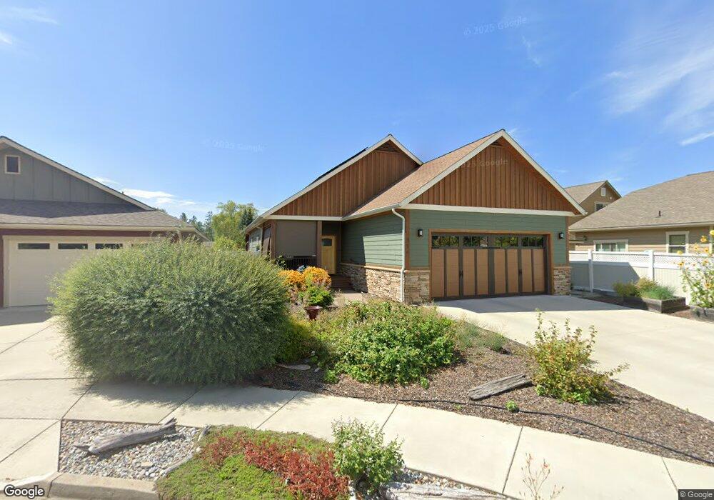
914 Cattail Ct Sandpoint, ID 83864
Estimated Value: $576,000 - $612,000
3
Beds
2
Baths
1,580
Sq Ft
$377/Sq Ft
Est. Value
About This Home
This home is located at 914 Cattail Ct, Sandpoint, ID 83864 and is currently estimated at $595,686, approximately $377 per square foot. 914 Cattail Ct is a home with nearby schools including Washington Elementary School, Sandpoint Middle School, and Sandpoint High School.
Ownership History
Date
Name
Owned For
Owner Type
Purchase Details
Closed on
Aug 14, 2025
Sold by
Defremery Elizabeth A
Bought by
Defremery Elizabeth A and Tighe Brian T
Current Estimated Value
Purchase Details
Closed on
Jul 23, 2018
Sold by
Tighe Brian T
Bought by
Defremery Elizabeth A
Purchase Details
Closed on
Aug 8, 2017
Sold by
Moore Charesse
Bought by
Tighe Brian T and Defremery Elizabeth A
Purchase Details
Closed on
Mar 10, 2014
Sold by
Lake Town Investments Llc
Bought by
Moore Charesse
Create a Home Valuation Report for This Property
The Home Valuation Report is an in-depth analysis detailing your home's value as well as a comparison with similar homes in the area
Home Values in the Area
Average Home Value in this Area
Purchase History
| Date | Buyer | Sale Price | Title Company |
|---|---|---|---|
| Defremery Elizabeth A | -- | None Listed On Document | |
| Defremery Elizabeth A | -- | North Idaho Title Co | |
| Tighe Brian T | -- | North Idaho Title Ocmpany Sa | |
| Moore Charesse | -- | North Idaho Title Co |
Source: Public Records
Tax History
| Year | Tax Paid | Tax Assessment Tax Assessment Total Assessment is a certain percentage of the fair market value that is determined by local assessors to be the total taxable value of land and additions on the property. | Land | Improvement |
|---|---|---|---|---|
| 2025 | $3,097 | $647,610 | $236,420 | $411,190 |
| 2024 | $3,743 | $674,377 | $258,337 | $416,040 |
| 2023 | $2,981 | $672,705 | $258,337 | $414,368 |
| 2022 | $3,855 | $647,551 | $271,017 | $376,534 |
| 2021 | $3,176 | $410,782 | $160,360 | $250,422 |
| 2020 | $2,993 | $374,134 | $127,315 | $246,819 |
| 2019 | $1,243 | $103,928 | $103,928 | $0 |
| 2018 | $1,139 | $103,928 | $103,928 | $0 |
| 2017 | $1,139 | $90,491 | $0 | $0 |
| 2016 | $1,037 | $78,698 | $0 | $0 |
| 2015 | -- | $78,698 | $0 | $0 |
| 2014 | -- | $56,331 | $0 | $0 |
Source: Public Records
Map
Nearby Homes
- 1004 Park Ave
- 704 S Merton Ave
- 141 Madera Dr
- 509 S Olive Ave
- 424 S Olive Ave Unit 303
- 424 S Olive Ave Unit 203
- 436 S Lavina Ave
- 316 S Lavina Ave
- 1509 Cedar St
- 724 Pine St
- 1623 Gondola Ct
- 1619 Gondola Ct
- 215 N Forest Ave
- 1607 Gondola Ct
- 513 N Division Ave
- 417 Pine St
- 311 S Third Ave
- 215 Lake St W
- 503 Cedar St
- 503 Cedar St Unit 203
- 918 Cattail Ct
- 1521 River Rock Rd
- 1515 River Rock Rd
- 922 Cattail Ct
- 913 Cattail Ct
- 1717 Northshore Dr
- 1715 Northshore Dr
- 917 Cattail Ct
- 917 Cattail Ct Unit Maplewood Village
- 1505 River Rock Rd
- 921 Cattail Ct
- 1516 River Rock Rd
- 1520 River Rock Rd
- 1719 Northshore Dr
- 1713 Northshore Dr
- 1512 River Rock Rd
- 1501 River Rock Rd
- 1508 River Rock Rd
- 1425 River Rock Rd
- 1422 J r Ct