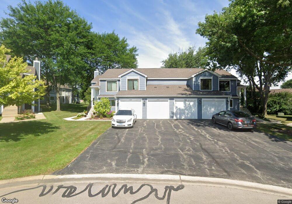
914 Manchester Cir Unit 92A Schaumburg, IL 60193
South Schaumburg NeighborhoodEstimated Value: $277,655 - $301,000
2
Beds
--
Bath
1,200
Sq Ft
$243/Sq Ft
Est. Value
About This Home
This home is located at 914 Manchester Cir Unit 92A, Schaumburg, IL 60193 and is currently estimated at $291,164, approximately $242 per square foot. 914 Manchester Cir Unit 92A is a home located in Cook County with nearby schools including Michael Collins Elementary School, Robert Frost Junior High School, and J B Conant High School.
Ownership History
Date
Name
Owned For
Owner Type
Purchase Details
Closed on
Sep 15, 1999
Sold by
Portincaso Nancy F
Bought by
Acheson Jeanne M
Current Estimated Value
Home Financials for this Owner
Home Financials are based on the most recent Mortgage that was taken out on this home.
Original Mortgage
$117,800
Outstanding Balance
$35,970
Interest Rate
8.21%
Estimated Equity
$255,194
Purchase Details
Closed on
Feb 26, 1998
Sold by
Doss William D and Doss Laurie E
Bought by
Portincaso Nancy F
Home Financials for this Owner
Home Financials are based on the most recent Mortgage that was taken out on this home.
Original Mortgage
$93,200
Interest Rate
7.08%
Purchase Details
Closed on
Mar 29, 1996
Sold by
Elkin Rosalie E
Bought by
Doss William D and Kamaryt Laurie E
Home Financials for this Owner
Home Financials are based on the most recent Mortgage that was taken out on this home.
Original Mortgage
$104,000
Interest Rate
6.6%
Create a Home Valuation Report for This Property
The Home Valuation Report is an in-depth analysis detailing your home's value as well as a comparison with similar homes in the area
Home Values in the Area
Average Home Value in this Area
Purchase History
| Date | Buyer | Sale Price | Title Company |
|---|---|---|---|
| Acheson Jeanne M | $127,000 | -- | |
| Portincaso Nancy F | $116,500 | -- | |
| Doss William D | $110,000 | Chicago Title Insurance Co |
Source: Public Records
Mortgage History
| Date | Status | Borrower | Loan Amount |
|---|---|---|---|
| Open | Acheson Jeanne M | $117,800 | |
| Previous Owner | Portincaso Nancy F | $93,200 | |
| Previous Owner | Doss William D | $104,000 |
Source: Public Records
Tax History Compared to Growth
Tax History
| Year | Tax Paid | Tax Assessment Tax Assessment Total Assessment is a certain percentage of the fair market value that is determined by local assessors to be the total taxable value of land and additions on the property. | Land | Improvement |
|---|---|---|---|---|
| 2024 | $4,645 | $19,900 | $4,663 | $15,237 |
| 2023 | $4,476 | $19,900 | $4,663 | $15,237 |
| 2022 | $4,476 | $19,900 | $4,663 | $15,237 |
| 2021 | $3,849 | $16,029 | $2,543 | $13,486 |
| 2020 | $3,851 | $16,029 | $2,543 | $13,486 |
| 2019 | $3,855 | $17,810 | $2,543 | $15,267 |
| 2018 | $2,682 | $12,371 | $2,119 | $10,252 |
| 2017 | $2,657 | $12,371 | $2,119 | $10,252 |
| 2016 | $2,727 | $12,371 | $2,119 | $10,252 |
| 2015 | $2,505 | $10,998 | $1,907 | $9,091 |
| 2014 | $2,494 | $10,998 | $1,907 | $9,091 |
| 2013 | $2,413 | $10,998 | $1,907 | $9,091 |
Source: Public Records
Map
Nearby Homes
- 126 Manchester Ct Unit 61B
- 916 Manchester Cir Unit 91A
- 36 Shore Dr
- 205 Nantucket Harbor Unit 104
- 1100 Boston Harbor Unit 7004
- 421 E Wise Rd
- 426 E Niagara Ave
- 733 Limerick Ln Unit 7333D
- 711 Tipperary Ct Unit 2D
- 712 Tipperary Ct Unit 1C
- 124 E Monterey Ave
- 727 Killarney Ct Unit 1C
- 631 Derry Ct Unit 3C
- 635 Limerick Ln Unit 2B
- 614 Tralee Ct Unit 2-C
- 718 N Point Dr
- 553 Stone Gate Cir
- 421 Summit Dr
- 620 S Point Dr
- 722 Merlin Dr Unit 16
- 910 Manchester Cir Unit 91B
- 912 Manchester Cir Unit 92B
- 920 Manchester Cir Unit 81B
- 903 Manchester Cir Unit 102A
- 922 Manchester Cir Unit 82B
- 926 Manchester Cir Unit 81A
- 926 Manchester Cir Unit 926
- 924 Manchester Cir Unit 82A
- 924 Manchester Cir Unit 1
- 901 Manchester Cir Unit 101A
- 124 Manchester Ct Unit 62B
- 907 Manchester Cir Unit 101B
- 905 Manchester Cir Unit 102B
- 229 Kingsport Dr
- 225 Kingsport Dr
- 233 Kingsport Dr
- 120 Manchester Ct Unit 61A
- 122 Manchester Ct Unit 62A
- 130 Manchester Ct Unit 71A
- 130 Manchester Ct Unit 130