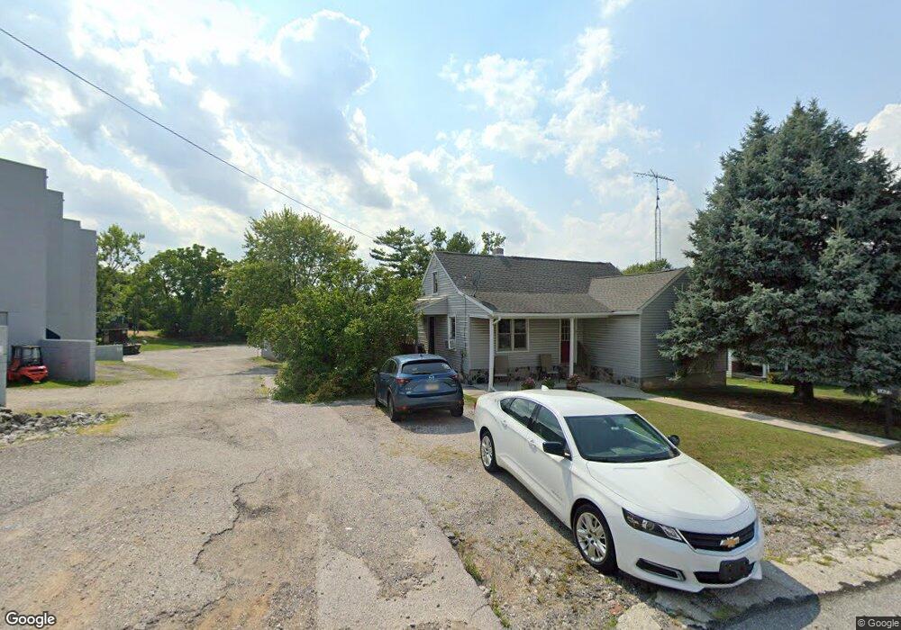
914 Mcallister St Hanover, PA 17331
Estimated Value: $167,000 - $243,000
3
Beds
1
Bath
1,040
Sq Ft
$196/Sq Ft
Est. Value
About This Home
This home is located at 914 Mcallister St, Hanover, PA 17331 and is currently estimated at $203,425, approximately $195 per square foot. 914 Mcallister St is a home with nearby schools including South Western Senior High School and St Joseph Catholic School.
Ownership History
Date
Name
Owned For
Owner Type
Purchase Details
Closed on
Dec 18, 2017
Sold by
Hawk Jeffrey Alan and Hawk Belinda Ann
Bought by
Conrad Michael T
Current Estimated Value
Home Financials for this Owner
Home Financials are based on the most recent Mortgage that was taken out on this home.
Original Mortgage
$111,443
Interest Rate
4.46%
Mortgage Type
FHA
Purchase Details
Closed on
Dec 20, 2016
Sold by
The Secertaty Of Hud
Bought by
Hawk Jeffrey Alan and Hawk Belinda Ann
Purchase Details
Closed on
Nov 25, 2015
Sold by
Wells Fargo Bank Na
Bought by
Secretary Of Housing And Urban Developme
Purchase Details
Closed on
Nov 13, 2013
Sold by
Secretary Of Hud
Bought by
Wells Fargo Bank Na
Purchase Details
Closed on
Apr 10, 2013
Sold by
Wells Fargo Bank Na
Bought by
Secretary Of Hud
Purchase Details
Closed on
Mar 8, 2013
Sold by
Warring Robert L
Bought by
Wells Fargo Bank Nc
Create a Home Valuation Report for This Property
The Home Valuation Report is an in-depth analysis detailing your home's value as well as a comparison with similar homes in the area
Home Values in the Area
Average Home Value in this Area
Purchase History
| Date | Buyer | Sale Price | Title Company |
|---|---|---|---|
| Conrad Michael T | $113,500 | None Available | |
| Hawk Jeffrey Alan | $68,000 | None Available | |
| Secretary Of Housing And Urban Developme | -- | None Available | |
| Wells Fargo Bank Na | -- | None Available | |
| Secretary Of Hud | -- | None Available | |
| Wells Fargo Bank Nc | $1,950 | None Available |
Source: Public Records
Mortgage History
| Date | Status | Borrower | Loan Amount |
|---|---|---|---|
| Previous Owner | Conrad Michael T | $111,443 |
Source: Public Records
Tax History Compared to Growth
Tax History
| Year | Tax Paid | Tax Assessment Tax Assessment Total Assessment is a certain percentage of the fair market value that is determined by local assessors to be the total taxable value of land and additions on the property. | Land | Improvement |
|---|---|---|---|---|
| 2025 | $3,209 | $95,220 | $26,700 | $68,520 |
| 2024 | $3,209 | $95,220 | $26,700 | $68,520 |
| 2023 | $3,152 | $95,220 | $26,700 | $68,520 |
| 2022 | $3,084 | $95,220 | $26,700 | $68,520 |
| 2021 | $2,916 | $95,220 | $26,700 | $68,520 |
| 2020 | $2,916 | $95,220 | $26,700 | $68,520 |
| 2019 | $2,859 | $95,220 | $26,700 | $68,520 |
| 2018 | $2,822 | $95,220 | $26,700 | $68,520 |
| 2017 | $2,757 | $95,220 | $26,700 | $68,520 |
| 2016 | $0 | $95,220 | $26,700 | $68,520 |
| 2015 | -- | $95,220 | $26,700 | $68,520 |
| 2014 | -- | $95,220 | $26,700 | $68,520 |
Source: Public Records
Map
Nearby Homes
- 0 Baltimore St Unit 16 PAYK2079352
- 832 Baltimore St
- 45 Bowman Rd
- 101 Granbury Crossing Unit 129
- 100 Stonewicke Dr Unit 88
- 104 Stonewicke Dr Unit 86
- 405 Ripple Dr Unit 57
- 1280 Maple Ln Unit 10
- 420 Ripple Dr Unit 54
- 400 Wirt Ave
- 430 Ripple Dr Unit 53
- 445 Ripple Dr Unit 61
- 1202 Baltimore St
- 115 Stonewicke Dr Unit 96
- 49 Red Rock Run
- 440 Ripple Dr Unit 52
- 1240 Maple Ln Unit 14
- 1 Little Way Unit 79
- 430 Clover Ln
- 6 Little Way Unit 64
- 912 Baltimore St
- 1627 Baer Ave
- 1619 Baer Ave
- 1621 Baer Ave
- 1623 Baer Ave
- 12 Black Rock Rd
- 908 Baltimore St
- 1617 Baer Ave
- 1617 Baer Ave
- 1617 Baer Ave
- 920 Baltimore St
- 900 Baltimore St
- 916 Baltimore St
- 914 Baltimore St
- 26 Black Rock Rd
- Lot 10 Black Rock Road (Lot10)
- 2 Black Rock Rd
- 1613 Baer Ave
- 0 Black Rock Rd Unit 12 21600880
- lot 12 Black Rock Rd