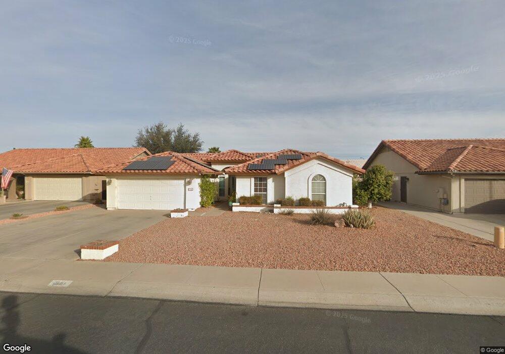
9140 W Watson Ln Peoria, AZ 85381
Estimated Value: $449,243 - $531,000
4
Beds
2
Baths
2,052
Sq Ft
$241/Sq Ft
Est. Value
About This Home
This home is located at 9140 W Watson Ln, Peoria, AZ 85381 and is currently estimated at $494,811, approximately $241 per square foot. 9140 W Watson Ln is a home located in Maricopa County with nearby schools including Desert Harbor Elementary School, Centennial High School, and Sonoran Science Academy-Peoria.
Ownership History
Date
Name
Owned For
Owner Type
Purchase Details
Closed on
Sep 23, 2010
Sold by
Johnson Michael M
Bought by
Johnson Michael M and Sears Jennifer E
Current Estimated Value
Purchase Details
Closed on
Jun 10, 2008
Sold by
Klimas Michael J and Klimas Heather A
Bought by
Johnson Dr Michael M
Home Financials for this Owner
Home Financials are based on the most recent Mortgage that was taken out on this home.
Original Mortgage
$160,000
Outstanding Balance
$102,409
Interest Rate
6%
Mortgage Type
New Conventional
Estimated Equity
$392,402
Purchase Details
Closed on
May 21, 2001
Sold by
Webb Richard P and Webb Susan J
Bought by
Klimas Michael J and Klimas Heather A
Home Financials for this Owner
Home Financials are based on the most recent Mortgage that was taken out on this home.
Original Mortgage
$102,500
Interest Rate
7.15%
Mortgage Type
New Conventional
Create a Home Valuation Report for This Property
The Home Valuation Report is an in-depth analysis detailing your home's value as well as a comparison with similar homes in the area
Home Values in the Area
Average Home Value in this Area
Purchase History
| Date | Buyer | Sale Price | Title Company |
|---|---|---|---|
| Johnson Michael M | -- | None Available | |
| Johnson Dr Michael M | $260,000 | First American Title Ins Co | |
| Klimas Michael J | $160,000 | Stewart Title & Trust |
Source: Public Records
Mortgage History
| Date | Status | Borrower | Loan Amount |
|---|---|---|---|
| Open | Johnson Dr Michael M | $160,000 | |
| Previous Owner | Klimas Michael J | $102,500 |
Source: Public Records
Tax History Compared to Growth
Tax History
| Year | Tax Paid | Tax Assessment Tax Assessment Total Assessment is a certain percentage of the fair market value that is determined by local assessors to be the total taxable value of land and additions on the property. | Land | Improvement |
|---|---|---|---|---|
| 2025 | $1,561 | $20,620 | -- | -- |
| 2024 | $1,581 | $19,638 | -- | -- |
| 2023 | $1,581 | $33,580 | $6,710 | $26,870 |
| 2022 | $1,548 | $25,350 | $5,070 | $20,280 |
| 2021 | $1,658 | $23,110 | $4,620 | $18,490 |
| 2020 | $1,673 | $22,370 | $4,470 | $17,900 |
| 2019 | $1,619 | $20,080 | $4,010 | $16,070 |
| 2018 | $1,565 | $19,000 | $3,800 | $15,200 |
| 2017 | $1,566 | $17,510 | $3,500 | $14,010 |
| 2016 | $1,550 | $16,650 | $3,330 | $13,320 |
| 2015 | $1,447 | $16,130 | $3,220 | $12,910 |
Source: Public Records
Map
Nearby Homes
- 14407 N 75th Dr
- 14429 N 75th Dr
- 14566 N 90th Ln
- 9169 W Lisbon Ln
- 14610 N Bolivar Dr
- 9150 W Banff Ln
- 14217 N Bolivar Dr
- 14816 N 90th Ave
- 14433 N Cameo Dr
- 9405 W Rolling Hills Dr
- 9056 W Port Royale Ln
- 9413 W Raintree Dr
- 8849 W Port Royale Ln
- 9420 W Shiprock Dr Unit 25
- 9325 W Arrowhead Dr
- 9429 W Rolling Hills Dr
- 14618 N Shiprock Dr
- 9434 W Raintree Dr
- 9430 W Arrowhead Dr
- 14548 N 87th Ave
- 9134 W Watson Ln
- 9146 W Watson Ln
- 9139 W Crocus Dr
- 9133 W Crocus Dr
- 9145 W Crocus Dr
- 9139 W Watson Ln
- 9152 W Watson Ln
- 9151 W Crocus Dr
- 9133 W Watson Ln
- 9145 W Watson Ln
- 9158 W Watson Ln
- 14235 N 91st Ln
- 14245 N 91st Ln
- 9151 W Watson Ln
- 9157 W Crocus Dr
- 14255 N 91st Ln
- 9121 W Watson Ln
- 9140 W Crocus Dr
- 9134 W Crocus Dr
- 9146 W Crocus Dr