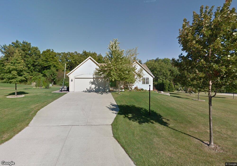
9148 S 47th St Franklin, WI 53132
Estimated Value: $478,000 - $582,000
3
Beds
2
Baths
1,824
Sq Ft
$297/Sq Ft
Est. Value
About This Home
This home is located at 9148 S 47th St, Franklin, WI 53132 and is currently estimated at $540,990, approximately $296 per square foot. 9148 S 47th St is a home located in Milwaukee County with nearby schools including Southwood Glen Elementary School, Forest Park Middle School, and Franklin High School.
Ownership History
Date
Name
Owned For
Owner Type
Purchase Details
Closed on
Jun 11, 2020
Sold by
Guenther Dale P and Guenther Mary Jo
Bought by
Guenther Dale P and Guenther Mary Jo
Current Estimated Value
Purchase Details
Closed on
Sep 29, 2017
Sold by
Hanning Harold and Hanning Natale
Bought by
Guenther Dale P and Guenther Mary J
Home Financials for this Owner
Home Financials are based on the most recent Mortgage that was taken out on this home.
Original Mortgage
$265,500
Outstanding Balance
$222,182
Interest Rate
3.89%
Mortgage Type
New Conventional
Estimated Equity
$318,808
Create a Home Valuation Report for This Property
The Home Valuation Report is an in-depth analysis detailing your home's value as well as a comparison with similar homes in the area
Home Values in the Area
Average Home Value in this Area
Purchase History
| Date | Buyer | Sale Price | Title Company |
|---|---|---|---|
| Guenther Dale P | -- | None Available | |
| Guenther Dale P | $321,500 | None Available |
Source: Public Records
Mortgage History
| Date | Status | Borrower | Loan Amount |
|---|---|---|---|
| Open | Guenther Dale P | $265,500 |
Source: Public Records
Tax History Compared to Growth
Tax History
| Year | Tax Paid | Tax Assessment Tax Assessment Total Assessment is a certain percentage of the fair market value that is determined by local assessors to be the total taxable value of land and additions on the property. | Land | Improvement |
|---|---|---|---|---|
| 2024 | $3,818 | -- | -- | -- |
| 2023 | $7,056 | $447,200 | $77,400 | $369,800 |
| 2022 | $7,221 | $379,300 | $77,400 | $301,900 |
| 2021 | $7,114 | $345,700 | $72,800 | $272,900 |
| 2020 | $7,143 | $0 | $0 | $0 |
| 2019 | $8,375 | $347,600 | $72,800 | $274,800 |
| 2018 | $7,059 | $0 | $0 | $0 |
| 2017 | $7,867 | $310,200 | $72,800 | $237,400 |
| 2015 | -- | $266,600 | $67,100 | $199,500 |
| 2013 | -- | $266,600 | $67,100 | $199,500 |
Source: Public Records
Map
Nearby Homes
- 4562 W Martinton Ct
- 9233 S 51st St Unit 207
- 9285 S 51st St Unit 703
- 9271 S 51st St Unit 604
- 8836 S Buckhorn Grove Way
- 9388 S 43rd St
- 3830 W Southland Dr
- 3543 W Hilltop Ln
- 4700 W Hunting Park Dr
- 3121 W Southwood Dr
- 3015 W Thorncrest Dr
- 3426 W Links Dr
- 3091 W Yorkshire Cir
- PCL3 S 29th St
- 9438 S 29th St
- 5726 W Cascade Dr
- 7775 S 31st St
- 8920 S 27th St
- 8424 S River Terrace Dr
- 2925 W Acre Ave
- 9147 S 47th St
- 9130 S 47th St
- 9166 S 47th St
- 9125 S 47th St
- 9112 S 47th St
- 9184 S 47th St
- 9183 S 47th St
- 4780 W Thorncrest Dr
- 4656 W Hilltop Ln
- 4628 W Hilltop Ln
- 4804 W Thorncrest Dr
- 9161 S 46th St
- 4604 W Thorncrest Dr
- 9209 S 47th St
- 9208 S 47th St
- 9121 S 46th St
- 4717 W Hilltop Ln
- 4604 W Hilltop Ln
- 9110 S 46th St
- 9180 S 46th St