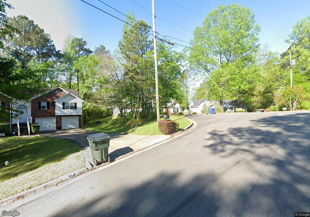
9149 Tara Ln SW Covington, GA 30014
Estimated Value: $230,000 - $253,000
Studio
2
Baths
1,403
Sq Ft
$170/Sq Ft
Est. Value
About This Home
This home is located at 9149 Tara Ln SW, Covington, GA 30014 and is currently estimated at $238,204, approximately $169 per square foot. 9149 Tara Ln SW is a home located in Newton County with nearby schools including Porterdale Elementary School, Clements Middle School, and Newton High School.
Ownership History
Date
Name
Owned For
Owner Type
Purchase Details
Closed on
May 7, 2002
Sold by
Barnes Richelle V and Barnes Richard
Bought by
Stone Tommi L
Current Estimated Value
Home Financials for this Owner
Home Financials are based on the most recent Mortgage that was taken out on this home.
Original Mortgage
$111,314
Outstanding Balance
$46,417
Interest Rate
7.18%
Mortgage Type
FHA
Estimated Equity
$191,787
Purchase Details
Closed on
Sep 22, 1995
Sold by
Slaughter Construction Co
Bought by
Barnes Richelle V Richard
Create a Home Valuation Report for This Property
The Home Valuation Report is an in-depth analysis detailing your home's value as well as a comparison with similar homes in the area
Home Values in the Area
Average Home Value in this Area
Purchase History
| Date | Buyer | Sale Price | Title Company |
|---|---|---|---|
| Stone Tommi L | $112,900 | -- | |
| Barnes Richelle V Richard | $83,300 | -- |
Source: Public Records
Mortgage History
| Date | Status | Borrower | Loan Amount |
|---|---|---|---|
| Open | Stone Tommi L | $111,314 |
Source: Public Records
Tax History
| Year | Tax Paid | Tax Assessment Tax Assessment Total Assessment is a certain percentage of the fair market value that is determined by local assessors to be the total taxable value of land and additions on the property. | Land | Improvement |
|---|---|---|---|---|
| 2025 | $1,522 | $87,880 | $17,600 | $70,280 |
| 2024 | $2,603 | $91,360 | $17,600 | $73,760 |
| 2023 | $2,232 | $73,840 | $8,800 | $65,040 |
| 2022 | $2,041 | $62,800 | $8,800 | $54,000 |
| 2021 | $1,949 | $53,680 | $8,800 | $44,880 |
| 2020 | $1,832 | $45,920 | $8,800 | $37,120 |
| 2019 | $1,693 | $41,680 | $8,800 | $32,880 |
| 2018 | $1,696 | $41,280 | $7,800 | $33,480 |
| 2017 | $1,334 | $35,720 | $7,800 | $27,920 |
| 2016 | $945 | $26,240 | $2,800 | $23,440 |
| 2015 | $995 | $27,440 | $2,800 | $24,640 |
| 2014 | $997 | $27,440 | $0 | $0 |
Source: Public Records
Map
Nearby Homes
- 0 Brown Bridge Rd Unit 10665499
- 0 Brown Bridge Rd Unit 7723601
- 0 Brown Bridge Rd Unit 7698870
- 9004 Jim Purcell Dr
- 9185 Melody Cir SW
- 9010 Jim Purcell Dr
- 10151 Benton Woods Dr
- 10166 Benton Woods Dr
- 13905 Brown Bridge Rd
- 12109 Brown Bridge Rd
- 12103 Brown Bridge Rd
- 9213 Westview Dr SW
- 7167 Brown Bridge Rd
- 90 Waters Edge Ln
- 80 Riverstone Dr
- 8150 Lakeview Dr SW
- 10161 N Dinah Cir
- 8196 Lakeview Dr SW
- 9178 Lakeview Dr SW
- 163 Kingfisher Walk
- 9153 Tara Ln SW
- 9569 Brown Bridge Rd
- 9141 Tara Ln SW
- 0 Brown Bridge Rd Unit 22917126
- 0 Brown Bridge Rd Unit 7531198
- 0 Brown Bridge Rd Unit 7508259
- 0 Brown Bridge Rd Unit 10439221
- 0 Brown Bridge Rd Unit 20141535
- 0 Brown Bridge Rd Unit 18 7346879
- 0 Brown Bridge Rd Unit 18 7050839
- 0 Brown Bridge Rd Unit 9054429
- 0 Brown Bridge Rd Unit 9016663
- 0 Brown Bridge Rd Unit 6912848
- 0 Brown Bridge Rd Unit 8275226
- 0 Brown Bridge Rd Unit 8429179
- 0 Brown Bridge Rd Unit 8536136
- TBD Brown Bridge Rd
- 0 Brown Bridge Rd Unit 8693744
- 0 Brown Bridge Rd Unit 8668908
- 9161 Scarlett Dr SW
Your Personal Tour Guide
Ask me questions while you tour the home.