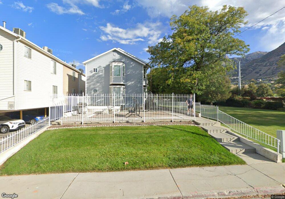
915 E 820 N Provo, UT 84606
Foot Hills NeighborhoodEstimated Value: $224,000 - $244,000
1
Bed
1
Bath
515
Sq Ft
$458/Sq Ft
Est. Value
About This Home
This home is located at 915 E 820 N, Provo, UT 84606 and is currently estimated at $236,016, approximately $458 per square foot. 915 E 820 N is a home located in Utah County with nearby schools including Wasatch Elementary School, Centennial Middle School, and Timpview High School.
Ownership History
Date
Name
Owned For
Owner Type
Purchase Details
Closed on
Feb 5, 2026
Sold by
Nantucket 24 Llc
Bought by
Tygee Valley Ranch Llc
Current Estimated Value
Purchase Details
Closed on
May 26, 2010
Sold by
Mueller Properties Llc
Bought by
Nantucket 24 Llc
Purchase Details
Closed on
Feb 14, 2007
Sold by
Mueller Mark and Mueller Alison
Bought by
Mueller Properties Llc
Purchase Details
Closed on
Sep 4, 1998
Sold by
Sybrowksy Lynne F
Bought by
Freestone Blaine S and Freestone Kristin J
Home Financials for this Owner
Home Financials are based on the most recent Mortgage that was taken out on this home.
Original Mortgage
$67,400
Interest Rate
6.89%
Mortgage Type
FHA
Create a Home Valuation Report for This Property
The Home Valuation Report is an in-depth analysis detailing your home's value as well as a comparison with similar homes in the area
Home Values in the Area
Average Home Value in this Area
Purchase History
| Date | Buyer | Sale Price | Title Company |
|---|---|---|---|
| Tygee Valley Ranch Llc | -- | Access Title | |
| Nantucket 24 Llc | -- | None Available | |
| Mueller Properties Llc | -- | None Available | |
| Freestone Blaine S | -- | First American Title |
Source: Public Records
Mortgage History
| Date | Status | Borrower | Loan Amount |
|---|---|---|---|
| Previous Owner | Freestone Blaine S | $67,400 |
Source: Public Records
Tax History
| Year | Tax Paid | Tax Assessment Tax Assessment Total Assessment is a certain percentage of the fair market value that is determined by local assessors to be the total taxable value of land and additions on the property. | Land | Improvement |
|---|---|---|---|---|
| 2025 | $1,283 | $121,220 | -- | -- |
| 2024 | $1,380 | $126,280 | $0 | $0 |
| 2023 | $1,380 | $133,870 | $0 | $0 |
| 2022 | $1,103 | $107,965 | $0 | $0 |
| 2021 | $928 | $158,300 | $19,000 | $139,300 |
| 2020 | $915 | $146,400 | $17,600 | $128,800 |
| 2019 | $796 | $132,500 | $16,000 | $116,500 |
| 2018 | $785 | $132,500 | $16,000 | $116,500 |
| 2017 | $681 | $63,140 | $0 | $0 |
| 2016 | $677 | $58,465 | $0 | $0 |
| 2015 | $643 | $56,210 | $0 | $0 |
| 2014 | $617 | $56,210 | $0 | $0 |
Source: Public Records
Map
Nearby Homes
- 907 E 820 N Unit 11
- 986 N 900 E Unit 31
- 737 E 750 N Unit 1
- 785 E 560 N Unit 405
- 611 N 700 E Unit 5
- 655 E 600 N Unit 6
- 990 Cedar Ave
- 541 E 500 N Unit 12
- 532 N Seven Peaks Blvd Unit 302
- 1205 N Old Willow Ln
- 1051 E 300 N
- 1040 N Oakmont Ln
- 635 N Ridge Dr Unit 25
- 364 N 500 E
- 487 N 400 E
- 864 E 200 N
- 240 N 500 East St
- 433 N 300 E
- 1215 N Terrace Dr
- 905 N Terrace Dr
- 915 E 820 N
- 915 E 820 N
- 915 E 820 N Unit 22
- 915 E 820 N
- 915 E 820 N Unit 20
- 915 E 820 N
- 915 E 820 N
- 915 E 820 N
- 915 E 820 N
- 915 E 820 N
- 915 E 820 N
- 915 E 820 N Unit 15
- 915 E 820 N Unit 25
- 915 E 820 N Unit 16
- 915 E 820 N Unit 23
- 915 E 820 N Unit 18
- 915 E 820 N Unit 21
- 915 E 820 N Unit 19
- 915 E 820 N Unit 26
- 907 E 820 N Unit 13
Your Personal Tour Guide
Ask me questions while you tour the home.