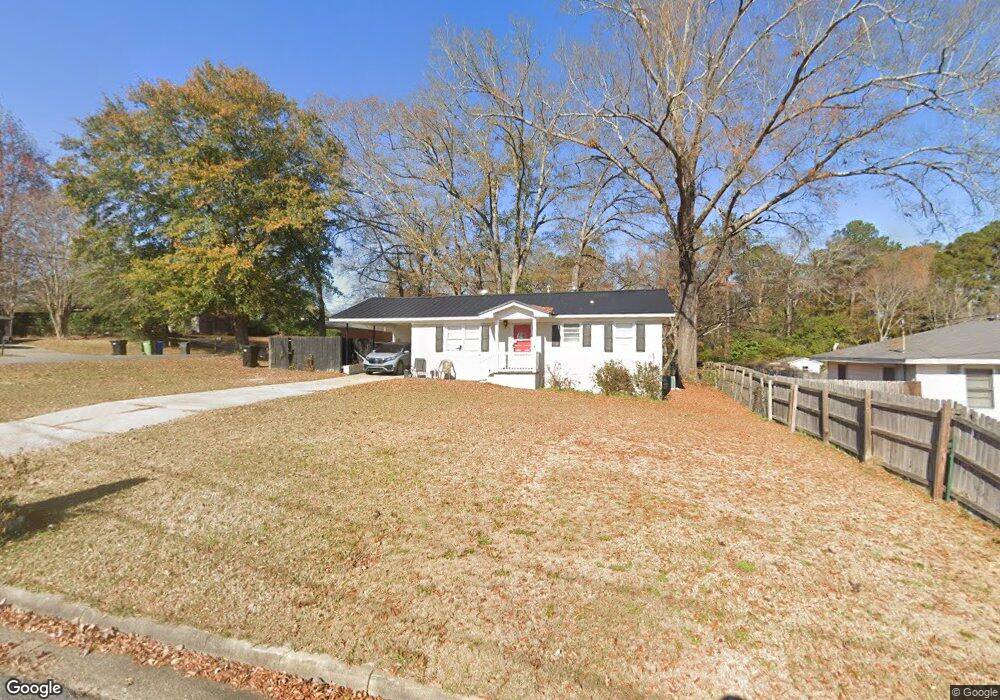
915 Forbes St Columbus, GA 31904
Northern Columbus NeighborhoodEstimated Value: $133,000 - $158,000
3
Beds
1
Bath
988
Sq Ft
$151/Sq Ft
Est. Value
About This Home
This home is located at 915 Forbes St, Columbus, GA 31904 and is currently estimated at $149,002, approximately $150 per square foot. 915 Forbes St is a home located in Muscogee County with nearby schools including River Road Elementary School, Arnold Middle School, and Jordan Vocational High School.
Ownership History
Date
Name
Owned For
Owner Type
Purchase Details
Closed on
Jul 14, 2020
Sold by
Poole J Patrick
Bought by
Johnson Jennifer M
Current Estimated Value
Home Financials for this Owner
Home Financials are based on the most recent Mortgage that was taken out on this home.
Original Mortgage
$91,728
Outstanding Balance
$81,338
Interest Rate
3.1%
Mortgage Type
FHA
Estimated Equity
$67,664
Purchase Details
Closed on
Jan 16, 2020
Sold by
Watson Martha
Bought by
Poole J Patrick
Create a Home Valuation Report for This Property
The Home Valuation Report is an in-depth analysis detailing your home's value as well as a comparison with similar homes in the area
Home Values in the Area
Average Home Value in this Area
Purchase History
| Date | Buyer | Sale Price | Title Company |
|---|---|---|---|
| Johnson Jennifer M | -- | -- | |
| Poole J Patrick | -- | -- |
Source: Public Records
Mortgage History
| Date | Status | Borrower | Loan Amount |
|---|---|---|---|
| Open | Johnson Jennifer M | $91,728 |
Source: Public Records
Tax History Compared to Growth
Tax History
| Year | Tax Paid | Tax Assessment Tax Assessment Total Assessment is a certain percentage of the fair market value that is determined by local assessors to be the total taxable value of land and additions on the property. | Land | Improvement |
|---|---|---|---|---|
| 2025 | $2,038 | $52,060 | $11,844 | $40,216 |
| 2024 | $2,038 | $52,060 | $11,844 | $40,216 |
| 2023 | $2,051 | $52,060 | $11,844 | $40,216 |
| 2022 | $1,668 | $40,856 | $8,884 | $31,972 |
| 2021 | $1,608 | $39,392 | $8,884 | $30,508 |
| 2020 | $1,210 | $29,620 | $8,884 | $20,736 |
| 2019 | $1,214 | $29,620 | $8,884 | $20,736 |
| 2018 | $1,214 | $29,620 | $8,884 | $20,736 |
| 2017 | $1,217 | $29,620 | $8,884 | $20,736 |
| 2016 | $625 | $15,143 | $2,027 | $13,116 |
| 2015 | $250 | $15,143 | $2,027 | $13,116 |
| 2014 | $626 | $15,143 | $2,027 | $13,116 |
| 2013 | $627 | $15,143 | $2,027 | $13,116 |
Source: Public Records
Map
Nearby Homes
- 831 53rd St
- 5027 Abbott Ave
- 1103 52nd St
- 5118 11th Ave
- 5110 11th Ave
- 717 Crockett Dr
- 5106 11th Ave
- 803 Lichfield Rd
- 5357 Gibney Dr
- 5212 River Rd
- 643 Lichfield Rd
- 217 Moss Dr
- 5608 Grove Ave
- 411 49th St
- 5534 Orchard Dr
- 4830 17th Ave
- 2014 Airport Thruway
- 4422 Oates Ave
- 5908 Brookstone Blvd
- 616 Newport Place
- 921 Forbes St
- 5238 Cochran Ave
- 0 Cochran Ave Unit 7358325
- 5205 Cochran Ave
- 5239 Fowler Ave
- 5214 Cochran Ave
- 5244 Cochran Ave
- 5229 Cochran Ave
- 5203 Cochran Ave
- 922 Forbes St
- 930 Lovick St
- 5250 Cochran Ave
- 5226 N Abbott Ave
- 928 Forbes St
- 5222 N Abbott Ave
- 926 Lovick St
- 1001 52nd St
- 941 52nd St
- 5236 N Abbott Ave
- 901 Turner Rd