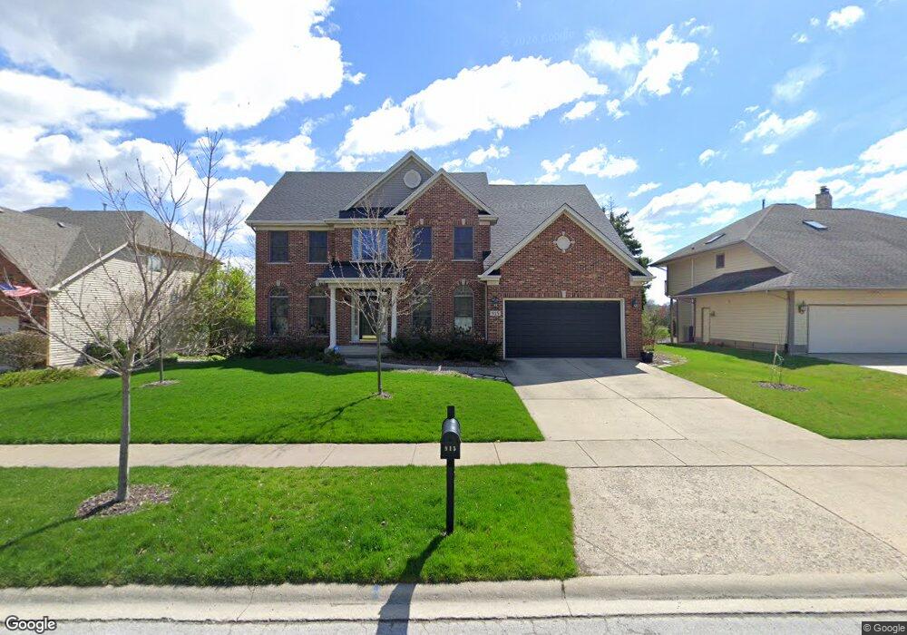
915 Merrill New Rd Sugar Grove, IL 60554
Estimated Value: $610,003 - $699,000
4
Beds
5
Baths
4,355
Sq Ft
$149/Sq Ft
Est. Value
About This Home
This home is located at 915 Merrill New Rd, Sugar Grove, IL 60554 and is currently estimated at $648,251, approximately $148 per square foot. 915 Merrill New Rd is a home located in Kane County with nearby schools including Kaneland Mcdole Elementary School, Harter Middle School, and Kaneland High School.
Ownership History
Date
Name
Owned For
Owner Type
Purchase Details
Closed on
Apr 24, 2017
Sold by
Tellschow Brad J and Tellschow Debra L
Bought by
Saba Paul G and Saba Kari A
Current Estimated Value
Home Financials for this Owner
Home Financials are based on the most recent Mortgage that was taken out on this home.
Original Mortgage
$225,000
Outstanding Balance
$186,667
Interest Rate
4.1%
Mortgage Type
New Conventional
Estimated Equity
$461,584
Purchase Details
Closed on
Mar 5, 1999
Sold by
Moghadam Fatima and Moghadam Fatemeh
Bought by
Tellschow Brad J and Tellschow Debra L
Purchase Details
Closed on
May 19, 1998
Sold by
Moghadam Hassan A and Moghadam Fatima
Bought by
Moghadam Fatima
Create a Home Valuation Report for This Property
The Home Valuation Report is an in-depth analysis detailing your home's value as well as a comparison with similar homes in the area
Home Values in the Area
Average Home Value in this Area
Purchase History
| Date | Buyer | Sale Price | Title Company |
|---|---|---|---|
| Saba Paul G | $415,000 | Citywide Title Corp | |
| Tellschow Brad J | $70,000 | -- | |
| Moghadam Fatima | -- | -- |
Source: Public Records
Mortgage History
| Date | Status | Borrower | Loan Amount |
|---|---|---|---|
| Open | Saba Paul G | $225,000 |
Source: Public Records
Tax History Compared to Growth
Tax History
| Year | Tax Paid | Tax Assessment Tax Assessment Total Assessment is a certain percentage of the fair market value that is determined by local assessors to be the total taxable value of land and additions on the property. | Land | Improvement |
|---|---|---|---|---|
| 2024 | $12,240 | $160,193 | $35,008 | $125,185 |
| 2023 | $11,773 | $144,474 | $31,573 | $112,901 |
| 2022 | $12,047 | $138,781 | $29,148 | $109,633 |
| 2021 | $11,592 | $132,072 | $27,739 | $104,333 |
| 2020 | $11,419 | $129,254 | $27,147 | $102,107 |
| 2019 | $12,097 | $133,834 | $26,259 | $107,575 |
| 2018 | $11,657 | $126,477 | $27,157 | $99,320 |
| 2017 | $11,447 | $120,787 | $25,935 | $94,852 |
| 2016 | $11,524 | $115,464 | $24,792 | $90,672 |
| 2015 | -- | $107,429 | $23,067 | $84,362 |
| 2014 | -- | $102,724 | $22,057 | $80,667 |
| 2013 | -- | $103,804 | $22,289 | $81,515 |
Source: Public Records
Map
Nearby Homes
- 905 Merrill New Rd
- 757 Merrill New Rd Unit 7
- 611 Pine St
- 868 Edgewood Dr
- 706 Brighton Dr
- 670 Sheffield Cir
- 933 Lakeridge Ct
- 684 Greenfield Rd
- 693 Greenfield Rd
- 947 Lakeridge Ct
- 7 Douglas Dr Unit 3
- 954 Black Walnut Dr
- 781 Manor Hill Place
- 778 Black Walnut Ct
- 1070 Wheatfield Ave
- Lot 30 Chestnut Hill Ln
- 966 Wheatfield Ave
- 917 Wheatfield Ave
- 905 Wheatfield Ave
- 352 Normandie Dr
- 913 Merrill New Rd
- 917 Merrill New Rd Unit 1
- 911 Merrill New Rd
- 919 Merrill New Rd Unit 1
- 914 Merrill New Rd Unit 1
- 909 Merrill New Rd
- 912 Merrill New Rd Unit 1
- 916 Merrill New Rd
- 910 Merrill New Rd
- 921 Merrill New Rd Unit 1
- 918 Merrill New Rd Unit 1
- 907 Merrill New Rd
- 908 Merrill New Rd
- 706 Stonehill Ct Unit 1
- 920 Merrill New Rd Unit 1
- 708 Stonehill Ct
- 906 Merrill New Rd
- 923 Merrill New Rd
- 934 Stamford Place
- 922 Merrill New Rd