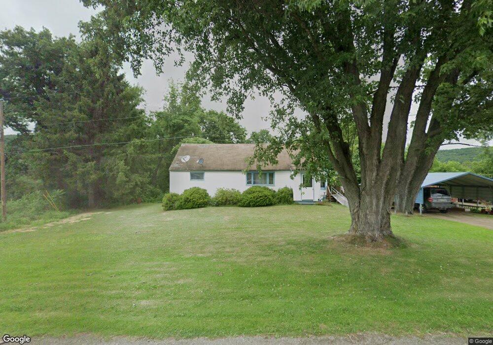
9151 Route 49 Elkland, PA 16920
Estimated Value: $116,000 - $158,000
2
Beds
2
Baths
1,128
Sq Ft
$120/Sq Ft
Est. Value
About This Home
This home is located at 9151 Route 49, Elkland, PA 16920 and is currently estimated at $135,327, approximately $119 per square foot. 9151 Route 49 is a home located in Tioga County with nearby schools including Clark Wood Elementary School, Williamson Senior High School, and Wesley Academy.
Ownership History
Date
Name
Owned For
Owner Type
Purchase Details
Closed on
Aug 14, 2024
Sold by
Flynn Marvin
Bought by
Flynn Marvin G and Flynn Mark J
Current Estimated Value
Purchase Details
Closed on
Aug 22, 2008
Sold by
The Bank Of New York Trust Co Na
Bought by
Flynn Marvin and Flynn Cora
Home Financials for this Owner
Home Financials are based on the most recent Mortgage that was taken out on this home.
Original Mortgage
$32,800
Interest Rate
6.54%
Mortgage Type
New Conventional
Purchase Details
Closed on
Apr 21, 2008
Sold by
Yorlano Frances E and Yorlano Anthony P
Bought by
The Bank Of New York Trust Company Na
Purchase Details
Closed on
Apr 20, 2006
Sold by
Young Michael E and Young Mary Ann
Bought by
Yorlano Anthony P and Yorlano Frances E
Create a Home Valuation Report for This Property
The Home Valuation Report is an in-depth analysis detailing your home's value as well as a comparison with similar homes in the area
Purchase History
| Date | Buyer | Sale Price | Title Company |
|---|---|---|---|
| Flynn Marvin G | -- | None Listed On Document | |
| Flynn Marvin | $41,000 | None Available | |
| The Bank Of New York Trust Company Na | -- | None Available | |
| Yorlano Anthony P | $76,500 | None Available |
Source: Public Records
Mortgage History
| Date | Status | Borrower | Loan Amount |
|---|---|---|---|
| Previous Owner | Flynn Marvin | $32,800 |
Source: Public Records
Tax History
| Year | Tax Paid | Tax Assessment Tax Assessment Total Assessment is a certain percentage of the fair market value that is determined by local assessors to be the total taxable value of land and additions on the property. | Land | Improvement |
|---|---|---|---|---|
| 2025 | $1,548 | $96,980 | $24,730 | $72,250 |
| 2024 | $2,477 | $96,980 | $24,730 | $72,250 |
| 2023 | $1,884 | $60,880 | $15,600 | $45,280 |
| 2022 | $1,778 | $60,880 | $15,600 | $45,280 |
| 2021 | $1,778 | $60,880 | $15,600 | $45,280 |
| 2020 | $1,778 | $60,880 | $15,600 | $45,280 |
| 2019 | $1,741 | $60,880 | $15,600 | $45,280 |
| 2018 | $1,713 | $60,880 | $15,600 | $45,280 |
| 2017 | -- | $60,880 | $15,600 | $45,280 |
| 2016 | $1,664 | $60,880 | $15,600 | $45,280 |
| 2015 | -- | $60,880 | $15,600 | $45,280 |
| 2014 | -- | $60,880 | $15,600 | $45,280 |
Source: Public Records
Map
Nearby Homes
- 9163 Route 49
- 9144 Route 49
- 9134 Route 49
- 9125 Route 49
- 9134 Rt 49
- 9134 Rt 49
- 9110 Route 49
- 9090 Route 49
- 9203 Route 49
- 9200 Route 49
- 9216 Route 49
- 9279 Route 49
- 1133 Barney Hill Rd
- 9382 Route 49
- 8976 E Route 49 St
- 985 Barney Hill Rd
- 9340 Route 49
- 1234 Barney Hill Rd
- 1199 Barney Hill Rd
- 96 Browntown Rd
Your Personal Tour Guide
Ask me questions while you tour the home.