J
Seller's Agent in 2026
John Oleyar
Fountain Realty
(614) 899-2201
9 Total Sales
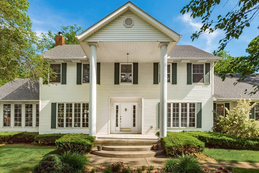
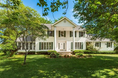
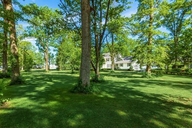
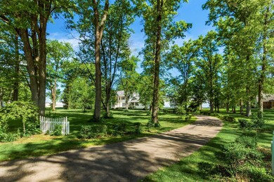
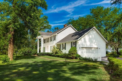

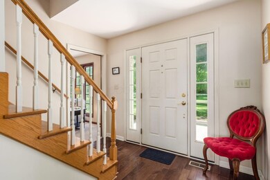
Impressive country house in a very quiet location on two acres. Three full baths, two fireplaces. Island kitchen with breakfast bar, dining room with a private backyard view. Large den adjacent to family room makes an ideal office for those who work at home. Very private feel, fronting to woods across the street and backing to farmland. Primary bedroom has a private bath with separate tub and shower, double-bowl sinks and a walk-in closet. First floor laundry, large patio, lots of additional storage space in the 27' x 22' garage. Unfinished basement, two sump pumps with battery backups. Connection for hot tub on NW side of patio. Burgett is a sparsely populated road, but is only ten minutes from Grove City shopping and employment centers. If you've been thinking about a big country home in a quiet rural atmosphere, take a look here!
| Date | Type | Sale Price | Title Company |
|---|---|---|---|
| Interfamily Deed Transfer | -- | None Available | |
| Interfamily Deed Transfer | -- | None Available | |
| Deed | $300,000 | -- | |
| Deed | $15,000 | -- |
| Date | Status | Loan Amount | Loan Type |
|---|---|---|---|
| Previous Owner | $285,000 | New Conventional |
| Date | Event | Price | List to Sale | Price per Sq Ft |
|---|---|---|---|---|
| 01/02/2026 01/02/26 | Sold | $522,000 | -1.5% | $181 / Sq Ft |
| 11/14/2025 11/14/25 | Price Changed | $529,900 | 0.0% | $183 / Sq Ft |
| 11/14/2025 11/14/25 | For Sale | $529,900 | +1.5% | $183 / Sq Ft |
| 06/02/2025 06/02/25 | Off Market | $522,000 | -- | -- |
| 05/30/2025 05/30/25 | For Sale | $525,000 | -- | $182 / Sq Ft |
| Year | Tax Paid | Tax Assessment Tax Assessment Total Assessment is a certain percentage of the fair market value that is determined by local assessors to be the total taxable value of land and additions on the property. | Land | Improvement |
|---|---|---|---|---|
| 2025 | $7,584 | $146,950 | $25,030 | $121,920 |
| 2024 | $7,584 | $146,950 | $25,030 | $121,920 |
| 2023 | $5,186 | $146,950 | $25,030 | $121,920 |
| 2022 | $3,924 | $104,520 | $16,700 | $87,820 |
| 2021 | $3,936 | $104,520 | $16,700 | $87,820 |
| 2020 | $3,937 | $104,520 | $16,700 | $87,820 |
| 2019 | $3,209 | $89,660 | $15,930 | $73,730 |
| 2018 | $3,156 | $89,660 | $15,930 | $73,730 |
| 2017 | $4,712 | $89,660 | $15,930 | $73,730 |
| 2016 | $2,991 | $83,310 | $14,000 | $69,310 |
| 2015 | $2,993 | $83,310 | $14,000 | $69,310 |
| 2014 | $2,996 | $83,310 | $14,000 | $69,310 |
| 2013 | $3,116 | $83,310 | $14,000 | $69,310 |
J
Seller's Agent in 2026
John Oleyar
Fountain Realty
(614) 899-2201
9 Total Sales

Buyer's Agent in 2026
Clint Ford
Coldwell Banker Realty
(614) 352-5645
260 Total Sales
Source: Columbus and Central Ohio Regional MLS
MLS Number: 225019236
APN: L27-0-001-00-687-03
Disclaimer: Certain information contained herein is derived from information provided by parties other than Homes.com. All information provided is deemed reliable, but is not guaranteed to be accurate and should be independently verified.
![]() IDX information is provided exclusively for personal, non-commercial use, and may not be used for any purpose other than to identify prospective properties consumers may be interested in purchasing.
IDX information is provided exclusively for personal, non-commercial use, and may not be used for any purpose other than to identify prospective properties consumers may be interested in purchasing.
Information is deemed reliable but not guaranteed.
Ask me questions while you tour the home.