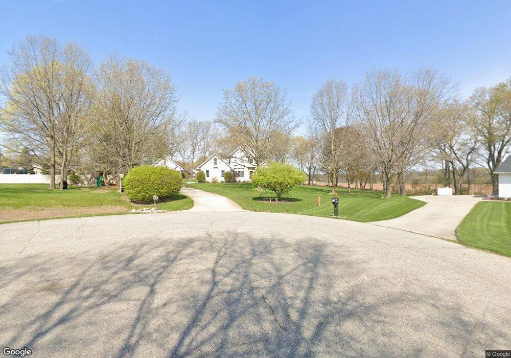
9156 Boulder Ridge Ct Unit CT Portland, MI 48875
Estimated Value: $533,270 - $721,000
--
Bed
4
Baths
2,520
Sq Ft
$244/Sq Ft
Est. Value
About This Home
This home is located at 9156 Boulder Ridge Ct Unit CT, Portland, MI 48875 and is currently estimated at $614,068, approximately $243 per square foot. 9156 Boulder Ridge Ct Unit CT is a home located in Ionia County with nearby schools including Oakwood Elementary School, Westwood Elementary School, and Portland Middle School.
Ownership History
Date
Name
Owned For
Owner Type
Purchase Details
Closed on
Dec 20, 2016
Sold by
Thomas Keusch
Bought by
Goodman David and Goodman Beth
Current Estimated Value
Home Financials for this Owner
Home Financials are based on the most recent Mortgage that was taken out on this home.
Original Mortgage
$230,000
Outstanding Balance
$189,295
Interest Rate
4.16%
Estimated Equity
$424,773
Purchase Details
Closed on
Nov 19, 1999
Bought by
Keusch Thomas and Keusch Lisa
Create a Home Valuation Report for This Property
The Home Valuation Report is an in-depth analysis detailing your home's value as well as a comparison with similar homes in the area
Home Values in the Area
Average Home Value in this Area
Purchase History
| Date | Buyer | Sale Price | Title Company |
|---|---|---|---|
| Goodman David | -- | -- | |
| Keusch Thomas | $27,900 | -- |
Source: Public Records
Mortgage History
| Date | Status | Borrower | Loan Amount |
|---|---|---|---|
| Open | Goodman David | $230,000 | |
| Closed | Goodman David | -- |
Source: Public Records
Tax History Compared to Growth
Tax History
| Year | Tax Paid | Tax Assessment Tax Assessment Total Assessment is a certain percentage of the fair market value that is determined by local assessors to be the total taxable value of land and additions on the property. | Land | Improvement |
|---|---|---|---|---|
| 2025 | $5,689 | $245,700 | $21,000 | $224,700 |
| 2024 | $2,131 | $245,700 | $21,000 | $224,700 |
| 2023 | $2,033 | $212,100 | $21,000 | $191,100 |
| 2022 | $1,936 | $212,100 | $21,000 | $191,100 |
| 2021 | $5,140 | $193,300 | $20,200 | $173,100 |
| 2020 | $1,858 | $193,300 | $20,200 | $173,100 |
| 2019 | $0 | $185,000 | $19,400 | $165,600 |
| 2018 | $4,901 | $183,500 | $17,200 | $166,300 |
| 2017 | $1,971 | $183,500 | $17,200 | $166,300 |
| 2016 | -- | $145,900 | $11,500 | $134,400 |
| 2015 | -- | $145,900 | $11,500 | $134,400 |
| 2014 | -- | $141,400 | $15,000 | $126,400 |
Source: Public Records
Map
Nearby Homes
- 926 Hill St
- 432 S Lincoln St
- 250 Meadowlane Dr
- 112 S Grant St
- 10141 Charlotte Hwy
- 507 E Grand River Ave
- 347 Looking Glass Ave
- 447 Divine Hwy
- 7998 E Grand River Ave
- 9584 Butler Rd
- 9237 Shimano Dr
- 9296 Shimano Dr
- 9383 Shimano Dr
- 0 E Emery Rd
- 0 Chicory Ln Unit 286267
- 1 Frost Rd
- 7620 Walnut Rd
- V/L Eagle Rest Dr
- 0 Mountainmint Cir Unit 287877
- 11678 E Grand River Ave
- 9156 Boulder Ridge Ct
- 9148 Boulder Ridge Ct Unit 20
- 8639 Riverbend Dr Unit 18
- 8683 Riverbend Dr Unit 16
- 8705 Riverbend Dr
- 8725 Riverbend Dr Unit 14
- 8611 Riverbend Dr Unit 22
- 9155 Boulder Ridge Ct
- 8642 Riverbend Dr Unit 6
- 8589 Riverbend Dr
- 8662 Riverbend Dr
- 8620 Riverbend Dr
- 8612 Riverbend Dr Unit 4
- 8680 Riverbend Dr
- 8567 Riverbend Dr
- 8590 Riverbend Dr Unit 3
- 8684 Riverbend Dr
- 8573 Cobblestone Ct
- 8704 Riverbend Dr
- 8724 Riverbend Dr