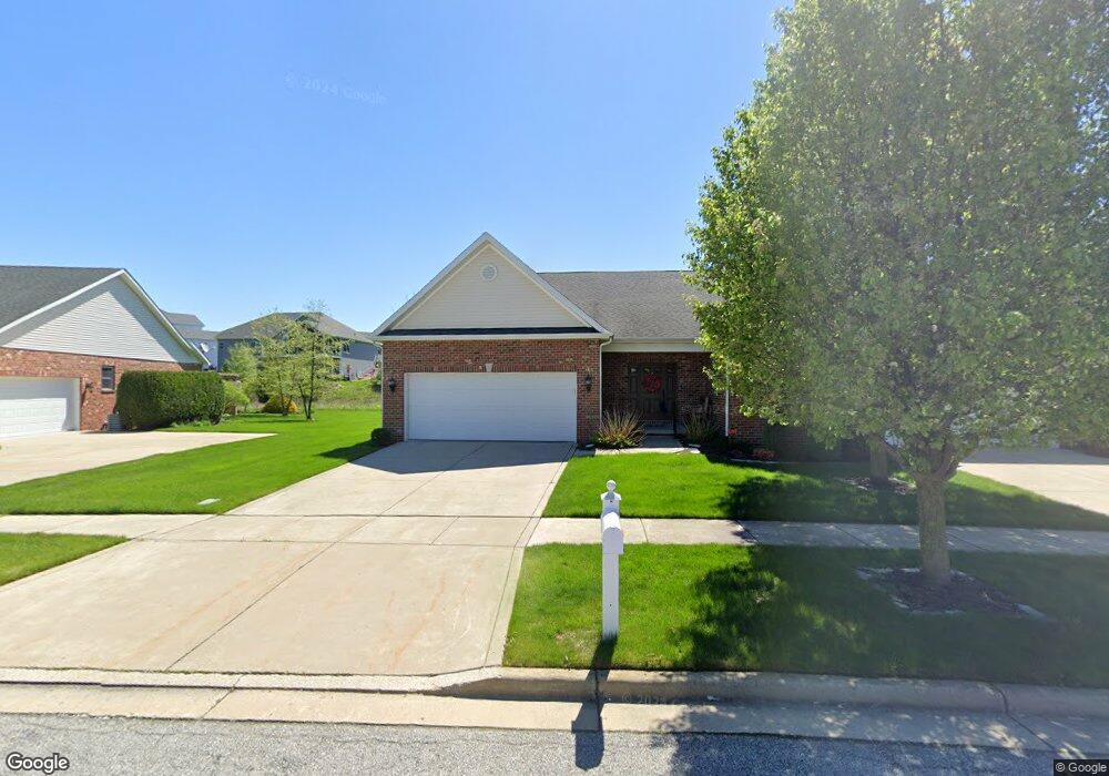
916 Aaron Ct Unit A Crown Point, IN 46307
Estimated Value: $493,000 - $554,000
2
Beds
2
Baths
1,795
Sq Ft
$294/Sq Ft
Est. Value
About This Home
This home is located at 916 Aaron Ct Unit A, Crown Point, IN 46307 and is currently estimated at $528,549, approximately $294 per square foot. 916 Aaron Ct Unit A is a home located in Lake County with nearby schools including Lake Street Elementary School, Robert Taft Middle School, and Crown Point High School.
Ownership History
Date
Name
Owned For
Owner Type
Purchase Details
Closed on
Oct 27, 2021
Sold by
Alt Patricia Anne
Bought by
Beckman Geraldine L
Current Estimated Value
Purchase Details
Closed on
Oct 26, 2021
Sold by
Beckman Geraldine L
Bought by
Beckman Geraldine L and Saltanovitz Leah J
Purchase Details
Closed on
Oct 25, 2021
Sold by
Alt Patricia Anne
Bought by
Beckman Geraldine L
Purchase Details
Closed on
May 30, 2012
Sold by
Cp Partners Llc
Bought by
Alt Patricia Anne
Create a Home Valuation Report for This Property
The Home Valuation Report is an in-depth analysis detailing your home's value as well as a comparison with similar homes in the area
Home Values in the Area
Average Home Value in this Area
Purchase History
| Date | Buyer | Sale Price | Title Company |
|---|---|---|---|
| Beckman Geraldine L | -- | Meridian Title | |
| Beckman Geraldine L | -- | Meridian Title Corp | |
| Beckman Geraldine L | $470,000 | Mtc | |
| Alt Patricia Anne | -- | Multiple |
Source: Public Records
Tax History Compared to Growth
Tax History
| Year | Tax Paid | Tax Assessment Tax Assessment Total Assessment is a certain percentage of the fair market value that is determined by local assessors to be the total taxable value of land and additions on the property. | Land | Improvement |
|---|---|---|---|---|
| 2024 | $11,796 | $484,100 | $75,600 | $408,500 |
| 2023 | $9,207 | $429,200 | $63,000 | $366,200 |
| 2022 | $9,207 | $416,600 | $63,000 | $353,600 |
| 2021 | $3,648 | $326,400 | $61,900 | $264,500 |
| 2020 | $3,541 | $317,000 | $61,900 | $255,100 |
| 2019 | $3,617 | $319,700 | $61,900 | $257,800 |
| 2018 | $4,641 | $322,500 | $61,900 | $260,600 |
| 2017 | $4,715 | $323,500 | $61,900 | $261,600 |
| 2016 | $4,856 | $326,900 | $61,900 | $265,000 |
| 2014 | $4,495 | $323,300 | $61,900 | $261,400 |
| 2013 | $4,426 | $315,800 | $61,900 | $253,900 |
Source: Public Records
Map
Nearby Homes
- 3709 W 121st Ave
- 802 Hayfield Dr
- 804 Shannon Dr
- 908 Mary Ellen Dr
- 775 Quinlan Ct
- 1002 Gordon Ct
- 1144 Mary Ellen Dr
- 217 Crestview Ln
- 1140 Hyde Park
- 312 Fairfield Dr
- 1156 Donegal Ln
- 780 Williams Ct
- 744 S Court St
- 924 W Crestview Ct
- 4714 W 121st Ave
- 1575 S Feather Rock Dr
- 334 Ellendale Pkwy
- 12201 Cedar Lake Rd
- The Cottonwood Plan at Golden Meadow
- The Magnolia Plan at Golden Meadow