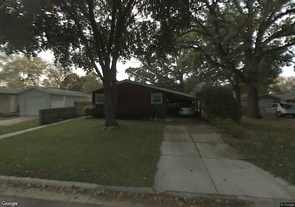
916 Grove St Fort Atkinson, WI 53538
Estimated Value: $255,290 - $297,000
--
Bed
--
Bath
--
Sq Ft
8,233
Sq Ft Lot
About This Home
This home is located at 916 Grove St, Fort Atkinson, WI 53538 and is currently estimated at $278,323. 916 Grove St is a home located in Jefferson County with nearby schools including Luther Elementary School, Fort Atkinson Middle School, and Fort Atkinson High School.
Ownership History
Date
Name
Owned For
Owner Type
Purchase Details
Closed on
Jan 13, 2017
Sold by
Mcginn John
Bought by
John And Colleen Mcginn Revocable Living
Current Estimated Value
Purchase Details
Closed on
Dec 1, 2011
Sold by
Mcginn Catherine M and Estate Of Betty Mcginn
Bought by
Mcginn John
Home Financials for this Owner
Home Financials are based on the most recent Mortgage that was taken out on this home.
Original Mortgage
$88,800
Outstanding Balance
$60,774
Interest Rate
4.02%
Mortgage Type
New Conventional
Estimated Equity
$217,549
Create a Home Valuation Report for This Property
The Home Valuation Report is an in-depth analysis detailing your home's value as well as a comparison with similar homes in the area
Home Values in the Area
Average Home Value in this Area
Purchase History
| Date | Buyer | Sale Price | Title Company |
|---|---|---|---|
| John And Colleen Mcginn Revocable Living | -- | None Available | |
| Mcginn John | $111,000 | None Available |
Source: Public Records
Mortgage History
| Date | Status | Borrower | Loan Amount |
|---|---|---|---|
| Open | Mcginn John | $88,800 |
Source: Public Records
Tax History Compared to Growth
Tax History
| Year | Tax Paid | Tax Assessment Tax Assessment Total Assessment is a certain percentage of the fair market value that is determined by local assessors to be the total taxable value of land and additions on the property. | Land | Improvement |
|---|---|---|---|---|
| 2024 | $3,686 | $198,000 | $41,000 | $157,000 |
| 2023 | $3,332 | $198,000 | $41,000 | $157,000 |
| 2022 | $3,252 | $128,000 | $28,500 | $99,500 |
| 2021 | $2,866 | $128,000 | $28,500 | $99,500 |
| 2020 | $2,827 | $128,000 | $28,500 | $99,500 |
| 2019 | $2,699 | $128,000 | $28,500 | $99,500 |
| 2018 | $2,607 | $128,000 | $28,500 | $99,500 |
| 2017 | $2,572 | $128,000 | $28,500 | $99,500 |
| 2016 | $2,890 | $137,700 | $27,200 | $110,500 |
| 2015 | $3,011 | $137,700 | $27,200 | $110,500 |
| 2014 | $2,908 | $137,700 | $27,200 | $110,500 |
| 2013 | $2,985 | $137,700 | $27,200 | $110,500 |
Source: Public Records
Map
Nearby Homes
- 611 Talcott Ave
- 1402 Adrian Blvd
- 633 Hilltop Trail W
- 206 Hilltop Trail
- 1268 Jamesway
- 1000 Whitetail Dr
- 336 Jones Ave
- 234 S Main St
- 265 Heritage Dr Unit 19
- 263 Heritage Dr Unit 20
- 205 Wollet Dr
- 233 S Water St E
- 125 Monroe St
- 42 Wilson Ave
- 1120 Van Buren St
- W6272 Apple Ln
- 311 N Main St
- 416 N 3rd St
- 1220 Sherman Ave W
- 1222 Sherman Ave W Unit P
- 914 Grove St
- 300 Adrian Blvd
- 304 Adrian Blvd
- 919 Gail Place
- 915 Gail Place
- 910 Grove St
- 923 Gail Place
- 911 Gail Place
- 214 Spry Ave
- 1003 Grove St
- 210 Spry Ave
- 1007 Grove St
- 1002 Grove St
- 914 Gail Place
- 918 Gail Place
- 309 W Rockwell Ave
- 309 W Rockwell Ave Unit 309
- 910 Gail Place
- 307 Adrian Blvd
- 928 Gail Place