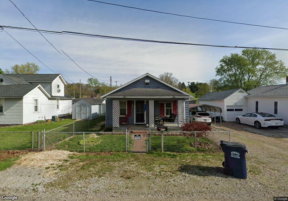
916 Jones Ave Newark, OH 43055
Estimated Value: $114,392 - $140,000
1
Bed
1
Bath
576
Sq Ft
$222/Sq Ft
Est. Value
About This Home
This home is located at 916 Jones Ave, Newark, OH 43055 and is currently estimated at $127,848, approximately $221 per square foot. 916 Jones Ave is a home located in Licking County with nearby schools including Carson Elementary School, Heritage Middle School, and Newark High School.
Ownership History
Date
Name
Owned For
Owner Type
Purchase Details
Closed on
Oct 30, 2024
Sold by
Chenault Tamara Lynn and Craig Tamra Lynn
Bought by
Craig Tamra Lynn
Current Estimated Value
Purchase Details
Closed on
May 31, 2006
Sold by
Hill Deanna S
Bought by
Chenault Tamara L
Home Financials for this Owner
Home Financials are based on the most recent Mortgage that was taken out on this home.
Original Mortgage
$34,200
Interest Rate
6.62%
Mortgage Type
Fannie Mae Freddie Mac
Create a Home Valuation Report for This Property
The Home Valuation Report is an in-depth analysis detailing your home's value as well as a comparison with similar homes in the area
Home Values in the Area
Average Home Value in this Area
Purchase History
| Date | Buyer | Sale Price | Title Company |
|---|---|---|---|
| Craig Tamra Lynn | -- | None Listed On Document | |
| Craig Tamra Lynn | -- | None Listed On Document | |
| Chenault Tamara L | $36,000 | None Available |
Source: Public Records
Mortgage History
| Date | Status | Borrower | Loan Amount |
|---|---|---|---|
| Previous Owner | Chenault Tamara L | $34,200 |
Source: Public Records
Tax History
| Year | Tax Paid | Tax Assessment Tax Assessment Total Assessment is a certain percentage of the fair market value that is determined by local assessors to be the total taxable value of land and additions on the property. | Land | Improvement |
|---|---|---|---|---|
| 2024 | $1,067 | $29,820 | $11,340 | $18,480 |
| 2023 | $1,052 | $29,440 | $10,960 | $18,480 |
| 2022 | $692 | $17,150 | $6,090 | $11,060 |
| 2021 | $725 | $17,150 | $6,090 | $11,060 |
| 2020 | $742 | $17,150 | $6,090 | $11,060 |
| 2019 | $568 | $12,610 | $6,480 | $6,130 |
| 2018 | $568 | $0 | $0 | $0 |
| 2017 | $567 | $0 | $0 | $0 |
| 2016 | $577 | $0 | $0 | $0 |
| 2015 | $646 | $0 | $0 | $0 |
| 2014 | $900 | $0 | $0 | $0 |
| 2013 | $670 | $0 | $0 | $0 |
Source: Public Records
Map
Nearby Homes
- 934 Garfield Ave
- 106 Monroe Ave
- 554 Garfield Ave
- 0 Monroe Ave Unit Lot 1612
- 0 Monroe Ave
- 665 E Main St
- 20 Bolen Ave
- 491 Garfield Ave
- 493 Allston Ave
- 468 Garfield Ave
- 56 Parker Ave
- 112 Oakwood Ave
- 61 Rosebud Ave
- 0 Swans Rd NE
- 167 Essex St
- 392 Arlington Ave
- 498 Clarendon St
- 331 Eastern Ave
- 438 Clarendon St
- 317 Wayne Ave
- 920 Jones Ave
- 910 Jones Ave
- 910 Jones Ave
- 910 Jones Ave Unit Rear
- 830 Jones Ave
- 926 Jones Ave
- 909 Garfield Ave
- 909 Garfield Ave
- 921 Garfield Ave
- 294 Ellis Dr
- 925 Garfield Ave
- 919 Jones Ave
- 917 Jones Ave
- 932 Jones Ave
- 899 Jones Ave
- 899 Garfield Ave
- 935 Garfield Ave
- 888 Jones Ave
- 888 Jones Ave
- 929 Jones Ave