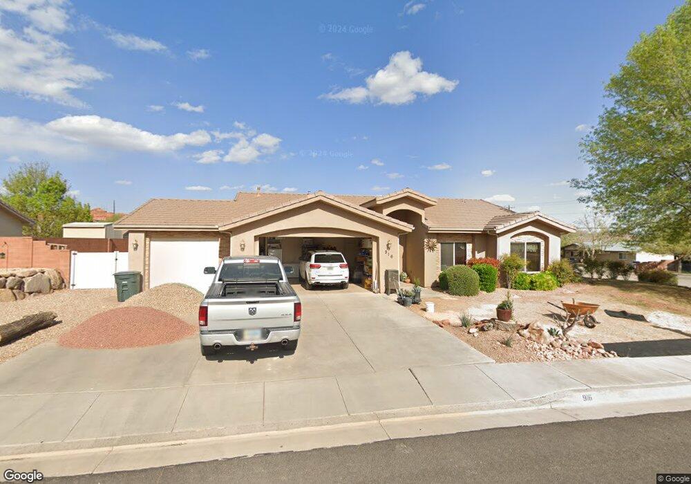
916 N 1950 E Saint George, UT 84770
Estimated Value: $464,904 - $499,000
3
Beds
2
Baths
1,436
Sq Ft
$335/Sq Ft
Est. Value
About This Home
This home is located at 916 N 1950 E, Saint George, UT 84770 and is currently estimated at $481,476, approximately $335 per square foot. 916 N 1950 E is a home located in Washington County with nearby schools including Sandstone School, Pine View Middle School, and Fossil Ridge Intermediate School.
Ownership History
Date
Name
Owned For
Owner Type
Purchase Details
Closed on
Jul 11, 2011
Sold by
Dare Billie G and Dare Bonnie K
Bought by
Stiver Mark D and Frye Jane E
Current Estimated Value
Purchase Details
Closed on
Jan 25, 2011
Sold by
Dare Billie Gene and Dare Bonnie Kay
Bought by
Dare Billie G and Dare Bonnie K
Purchase Details
Closed on
Nov 16, 2010
Sold by
Dare Billie Gene and Dare Bonnie Kay
Bought by
Dare Billie G and Dare Bonnie K
Purchase Details
Closed on
Aug 18, 2008
Sold by
Titanium Investment Llc
Bought by
Dare Billie Gene and Dare Bonnie Kay
Home Financials for this Owner
Home Financials are based on the most recent Mortgage that was taken out on this home.
Original Mortgage
$190,000
Interest Rate
6.37%
Mortgage Type
Purchase Money Mortgage
Purchase Details
Closed on
Dec 19, 2006
Sold by
Ors Development Inc
Bought by
Titanium Investment Lcc
Home Financials for this Owner
Home Financials are based on the most recent Mortgage that was taken out on this home.
Original Mortgage
$220,000
Interest Rate
6.16%
Mortgage Type
Purchase Money Mortgage
Create a Home Valuation Report for This Property
The Home Valuation Report is an in-depth analysis detailing your home's value as well as a comparison with similar homes in the area
Home Values in the Area
Average Home Value in this Area
Purchase History
| Date | Buyer | Sale Price | Title Company |
|---|---|---|---|
| Stiver Mark D | -- | Terra Title St George Branch | |
| Dare Billie G | -- | Accommodation | |
| Dare Billie G | -- | None Available | |
| Dare Billie G | -- | None Available | |
| Dare Billie Gene | -- | Southern Utah Title | |
| Titanium Investment Lcc | -- | Southern Utah Title Co |
Source: Public Records
Mortgage History
| Date | Status | Borrower | Loan Amount |
|---|---|---|---|
| Previous Owner | Dare Billie Gene | $190,000 | |
| Previous Owner | Titanium Investment Lcc | $220,000 |
Source: Public Records
Tax History Compared to Growth
Tax History
| Year | Tax Paid | Tax Assessment Tax Assessment Total Assessment is a certain percentage of the fair market value that is determined by local assessors to be the total taxable value of land and additions on the property. | Land | Improvement |
|---|---|---|---|---|
| 2025 | $3,025 | $444,000 | $142,500 | $301,500 |
| 2023 | $3,047 | $455,300 | $142,500 | $312,800 |
| 2022 | $3,225 | $453,200 | $118,800 | $334,400 |
| 2021 | $2,779 | $320,300 | $80,800 | $239,500 |
| 2020 | $2,605 | $282,800 | $71,300 | $211,500 |
| 2019 | $2,468 | $261,700 | $71,300 | $190,400 |
| 2018 | $2,218 | $220,800 | $0 | $0 |
| 2017 | $2,234 | $215,900 | $0 | $0 |
| 2016 | $2,266 | $202,500 | $0 | $0 |
| 2015 | $2,248 | $192,800 | $0 | $0 |
| 2014 | $2,210 | $190,700 | $0 | $0 |
Source: Public Records
Map
Nearby Homes
- 948 N 2050 East Cir
- 1009 N 2050 E
- 2031 E Colorado Dr
- 2031 E Colorado Dr Unit 209
- 2031 E Colorado Dr Unit 204
- 2031 E Colorado Dr Unit 406
- 1976 E 1200 Cir N
- 2105 Panorama Pkwy N
- 2088 Panorama Pkwy N
- 646 N 2000 E
- 1761 E 1150 N
- 2140 E 620 N
- 840 Twin Lakes Dr Unit 431
- 840 Twin Lakes Dr Unit 424
- 840 Twin Lakes Dr Unit 430
- 840 Twin Lakes Dr
- 840 Twin Lakes Dr Unit 225
- 840 Twin Lakes Dr Unit 228
- 840 Twin Lakes Dr Unit 414
- 840 Twin Lakes Dr Unit 411
- 917 N 2000 E
- 934 N 1950 E
- 935 N 2000 E
- 915 N 1950 E
- 931 N 1950 E
- 1958 E Middleton Dr
- 1938 E Middleton Dr
- 1150 E Middleton Dr
- 1968 E Middleton Dr
- 952 N 1950 E
- 951 N 2000 E
- 951 N 2000 E Unit 122
- 951 N 2000 E
- 1924 E Middleton Dr
- 914 N 1900 E
- 918 N 2000 E
- 949 N 1950 E
- 932 N 1900 E
- 930 N 2000 E
- 865 N 2000 E