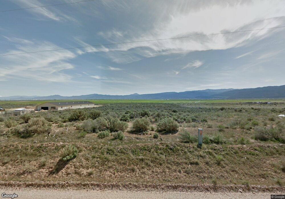
916 N 4200 Parowan, UT 84761
Estimated Value: $156,000 - $236,000
--
Bed
--
Bath
--
Sq Ft
4.13
Acres
About This Home
This home is located at 916 N 4200, Parowan, UT 84761 and is currently estimated at $196,000. 916 N 4200 is a home located in Iron County with nearby schools including Parowan School, Parowan High School, and Cedar City High School.
Ownership History
Date
Name
Owned For
Owner Type
Purchase Details
Closed on
May 2, 2023
Sold by
Gapasen Victor S
Bought by
Ferguson Wesley and Ferguson Kaitlyn
Current Estimated Value
Home Financials for this Owner
Home Financials are based on the most recent Mortgage that was taken out on this home.
Original Mortgage
$55,000
Outstanding Balance
$53,479
Interest Rate
6.42%
Mortgage Type
Construction
Estimated Equity
$142,521
Purchase Details
Closed on
Aug 2, 2019
Sold by
Heaton Douglas K and Heaton Coleen C
Bought by
Gapasen Victor S and Gapasen Guadalupe M
Purchase Details
Closed on
Jul 6, 2009
Sold by
Carter Benjamin and Carter Jodi
Bought by
Heaton Douglas K and Heaton Coleen C
Home Financials for this Owner
Home Financials are based on the most recent Mortgage that was taken out on this home.
Original Mortgage
$30,909
Interest Rate
5.25%
Mortgage Type
Purchase Money Mortgage
Purchase Details
Closed on
Apr 22, 2005
Sold by
Cooke Walter D and Page Marilyn S
Bought by
Carter Benjamin and Carter Jodi
Create a Home Valuation Report for This Property
The Home Valuation Report is an in-depth analysis detailing your home's value as well as a comparison with similar homes in the area
Home Values in the Area
Average Home Value in this Area
Purchase History
| Date | Buyer | Sale Price | Title Company |
|---|---|---|---|
| Ferguson Wesley | -- | Security Escrow & Title | |
| Gapasen Victor S | -- | Southern Utah Title Of Cedar | |
| Heaton Douglas K | -- | -- | |
| Carter Benjamin | -- | First American Title |
Source: Public Records
Mortgage History
| Date | Status | Borrower | Loan Amount |
|---|---|---|---|
| Open | Ferguson Wesley | $55,000 | |
| Previous Owner | Heaton Douglas K | $30,909 |
Source: Public Records
Tax History Compared to Growth
Tax History
| Year | Tax Paid | Tax Assessment Tax Assessment Total Assessment is a certain percentage of the fair market value that is determined by local assessors to be the total taxable value of land and additions on the property. | Land | Improvement |
|---|---|---|---|---|
| 2025 | $462 | $62,142 | $62,142 | -- |
| 2023 | $440 | $47,345 | $47,345 | $0 |
| 2022 | $334 | $39,455 | $39,455 | $0 |
| 2021 | $281 | $33,195 | $33,195 | $0 |
| 2020 | $318 | $33,195 | $33,195 | $0 |
| 2019 | $332 | $33,195 | $33,195 | $0 |
| 2018 | $340 | $33,195 | $33,195 | $0 |
| 2017 | $338 | $33,195 | $33,195 | $0 |
| 2016 | $375 | $33,195 | $33,195 | $0 |
| 2015 | $393 | $33,195 | $0 | $0 |
| 2014 | $416 | $33,195 | $0 | $0 |
Source: Public Records
Map
Nearby Homes
- 217.05 Ac. Gap Rd Near 4200 W
- SEC 2 T34s R10w Slm
- 0 2 35 Ac- Summit Valley Ranchos Unit 113469
- 0 Lot 3 Summit Valley Ranchos Unit 110908
- 0 Sec 2 T34s R10w Slm Unit 91983
- 267 S 2400 W
- 2246 W 450 S
- 2228 W 450 S
- 2239 W 475 S
- 7.13 Acres Commercial Land
- 131.07 Ac Working Farm +105 Ac Fort
- 131.07 Ac Working Farm +105 Ac Fort Unit Water
- 2660 N 2400 W
- 3505 W Allard Ranch Dr
- 1/2 acre Ft Water Right
- 700 W 700 N
- 0 Pine Canyon Dr Unit 25-260421
- Parowan Valley Water Rights
- 1435 W 200 S Unit 315
- 403 & 404 Kari