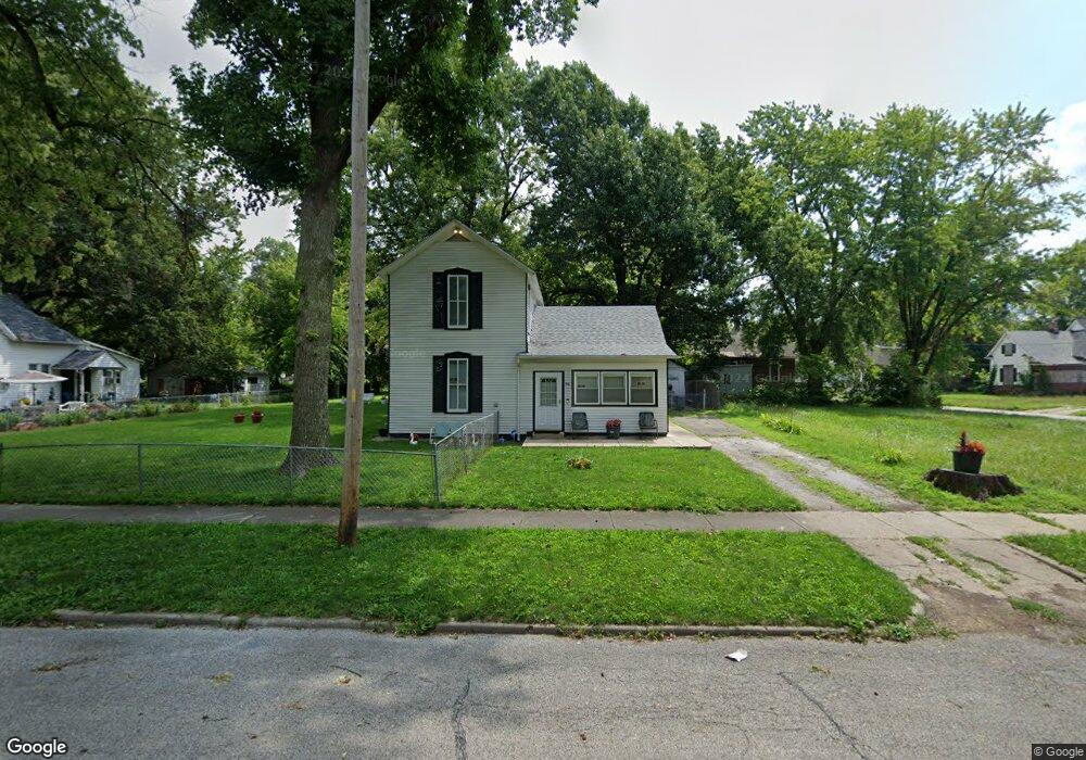
916 N College St Decatur, IL 62522
Estimated Value: $25,000 - $55,000
--
Bed
--
Bath
787
Sq Ft
$52/Sq Ft
Est. Value
About This Home
This home is located at 916 N College St, Decatur, IL 62522 and is currently estimated at $41,082, approximately $52 per square foot. 916 N College St is a home located in Macon County with nearby schools including Hope Academy, St. Patrick School, and Teen Challenge-Home For Girls.
Ownership History
Date
Name
Owned For
Owner Type
Purchase Details
Closed on
Jan 1, 1995
Current Estimated Value
Create a Home Valuation Report for This Property
The Home Valuation Report is an in-depth analysis detailing your home's value as well as a comparison with similar homes in the area
Home Values in the Area
Average Home Value in this Area
Purchase History
| Date | Buyer | Sale Price | Title Company |
|---|---|---|---|
| -- | $14,000 | -- |
Source: Public Records
Tax History Compared to Growth
Tax History
| Year | Tax Paid | Tax Assessment Tax Assessment Total Assessment is a certain percentage of the fair market value that is determined by local assessors to be the total taxable value of land and additions on the property. | Land | Improvement |
|---|---|---|---|---|
| 2024 | $391 | $4,650 | $629 | $4,021 |
| 2023 | $402 | $4,486 | $607 | $3,879 |
| 2022 | $413 | $4,224 | $562 | $3,662 |
| 2021 | $406 | $3,945 | $525 | $3,420 |
| 2020 | $400 | $3,762 | $501 | $3,261 |
| 2019 | $400 | $3,762 | $501 | $3,261 |
| 2018 | $425 | $4,344 | $709 | $3,635 |
| 2017 | $423 | $4,460 | $728 | $3,732 |
| 2016 | $427 | $4,505 | $735 | $3,770 |
| 2015 | $413 | $4,425 | $722 | $3,703 |
| 2014 | $387 | $5,080 | $474 | $4,606 |
| 2013 | $386 | $5,271 | $492 | $4,779 |
Source: Public Records
Map
Nearby Homes
- 844 N Edward St
- 415 W Green St
- 875 N Monroe St
- 1245 N Union St
- 141 E Packard St
- 837 W Grand Ave
- 422 W William St
- 330 W William St
- 1458 N Union St
- 609 W William St
- 1504 N Monroe St
- 1545 N Monroe St
- 233 N Edward St
- 452 W Prairie Ave
- 442 W Prairie Ave
- 366 W Prairie Ave
- 254 N Pine St
- 1065 W Green St
- 281 W Prairie Ave
- 717 W Prairie Ave Unit 2
- 904 N College St
- 938 N College St
- 909 N College St
- 442 W King St
- 905 N College St
- 944 N College St
- 956 N College St
- 430 W King St
- 949 N College St
- 475 W King St
- 465 W King St
- 532 W King St
- 455 W King St
- 445 W King St
- 420 W King St
- 525 W King St
- 435 W King St
- 968 N College St
- 423 W King St
- 869 N College St