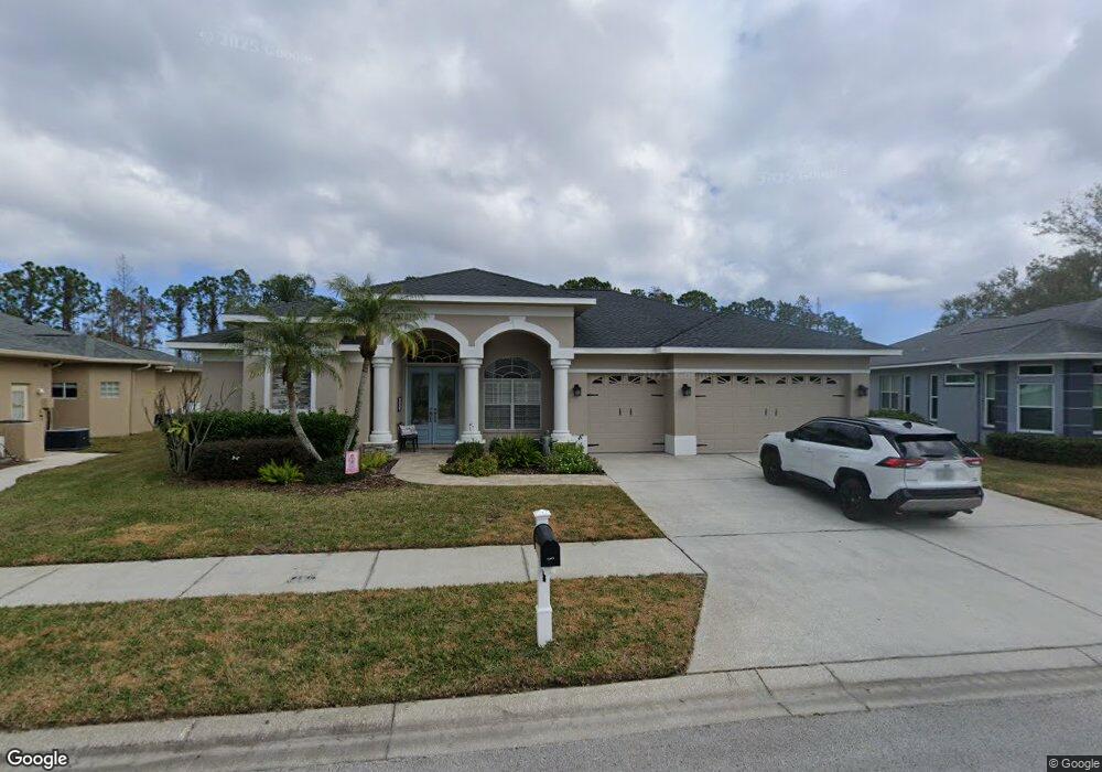
916 Wyngate Ct Safety Harbor, FL 34695
Estimated Value: $783,445 - $864,000
--
Bed
1
Bath
2,582
Sq Ft
$316/Sq Ft
Est. Value
About This Home
This home is located at 916 Wyngate Ct, Safety Harbor, FL 34695 and is currently estimated at $815,611, approximately $315 per square foot. 916 Wyngate Ct is a home located in Pinellas County with nearby schools including Safety Harbor Elementary School, Countryside High School, and Safety Harbor Middle School.
Ownership History
Date
Name
Owned For
Owner Type
Purchase Details
Closed on
Aug 17, 2016
Sold by
Kessel Michael G and Kessel Elisa M
Bought by
Kessel Michael G and Kessel Elisa M
Current Estimated Value
Purchase Details
Closed on
Apr 1, 2016
Bought by
Kessel Michael G & Elisa M Tr
Purchase Details
Closed on
Jul 9, 1996
Sold by
Lehigh Group Inc
Bought by
Kessel Michael G and Kessel Elisa M
Home Financials for this Owner
Home Financials are based on the most recent Mortgage that was taken out on this home.
Original Mortgage
$203,400
Interest Rate
7.99%
Mortgage Type
New Conventional
Create a Home Valuation Report for This Property
The Home Valuation Report is an in-depth analysis detailing your home's value as well as a comparison with similar homes in the area
Home Values in the Area
Average Home Value in this Area
Purchase History
| Date | Buyer | Sale Price | Title Company |
|---|---|---|---|
| Kessel Michael G | -- | None Available | |
| Kessel Michael G & Elisa M Tr | $100 | -- | |
| Kessel Michael G | $64,900 | -- |
Source: Public Records
Mortgage History
| Date | Status | Borrower | Loan Amount |
|---|---|---|---|
| Previous Owner | Kessel Michael G | $203,400 |
Source: Public Records
Tax History Compared to Growth
Tax History
| Year | Tax Paid | Tax Assessment Tax Assessment Total Assessment is a certain percentage of the fair market value that is determined by local assessors to be the total taxable value of land and additions on the property. | Land | Improvement |
|---|---|---|---|---|
| 2024 | $5,232 | $353,464 | -- | -- |
| 2023 | $5,232 | $343,169 | $0 | $0 |
| 2022 | $5,092 | $333,174 | $0 | $0 |
| 2021 | $5,167 | $323,470 | $0 | $0 |
| 2020 | $5,159 | $319,004 | $0 | $0 |
| 2019 | $5,074 | $311,832 | $0 | $0 |
| 2018 | $5,010 | $306,018 | $0 | $0 |
| 2017 | $4,972 | $299,724 | $0 | $0 |
| 2016 | $4,936 | $293,559 | $0 | $0 |
| 2015 | $5,040 | $291,518 | $0 | $0 |
| 2014 | $5,017 | $289,204 | $0 | $0 |
Source: Public Records
Map
Nearby Homes
- 1009 Wyndham Way
- 1119 Huntington Ln
- 720 Earls Ct
- 1205 Hounds Run
- 1111 Chatham Ct
- 910 Kingscote Ct
- 1209 Roxbury Dr
- 1103 Kensington Ct
- 3321 Meander Ln
- 603 Baldwin Ave Unit B
- 2363 Flanders Way Unit C
- 2368 Flanders Way Unit D
- 2225 Windsong Ct
- 647 Fairmont Ave Unit C
- 511 Longfellow Ct Unit D
- 615 Fairmont Ave Unit C
- 612 Fairmont Ave Unit D
- 1014 Bramblewood Ct
- 1035 7th St N
- 1155 7th St N
- 918 Wyngate Ct
- 914 Wyngate Ct
- 913 Wyngate Ct
- 920 Wyngate Ct
- 912 Wyngate Ct
- 911 Wyngate Ct
- 915 Wyngate Ct
- 910 Wyngate Ct
- 909 Wyngate Ct
- 917 Wyngate Ct
- 908 Wyngate Ct
- 922 Wyngate Ct
- 919 Wyngate Ct
- 1111 Hounds Run
- 1109 Hounds Run
- 1105 Huntington Ln
- 907 Wyngate Ct
- 1113 Hounds Run
- 1107 Hounds Run
- 903 Wyngate Ct