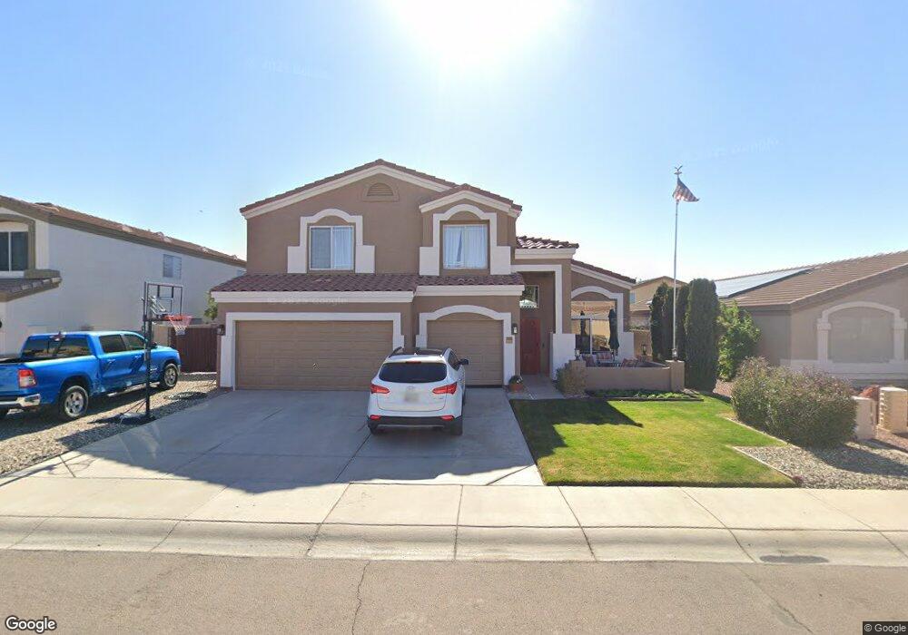
9163 W Quail Ave Peoria, AZ 85382
Estimated Value: $532,195 - $610,000
4
Beds
3
Baths
3,086
Sq Ft
$186/Sq Ft
Est. Value
About This Home
This home is located at 9163 W Quail Ave, Peoria, AZ 85382 and is currently estimated at $574,799, approximately $186 per square foot. 9163 W Quail Ave is a home located in Maricopa County with nearby schools including Coyote Hills Elementary School, Sunrise Mountain High School, and Guidepost Montessori at Peoria.
Ownership History
Date
Name
Owned For
Owner Type
Purchase Details
Closed on
Dec 10, 2018
Sold by
Hensel Anthony
Bought by
Hensel Anthony Karl and Hensel Melinda Sue
Current Estimated Value
Home Financials for this Owner
Home Financials are based on the most recent Mortgage that was taken out on this home.
Original Mortgage
$209,500
Outstanding Balance
$184,574
Interest Rate
4.8%
Mortgage Type
New Conventional
Estimated Equity
$390,225
Purchase Details
Closed on
Jun 28, 2017
Sold by
Hensel Melinda S and Hensel Anthony
Bought by
Hensel Anthony
Home Financials for this Owner
Home Financials are based on the most recent Mortgage that was taken out on this home.
Original Mortgage
$180,000
Interest Rate
4.02%
Mortgage Type
New Conventional
Purchase Details
Closed on
Jul 25, 2008
Sold by
Yuzuik Theodore A
Bought by
Hensel Anthony K and Hensel Melinda S
Home Financials for this Owner
Home Financials are based on the most recent Mortgage that was taken out on this home.
Original Mortgage
$126,000
Interest Rate
6.31%
Mortgage Type
New Conventional
Purchase Details
Closed on
Apr 6, 2006
Sold by
Copeland Lisa
Bought by
Yuzuik Theodore A
Home Financials for this Owner
Home Financials are based on the most recent Mortgage that was taken out on this home.
Original Mortgage
$310,000
Interest Rate
1%
Mortgage Type
Negative Amortization
Purchase Details
Closed on
Apr 13, 2001
Sold by
Cooper Patrick John and Cooper Noel K
Bought by
Yuzuik Theodore A and Copeland Lisa
Home Financials for this Owner
Home Financials are based on the most recent Mortgage that was taken out on this home.
Original Mortgage
$181,800
Interest Rate
7.06%
Mortgage Type
New Conventional
Purchase Details
Closed on
Nov 24, 1999
Sold by
Dietz Crane Homes Llc
Bought by
Cooper Patrick John and Cooper Noel K
Home Financials for this Owner
Home Financials are based on the most recent Mortgage that was taken out on this home.
Original Mortgage
$138,800
Interest Rate
7.84%
Mortgage Type
New Conventional
Create a Home Valuation Report for This Property
The Home Valuation Report is an in-depth analysis detailing your home's value as well as a comparison with similar homes in the area
Home Values in the Area
Average Home Value in this Area
Purchase History
| Date | Buyer | Sale Price | Title Company |
|---|---|---|---|
| Hensel Anthony Karl | -- | Security Title Agency Inc | |
| Hensel Anthony | -- | First American Title Insuran | |
| Hensel Anthony K | $272,000 | Pioneer Title Agency Inc | |
| Yuzuik Theodore A | -- | Tsa Title Agency | |
| Yuzuik Theodore A | $202,000 | Capital Title Agency Inc | |
| Cooper Patrick John | $173,558 | Security Title Agency | |
| Dietz Crane Homes Llc | -- | Security Title Agency |
Source: Public Records
Mortgage History
| Date | Status | Borrower | Loan Amount |
|---|---|---|---|
| Open | Hensel Anthony Karl | $209,500 | |
| Previous Owner | Hensel Anthony | $180,000 | |
| Previous Owner | Hensel Anthony K | $126,000 | |
| Previous Owner | Yuzuik Theodore A | $310,000 | |
| Previous Owner | Yuzuik Theodore A | $181,800 | |
| Previous Owner | Cooper Patrick John | $138,800 |
Source: Public Records
Tax History Compared to Growth
Tax History
| Year | Tax Paid | Tax Assessment Tax Assessment Total Assessment is a certain percentage of the fair market value that is determined by local assessors to be the total taxable value of land and additions on the property. | Land | Improvement |
|---|---|---|---|---|
| 2025 | $2,841 | $29,180 | -- | -- |
| 2024 | $2,753 | $27,791 | -- | -- |
| 2023 | $2,753 | $41,430 | $8,280 | $33,150 |
| 2022 | $2,746 | $31,870 | $6,370 | $25,500 |
| 2021 | $3,004 | $29,780 | $5,950 | $23,830 |
| 2020 | $2,875 | $28,580 | $5,710 | $22,870 |
| 2019 | $2,736 | $26,810 | $5,360 | $21,450 |
| 2018 | $2,273 | $26,000 | $5,200 | $20,800 |
| 2017 | $2,811 | $24,130 | $4,820 | $19,310 |
| 2016 | $2,555 | $23,450 | $4,690 | $18,760 |
| 2015 | $2,423 | $22,630 | $4,520 | $18,110 |
Source: Public Records
Map
Nearby Homes
- 9040 W Deanna Dr
- 9143 W Harmony Ln
- 9031 W Adam Ave
- 9331 W Harmony Ln
- 9457 W Albert Ln
- 84XX W Deer Valley Rd
- 9250 W Runion Dr
- 9331 W Runion Dr
- 20508 N 93rd Ln
- 21617 N 89th Dr
- 9541 W Frank Ave
- 8824 W Adam Ave
- 83XX W Deer Valley Rd Unit 4B
- 20477 N 91st Dr
- 9574 W Quail Ave
- 20459 N 91st Dr
- 9561 W Frank Ave
- 20466 N 90th Ln
- 9372 W Louise Dr
- 9382 W Louise Dr
- 9167 W Quail Ave
- 9159 W Quail Ave
- 9164 W Albert Ln
- 9168 W Albert Ln
- 9160 W Albert Ln
- 9155 W Quail Ave
- 9171 W Quail Ave
- 9164 W Quail Ave
- 9156 W Albert Ln
- 9168 W Quail Ave
- 9160 W Quail Ave
- 9172 W Albert Ln
- 9151 W Quail Ave
- 9172 W Quail Ave
- 9156 W Quail Ave
- 9205 W Quail Ave
- 9152 W Albert Ln
- 9206 W Albert Ln
- 9152 W Quail Ave
- 21262 N 91st Ln