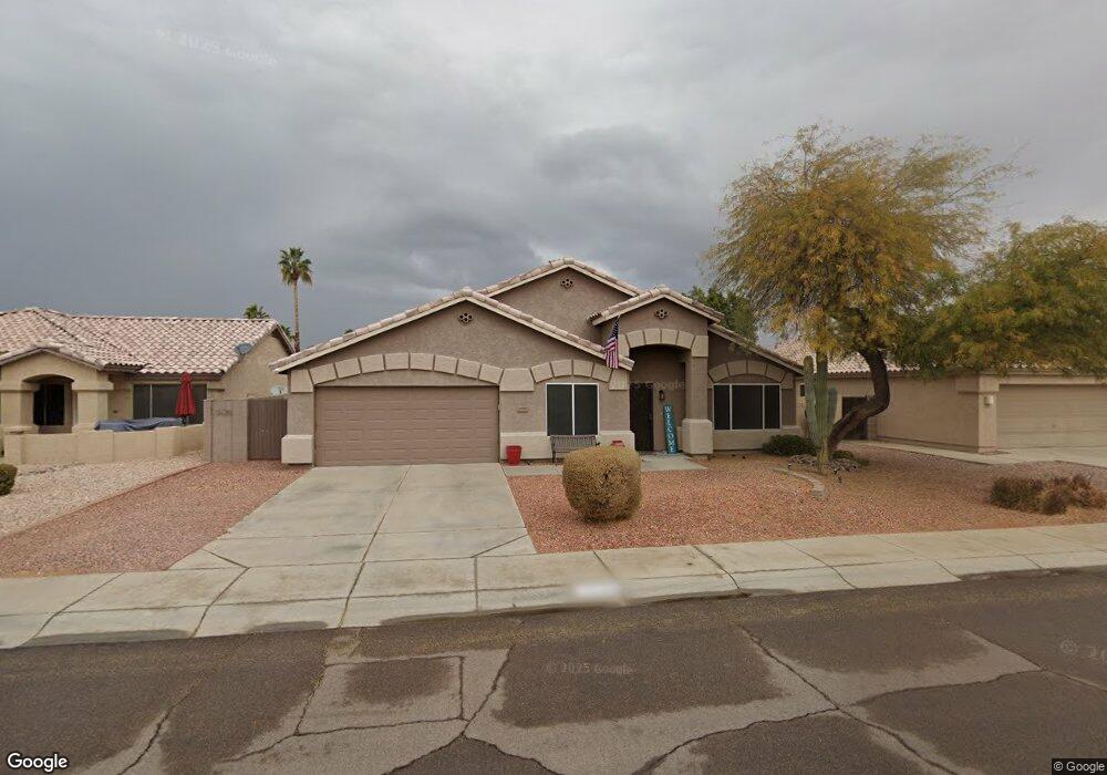
9166 W Lockland Ct Peoria, AZ 85382
Estimated Value: $473,599 - $555,000
--
Bed
3
Baths
2,310
Sq Ft
$227/Sq Ft
Est. Value
About This Home
This home is located at 9166 W Lockland Ct, Peoria, AZ 85382 and is currently estimated at $524,150, approximately $226 per square foot. 9166 W Lockland Ct is a home located in Maricopa County with nearby schools including Desert Harbor Elementary School, Centennial High School, and Sonoran Science Academy-Peoria.
Ownership History
Date
Name
Owned For
Owner Type
Purchase Details
Closed on
May 28, 1998
Sold by
Bolin James O
Bought by
Patty Todd C and Patty Christine M
Current Estimated Value
Home Financials for this Owner
Home Financials are based on the most recent Mortgage that was taken out on this home.
Original Mortgage
$144,400
Interest Rate
7.01%
Mortgage Type
New Conventional
Purchase Details
Closed on
Feb 7, 1997
Sold by
Bpc Inc
Bought by
Bolin James O and Bolin Shawn C
Home Financials for this Owner
Home Financials are based on the most recent Mortgage that was taken out on this home.
Original Mortgage
$131,050
Interest Rate
7.66%
Mortgage Type
New Conventional
Purchase Details
Closed on
Oct 21, 1996
Sold by
Acacia Credit Fund Iii Lp
Bought by
Bpc Inc
Create a Home Valuation Report for This Property
The Home Valuation Report is an in-depth analysis detailing your home's value as well as a comparison with similar homes in the area
Home Values in the Area
Average Home Value in this Area
Purchase History
| Date | Buyer | Sale Price | Title Company |
|---|---|---|---|
| Patty Todd C | $152,000 | Ati Title Agency | |
| Bolin James O | -- | Ati Title Agency | |
| Bolin James O | $145,665 | Fidelity Title | |
| Bpc Inc | $119,950 | Fidelity Title |
Source: Public Records
Mortgage History
| Date | Status | Borrower | Loan Amount |
|---|---|---|---|
| Previous Owner | Patty Todd C | $144,400 | |
| Previous Owner | Bolin James O | $131,050 |
Source: Public Records
Tax History Compared to Growth
Tax History
| Year | Tax Paid | Tax Assessment Tax Assessment Total Assessment is a certain percentage of the fair market value that is determined by local assessors to be the total taxable value of land and additions on the property. | Land | Improvement |
|---|---|---|---|---|
| 2025 | $2,107 | $26,565 | -- | -- |
| 2024 | $2,071 | $25,300 | -- | -- |
| 2023 | $2,071 | $38,600 | $7,720 | $30,880 |
| 2022 | $2,028 | $29,070 | $5,810 | $23,260 |
| 2021 | $2,168 | $26,810 | $5,360 | $21,450 |
| 2020 | $2,189 | $25,160 | $5,030 | $20,130 |
| 2019 | $2,120 | $24,980 | $4,990 | $19,990 |
| 2018 | $2,037 | $23,900 | $4,780 | $19,120 |
| 2017 | $2,039 | $22,460 | $4,490 | $17,970 |
| 2016 | $2,017 | $21,500 | $4,300 | $17,200 |
| 2015 | $1,883 | $20,630 | $4,120 | $16,510 |
Source: Public Records
Map
Nearby Homes
- 16251 N 91st Dr
- 9235 W Marconi Ave
- 16017 N Nicklaus Ln
- 8809 W Sandra Terrace
- 16414 N Meadow Park Dr
- 8653 W Paradise Ln
- 16801 N Pine Valley Dr
- 9002 W Caribbean Ln
- 16832 N Pine Valley Dr
- 15430 N Bowling Green Dr
- 9326 W Briarwood Cir
- 9151 W Greenway Rd Unit 288
- 15211 N 89th Ave
- 8640 W Mauro Ln
- 15406 N Bowling Green Dr
- 8630 W Marconi Ave
- 15360 N 87th Ave
- 9337 W Hidden Valley Cir N
- 16829 N Orchard Hills Dr
- 15099 N 89th Ave
- 9158 W Lockland Ct
- 9174 W Lockland Ct
- 9163 W Davis Rd
- 9157 W Davis Rd
- 9182 W Lockland Ct
- 9150 W Lockland Ct
- 9169 W Davis Rd
- 9151 W Davis Rd
- 9165 W Lockland Ct
- 9175 W Davis Rd
- 9157 W Lockland Ct
- 9145 W Davis Rd
- 9212 W Lockland Ct
- 9173 W Lockland Ct
- 9142 W Lockland Ct
- 15950 N 91st Dr
- 9181 W Davis Rd
- 9181 W Lockland Ct
- 9139 W Davis Rd
- 9220 W Lockland Ct