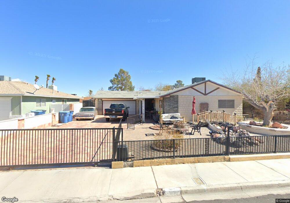
917 Alan Shepard St Las Vegas, NV 89145
Charleston Preservation NeighborhoodEstimated Value: $350,000 - $403,259
3
Beds
2
Baths
1,358
Sq Ft
$283/Sq Ft
Est. Value
About This Home
This home is located at 917 Alan Shepard St, Las Vegas, NV 89145 and is currently estimated at $384,565, approximately $283 per square foot. 917 Alan Shepard St is a home located in Clark County with nearby schools including Helen M Smith Elementary School, Walter Johnson Junior High School Academy of International Studies, and Bonanza High School.
Ownership History
Date
Name
Owned For
Owner Type
Purchase Details
Closed on
May 22, 1996
Sold by
Penick David K and Penick Gerre A
Bought by
Benjamins Jan and Benjamins Pamela E
Current Estimated Value
Home Financials for this Owner
Home Financials are based on the most recent Mortgage that was taken out on this home.
Original Mortgage
$104,500
Outstanding Balance
$6,003
Interest Rate
8.09%
Estimated Equity
$378,562
Create a Home Valuation Report for This Property
The Home Valuation Report is an in-depth analysis detailing your home's value as well as a comparison with similar homes in the area
Home Values in the Area
Average Home Value in this Area
Purchase History
| Date | Buyer | Sale Price | Title Company |
|---|---|---|---|
| Benjamins Jan | $110,000 | Old Republic Title Company |
Source: Public Records
Mortgage History
| Date | Status | Borrower | Loan Amount |
|---|---|---|---|
| Open | Benjamins Jan | $104,500 |
Source: Public Records
Tax History Compared to Growth
Tax History
| Year | Tax Paid | Tax Assessment Tax Assessment Total Assessment is a certain percentage of the fair market value that is determined by local assessors to be the total taxable value of land and additions on the property. | Land | Improvement |
|---|---|---|---|---|
| 2025 | $1,703 | $62,712 | $35,350 | $27,362 |
| 2024 | $1,577 | $62,712 | $35,350 | $27,362 |
| 2023 | $1,577 | $61,905 | $34,650 | $27,255 |
| 2022 | $1,461 | $54,807 | $29,050 | $25,757 |
| 2021 | $1,353 | $51,342 | $26,250 | $25,092 |
| 2020 | $1,253 | $50,365 | $24,850 | $25,515 |
| 2019 | $1,174 | $47,066 | $21,350 | $25,716 |
| 2018 | $1,121 | $44,128 | $18,900 | $25,228 |
| 2017 | $1,417 | $43,236 | $17,150 | $26,086 |
| 2016 | $1,050 | $40,347 | $13,300 | $27,047 |
| 2015 | $1,047 | $37,367 | $10,500 | $26,867 |
| 2014 | $1,016 | $32,075 | $6,300 | $25,775 |
Source: Public Records
Map
Nearby Homes
- 1020 Alan Shepard St
- 933 Palmhurst Dr
- 7213 Lakeland Ct
- 7116 Michael Collins Place
- 7609 Pheasant Ln
- 809 Peacock Ct
- 7701 Pheasant Ln
- 1121 Plantation Ct
- 7200 Alta Dr
- 7500 Crystal Cave Dr
- 7540 Crystal Cave Dr
- 824 Antigua St
- 816 Antigua St
- 7814 Gable Ln Unit 12112
- 7803 Canoe Ln
- 7820 Ravenhollow Ln Unit 11812
- 701 Harvest Run Dr Unit 104
- 804 Vincent Way
- 332 Huntly Rd Unit 13C
- 717 Wheat Ridge Ln Unit 103
- 921 Alan Shepard St
- 7221 John Glenn Cir
- 7224 John Glenn Cir
- 909 Alan Shepard St
- 7224 Frank Borman Ave
- 916 Alan Shepard St
- 920 Alan Shepard St
- 912 Alan Shepard St
- 924 Alan Shepard St
- 7220 John Glenn Cir
- 908 Alan Shepard St
- 905 Alan Shepard St
- 7217 John Glenn Cir
- 928 Alan Shepard St
- 7216 Frank Borman Ave
- 904 Alan Shepard St
- 1001 Alan Shepard St
- 7216 John Glenn Cir
- 7213 John Glenn Cir