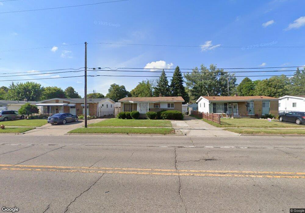
917 E Hemphill Rd Flint, MI 48507
Circle Drive NeighborhoodEstimated Value: $82,083 - $104,000
3
Beds
2
Baths
1,037
Sq Ft
$86/Sq Ft
Est. Value
About This Home
This home is located at 917 E Hemphill Rd, Flint, MI 48507 and is currently estimated at $89,021, approximately $85 per square foot. 917 E Hemphill Rd is a home located in Genesee County with nearby schools including Freeman Elementary School, Flint Southwestern Classical Academy, and International Academy of Flint (K-12).
Ownership History
Date
Name
Owned For
Owner Type
Purchase Details
Closed on
Jan 18, 2024
Sold by
Shields Edward D and Shields Joan L
Bought by
Shields Todd E
Current Estimated Value
Purchase Details
Closed on
Sep 9, 2014
Sold by
Do Loc Tien
Bought by
Shields Edward D
Purchase Details
Closed on
Jan 13, 2006
Sold by
Knowles Charles R and Knowles Carol A
Bought by
Do Loc Tien
Purchase Details
Closed on
Nov 19, 1998
Sold by
Adm Veterans Affairs
Bought by
Mehalopoulos Peter and Mehalopoulos Tasia
Create a Home Valuation Report for This Property
The Home Valuation Report is an in-depth analysis detailing your home's value as well as a comparison with similar homes in the area
Home Values in the Area
Average Home Value in this Area
Purchase History
| Date | Buyer | Sale Price | Title Company |
|---|---|---|---|
| Shields Todd E | -- | None Listed On Document | |
| Shields Edward D | $9,000 | None Available | |
| Do Loc Tien | -- | None Available | |
| Mehalopoulos Peter | -- | -- |
Source: Public Records
Tax History
| Year | Tax Paid | Tax Assessment Tax Assessment Total Assessment is a certain percentage of the fair market value that is determined by local assessors to be the total taxable value of land and additions on the property. | Land | Improvement |
|---|---|---|---|---|
| 2025 | $1,028 | $38,900 | $0 | $0 |
| 2024 | $954 | $34,000 | $0 | $0 |
| 2023 | $935 | $28,600 | $0 | $0 |
| 2022 | $0 | $21,900 | $0 | $0 |
| 2021 | $946 | $20,700 | $0 | $0 |
| 2020 | $873 | $20,200 | $0 | $0 |
| 2019 | $856 | $12,400 | $0 | $0 |
| 2018 | $840 | $10,000 | $0 | $0 |
| 2017 | $819 | $0 | $0 | $0 |
| 2016 | $814 | $0 | $0 | $0 |
| 2015 | -- | $0 | $0 | $0 |
| 2014 | -- | $0 | $0 | $0 |
| 2012 | -- | $15,700 | $0 | $0 |
Source: Public Records
Map
Nearby Homes
- 802 McKeighan Ave
- 818 Dell Ave
- 4424 Cheyenne Ave
- 617 McKeighan Ave
- 621 Lochhead Ave
- 530 McKeighan Ave
- 621 Burroughs Ave
- 630 Buckingham Ave
- 3128 Ludwig St
- 3056 Shaw St
- 4127 Custer Ave
- 4205 Red Arrow Rd
- 416 Burroughs Ave
- 0000 E Bristol Rd
- 338 Browning Ave
- 3442 Griffith Ct
- 3512 Barcey Ct
- 3505 Comanche Ave
- 326 Burroughs Ave
- 2194 E Bristol Rd
- 913 E Hemphill Rd
- 1001 E Hemphill Rd
- 909 E Hemphill Rd
- 1005 E Hemphill Rd
- 918 Macdonald Ave
- 914 Macdonald Ave
- 1002 Macdonald Ave
- 906 Macdonald Ave
- 905 E Hemphill Rd
- 910 Macdonald Ave
- 1006 Macdonald Ave
- 1010 Macdonald Ave
- 901 E Hemphill Rd
- 1013 E Hemphill Rd
- 902 Macdonald Ave
- 1014 Macdonald Ave
- 817 E Hemphill Rd
- 1017 E Hemphill Rd
- 818 Macdonald Ave
Your Personal Tour Guide
Ask me questions while you tour the home.