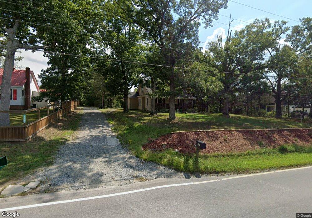
917 Fisher Ferry St Thomasville, NC 27360
Estimated Value: $189,000 - $245,000
4
Beds
1
Bath
1,717
Sq Ft
$119/Sq Ft
Est. Value
About This Home
This home is located at 917 Fisher Ferry St, Thomasville, NC 27360 and is currently estimated at $204,679, approximately $119 per square foot. 917 Fisher Ferry St is a home located in Davidson County with nearby schools including Thomasville Primary School, Liberty Drive Elementary School, and Thomasville Middle School.
Ownership History
Date
Name
Owned For
Owner Type
Purchase Details
Closed on
Jul 23, 2022
Sold by
Vaughn Harold E and Vaughn Joan P
Bought by
Vaughn Harold E and Vaughn Joan P
Current Estimated Value
Purchase Details
Closed on
Jun 5, 2002
Sold by
Martin Randy and Martin Lori
Bought by
Vaughn Harold E
Purchase Details
Closed on
Jan 1, 1999
Purchase Details
Closed on
Aug 1, 1998
Purchase Details
Closed on
Jan 1, 1996
Create a Home Valuation Report for This Property
The Home Valuation Report is an in-depth analysis detailing your home's value as well as a comparison with similar homes in the area
Home Values in the Area
Average Home Value in this Area
Purchase History
| Date | Buyer | Sale Price | Title Company |
|---|---|---|---|
| Vaughn Harold E | -- | Mcguire Mark L | |
| Vaughn Harold E | -- | Mcguire Mark L | |
| Vaughn Harold E | $62,000 | -- | |
| -- | $45,000 | -- | |
| -- | -- | -- | |
| -- | $35,000 | -- |
Source: Public Records
Tax History Compared to Growth
Tax History
| Year | Tax Paid | Tax Assessment Tax Assessment Total Assessment is a certain percentage of the fair market value that is determined by local assessors to be the total taxable value of land and additions on the property. | Land | Improvement |
|---|---|---|---|---|
| 2025 | $963 | $84,260 | $0 | $0 |
| 2024 | $1,040 | $91,010 | $0 | $0 |
| 2023 | $1,040 | $91,010 | $0 | $0 |
| 2022 | $1,040 | $91,010 | $0 | $0 |
| 2021 | $1,040 | $91,010 | $0 | $0 |
| 2020 | $737 | $65,610 | $0 | $0 |
| 2019 | $748 | $65,610 | $0 | $0 |
| 2018 | $742 | $65,100 | $0 | $0 |
| 2017 | $742 | $65,100 | $0 | $0 |
| 2016 | $716 | $65,100 | $0 | $0 |
| 2015 | $716 | $65,100 | $0 | $0 |
| 2014 | $740 | $67,300 | $0 | $0 |
Source: Public Records
Map
Nearby Homes
- 0 Smith Dr
- 307 Fisher Ferry St
- 708 Ferndale Dr
- 106 Kincemac Dr
- 122 S Old Fisher Ferry Rd
- 1 Westwood Ave
- 512 Concord St
- 217 Moon St
- 223 S Westwood Ave
- 6 Curtis Ct
- 14 Welloski Dr
- 208 Wagstaff St
- 2619 N Carolina 109
- 415 Spring St
- 305 Spring St
- 316 Spring St
- 314 Spring St
- 296 Fairgrove Rd
- 25 Cedar Lodge Rd
- 329 W Main St
- 915 Fisher Ferry St
- 919 Fisher Ferry St
- 921 Fisher Ferry St
- 913 Fisher Ferry St
- 910 Fisher Ferry St
- 908 Fisher Ferry St
- 907 Fisher Ferry St
- 912 Fisher Ferry St
- 906 Fisher Ferry St
- 905 Fisher Ferry St
- 911 Fisher Ferry St
- 923 Fisher Ferry St
- 1007 Virginia Rd
- 1007 Virginia St
- 916 Fisher Ferry St
- 1002 Virginia St
- 1002 Virginia St
- 904 Fisher Ferry St
- 1009 Virginia Rd
- 903 Fisher Ferry St