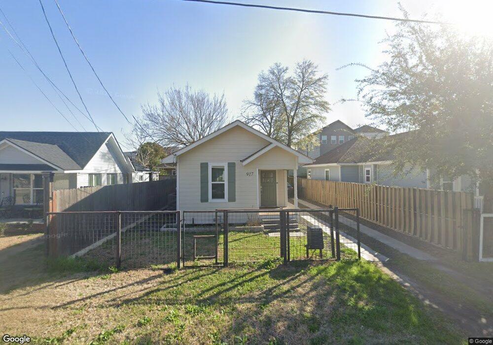
917 Kern St Houston, TX 77009
Greater Heights NeighborhoodEstimated Value: $407,646 - $475,000
2
Beds
1
Bath
790
Sq Ft
$548/Sq Ft
Est. Value
About This Home
This home is located at 917 Kern St, Houston, TX 77009 and is currently estimated at $433,162, approximately $548 per square foot. 917 Kern St is a home located in Harris County with nearby schools including Field Elementary School, Hogg Middle, and Heights High School.
Ownership History
Date
Name
Owned For
Owner Type
Purchase Details
Closed on
Dec 9, 2016
Sold by
Hakert Michael S and Hakert Deborah T
Bought by
Hakert John C
Current Estimated Value
Home Financials for this Owner
Home Financials are based on the most recent Mortgage that was taken out on this home.
Original Mortgage
$140,000
Outstanding Balance
$113,117
Interest Rate
3.54%
Mortgage Type
New Conventional
Estimated Equity
$320,045
Purchase Details
Closed on
Nov 2, 2015
Sold by
Mcdonald John
Bought by
Hakert Michael and Hakert Deborah
Purchase Details
Closed on
Feb 2, 2001
Sold by
Sweeney Sharon R
Bought by
Mcdonald John
Home Financials for this Owner
Home Financials are based on the most recent Mortgage that was taken out on this home.
Original Mortgage
$72,500
Interest Rate
7.13%
Create a Home Valuation Report for This Property
The Home Valuation Report is an in-depth analysis detailing your home's value as well as a comparison with similar homes in the area
Home Values in the Area
Average Home Value in this Area
Purchase History
| Date | Buyer | Sale Price | Title Company |
|---|---|---|---|
| Hakert John C | -- | None Available | |
| Hakert Michael | -- | None Available | |
| Mcdonald John | -- | American Title Co |
Source: Public Records
Mortgage History
| Date | Status | Borrower | Loan Amount |
|---|---|---|---|
| Open | Hakert John C | $140,000 | |
| Previous Owner | Mcdonald John | $72,500 |
Source: Public Records
Tax History Compared to Growth
Tax History
| Year | Tax Paid | Tax Assessment Tax Assessment Total Assessment is a certain percentage of the fair market value that is determined by local assessors to be the total taxable value of land and additions on the property. | Land | Improvement |
|---|---|---|---|---|
| 2025 | $5,742 | $438,126 | $281,250 | $156,876 |
| 2024 | $5,742 | $394,211 | $262,500 | $131,711 |
| 2023 | $5,742 | $384,838 | $262,500 | $122,338 |
| 2022 | $7,751 | $365,000 | $225,000 | $140,000 |
| 2021 | $7,458 | $320,000 | $180,000 | $140,000 |
| 2020 | $7,991 | $329,993 | $180,000 | $149,993 |
| 2019 | $7,591 | $300,000 | $180,000 | $120,000 |
| 2018 | $5,562 | $288,246 | $131,250 | $156,996 |
| 2017 | $7,288 | $288,246 | $131,250 | $156,996 |
| 2016 | $3,903 | $154,350 | $123,047 | $31,303 |
| 2015 | $3,410 | $177,983 | $123,047 | $54,936 |
| 2014 | $3,410 | $132,660 | $80,859 | $51,801 |
Source: Public Records
Map
Nearby Homes
- 1005 Kern St Unit C
- 1005 Kern St Unit B
- 905 Kern St
- 1737 Airline Dr
- 931 Louise St
- 1340 Idylwild St
- 1719 Redwing Pines Dr
- 1106 Robbie St
- 738 Redwing Place Dr
- 1124 Dunbar St
- 1102 Winston St
- 1707 Redwing Cove Dr
- 1611 Airline Dr
- 1805 Emir St Unit G
- 1805 Emir St Unit D
- 1805 Emir St Unit L
- 1805 Emir St Unit E
- 1021 Nadine St
- 1131 Louise St
- 1122 Louise St
- 921 Kern St
- 913 Kern St
- 929 Kern St
- 911 Kern St
- 911 Kern St Unit B
- 924 Dunbar St
- 920 Dunbar St
- 928 Dunbar St Unit B
- 907 Kern St
- 907 Kern St Unit A
- 907 Kern St Unit B
- 930 Dunbar St
- 912 Kern St
- 928 Kern St
- 1733 Airline Dr
- 1733 Airline Dr Unit A
- 1733 Airline Dr Unit B
- 932 Dunbar St
- 910 Kern St
- 5304 Michaux St