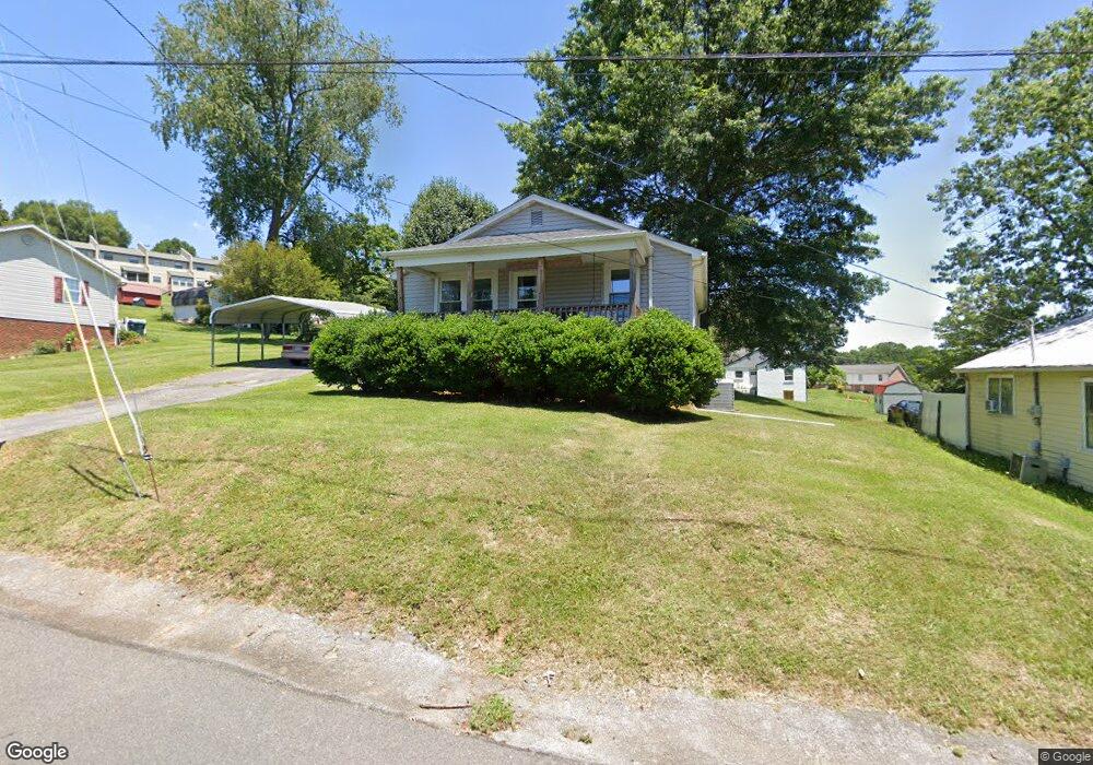
917 Lewis St Bristol, VA 24201
Estimated Value: $134,000 - $155,000
2
Beds
1
Bath
832
Sq Ft
$178/Sq Ft
Est. Value
About This Home
This home is located at 917 Lewis St, Bristol, VA 24201 and is currently estimated at $148,048, approximately $177 per square foot. 917 Lewis St is a home located in Bristol City with nearby schools including Virginia High School, Tri-Cities Christian School, and Morrison School.
Ownership History
Date
Name
Owned For
Owner Type
Purchase Details
Closed on
Mar 19, 2007
Sold by
Pannell Todd B and Stapleton Pr Patricia L
Bought by
Hutchison Frank P and Hutchison Sandra L
Current Estimated Value
Home Financials for this Owner
Home Financials are based on the most recent Mortgage that was taken out on this home.
Original Mortgage
$59,073
Outstanding Balance
$36,029
Interest Rate
6.4%
Mortgage Type
FHA
Estimated Equity
$112,019
Create a Home Valuation Report for This Property
The Home Valuation Report is an in-depth analysis detailing your home's value as well as a comparison with similar homes in the area
Home Values in the Area
Average Home Value in this Area
Purchase History
| Date | Buyer | Sale Price | Title Company |
|---|---|---|---|
| Hutchison Frank P | $60,000 | -- |
Source: Public Records
Mortgage History
| Date | Status | Borrower | Loan Amount |
|---|---|---|---|
| Open | Hutchison Frank P | $59,073 |
Source: Public Records
Tax History Compared to Growth
Tax History
| Year | Tax Paid | Tax Assessment Tax Assessment Total Assessment is a certain percentage of the fair market value that is determined by local assessors to be the total taxable value of land and additions on the property. | Land | Improvement |
|---|---|---|---|---|
| 2025 | $950 | $102,100 | $16,000 | $86,100 |
| 2024 | $687 | $61,300 | $12,500 | $48,800 |
| 2023 | $717 | $61,300 | $12,500 | $48,800 |
| 2022 | $687 | $61,300 | $12,500 | $48,800 |
| 2021 | $687 | $61,300 | $12,500 | $48,800 |
| 2020 | $634 | $54,200 | $12,500 | $41,700 |
| 2019 | $634 | $54,200 | $12,500 | $41,700 |
| 2018 | $317 | $54,200 | $12,500 | $41,700 |
| 2016 | -- | $42,500 | $0 | $0 |
| 2015 | -- | $0 | $0 | $0 |
| 2014 | -- | $0 | $0 | $0 |
Source: Public Records
Map
Nearby Homes
- 401 Crockett St
- 460 Vance St
- 255 Locust Hill Dr
- 728 Randolph St
- 2121 2123 Randolph St
- 1057 Moorland Ave
- Tbd Amy St
- 2104 Osborne St
- 1724 & 1728 Euclid Ave
- 2241 Bradley St
- 548 Floyd St
- 2000 Euclid Ave
- 2412,14,16 Bradley St
- 60 Peters St
- 000 Hemlock Dr
- 480 Ventura Cir
- 461 Douglas St
- 2400 Bradley St
- 420 Douglas St
- 520 Ventura Cir