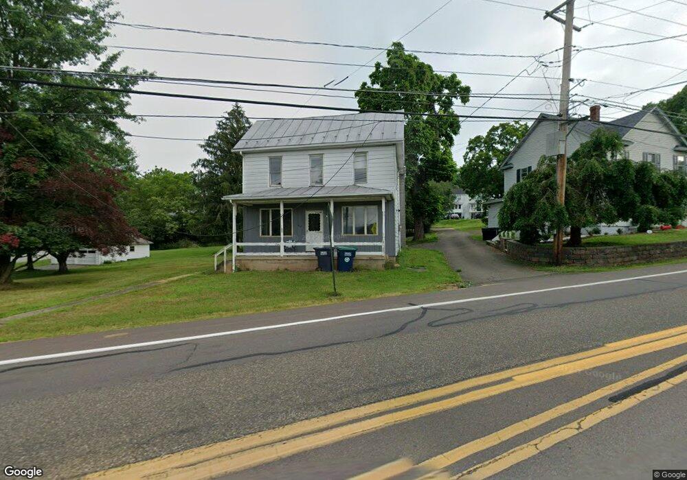
917 Lightstreet Rd Bloomsburg, PA 17815
Estimated Value: $191,000 - $233,000
--
Bed
--
Bath
1,572
Sq Ft
$135/Sq Ft
Est. Value
About This Home
This home is located at 917 Lightstreet Rd, Bloomsburg, PA 17815 and is currently estimated at $212,829, approximately $135 per square foot. 917 Lightstreet Rd is a home located in Columbia County with nearby schools including Memorial Elementary School, Bloomsburg Area Middle School, and Bloomsburg Area High School.
Ownership History
Date
Name
Owned For
Owner Type
Purchase Details
Closed on
Jul 25, 2024
Sold by
Donald And Kay Camplese Revocable Trust and Camplese Kay F
Bought by
Knapp Elijah T
Current Estimated Value
Home Financials for this Owner
Home Financials are based on the most recent Mortgage that was taken out on this home.
Original Mortgage
$140,000
Interest Rate
6.95%
Mortgage Type
Construction
Purchase Details
Closed on
May 27, 2016
Sold by
Camplese Donald A and The Donald A Camplese Revocabl
Bought by
Camplese Donald A and Camplese Kay F
Purchase Details
Closed on
Nov 27, 2013
Sold by
Carroll Dean
Bought by
Camplese Donald A
Purchase Details
Closed on
Jun 29, 2005
Sold by
Miller Thomas Charles
Bought by
Carroll Deann
Create a Home Valuation Report for This Property
The Home Valuation Report is an in-depth analysis detailing your home's value as well as a comparison with similar homes in the area
Home Values in the Area
Average Home Value in this Area
Purchase History
| Date | Buyer | Sale Price | Title Company |
|---|---|---|---|
| Knapp Elijah T | $175,000 | Multi County Land Abstract | |
| Camplese Donald A | -- | None Available | |
| Camplese Donald A | $125,000 | None Available | |
| Carroll Deann | $109,000 | None Available |
Source: Public Records
Mortgage History
| Date | Status | Borrower | Loan Amount |
|---|---|---|---|
| Closed | Knapp Elijah T | $140,000 |
Source: Public Records
Tax History Compared to Growth
Tax History
| Year | Tax Paid | Tax Assessment Tax Assessment Total Assessment is a certain percentage of the fair market value that is determined by local assessors to be the total taxable value of land and additions on the property. | Land | Improvement |
|---|---|---|---|---|
| 2025 | $2,453 | $27,196 | $0 | $0 |
| 2024 | $2,412 | $27,196 | $11,924 | $15,272 |
| 2023 | $2,236 | $27,196 | $11,924 | $15,272 |
| 2022 | $2,155 | $27,196 | $11,924 | $15,272 |
| 2021 | $2,109 | $27,196 | $11,924 | $15,272 |
| 2020 | $2,022 | $27,196 | $11,924 | $15,272 |
| 2019 | $1,988 | $27,196 | $11,924 | $15,272 |
| 2018 | $1,942 | $27,196 | $11,924 | $15,272 |
| 2017 | $1,843 | $27,196 | $11,924 | $15,272 |
| 2016 | -- | $27,196 | $11,924 | $15,272 |
| 2015 | -- | $27,196 | $11,924 | $15,272 |
| 2014 | -- | $27,196 | $11,924 | $15,272 |
Source: Public Records
Map
Nearby Homes
- 4 York Rd
- 712 Country Club Dr
- 925 Mcguire Rd
- 829 Lightstreet Rd
- 601 Honeysuckle Ln
- 575 Crestwood Dr
- 1219 Maple St
- 505 Crestwood Dr
- 638 E 4th St
- 1238 Cherry St
- 520 E 4th St
- 375377 Fetterman Ave
- 1246 Cherry St
- 315 E 3rd St
- 413 East St
- 10 Pine St
- 1311 Sassafras St
- 1251 Chestnut St
- 650652 Old Berwick Rd
- 240 E 5th St
- 931 Lightstreet Rd
- 7 Country Club Dr
- 3 Country Club Dr
- 922 Lightstreet Rd
- 916 Country Club Dr
- 918 Country Club Dr
- 920 Country Club Dr
- 922 Country Club Dr
- 914 Country Club Dr
- 912 Country Club Dr
- 924 Country Club Dr
- 910 Country Club Dr
- 7 York Rd
- 926 Country Club Dr
- 5 York Rd
- 9 York Rd
- 934 Lightstreet Rd
- 928 Country Club Dr
- 930 Country Club Dr
- 932 Country Club Dr