Estimated Value: $274,000 - $316,000
About This Home
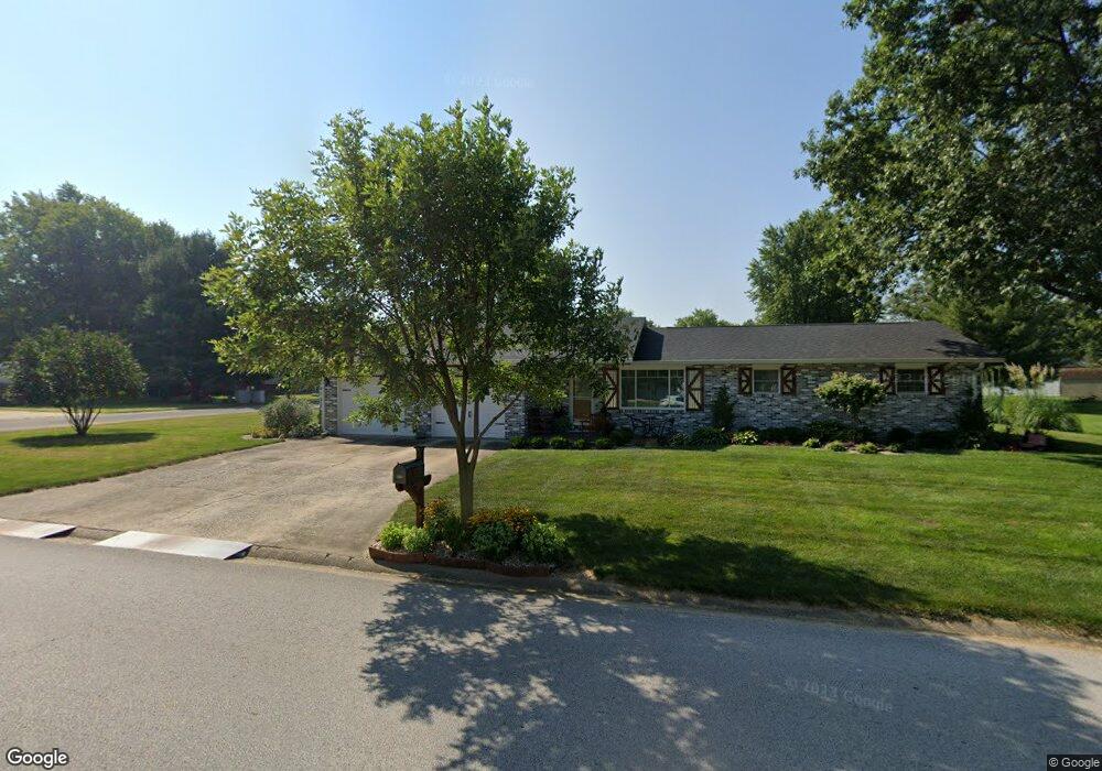
This home is located at 917 Long Branch Rd, Troy, IL 62294 and is currently estimated at $295,441, approximately $174 per square foot. 917 Long Branch Rd is a home located in Madison County with nearby schools including Silver Creek Elementary School, Triad Middle School, and Triad High School.
Ownership History
We collect this data history from publicly available records. To have your information removed, we recommend requesting removal directly through your county’s website.
Purchase Details
Home Financials for this Owner
Home Financials are based on the most recent Mortgage that was taken out on this home.Purchase Details
Home Financials for this Owner
Home Financials are based on the most recent Mortgage that was taken out on this home.Purchase Details
Home Financials for this Owner
Home Financials are based on the most recent Mortgage that was taken out on this home.Purchase Details
Home Financials for this Owner
Home Financials are based on the most recent Mortgage that was taken out on this home.Home Values in the Area
Average Home Value in this Area
Purchase History
We collect this data history from publicly available records. To have your information removed, we recommend requesting removal directly through your county’s website.
| Date | Buyer | Sale Price | Title Company |
|---|---|---|---|
| $187,500 | First American Title Ins Co | ||
| -- | Multiple | ||
| $162,000 | Abstracts & Titles Inc | ||
| $136,500 | Mctc |
Mortgage History
We collect this data history from publicly available records. To have your information removed, we recommend requesting removal directly through your county’s website.
| Date | Status | Borrower | Loan Amount |
|---|---|---|---|
| Open | $150,000 | ||
| Previous Owner | $164,815 | ||
| Previous Owner | $165,483 | ||
| Previous Owner | $140,694 |
Tax History
We collect this data history from publicly available records. To have your information removed, we recommend requesting removal directly through your county’s website.
| Year | Tax Paid | Tax Assessment Tax Assessment Total Assessment is a certain percentage of the fair market value that is determined by local assessors to be the total taxable value of land and additions on the property. | Land | Improvement |
|---|---|---|---|---|
| 2025 | $5,355 | $83,390 | $18,070 | $65,320 |
| 2024 | $5,013 | $77,760 | $16,850 | $60,910 |
| 2023 | $5,013 | $70,600 | $15,300 | $55,300 |
| 2022 | $4,637 | $65,010 | $14,090 | $50,920 |
| 2021 | $4,286 | $61,780 | $13,390 | $48,390 |
| 2020 | $4,284 | $60,180 | $13,040 | $47,140 |
| 2019 | $4,209 | $58,940 | $12,770 | $46,170 |
| 2018 | $4,097 | $54,610 | $11,830 | $42,780 |
| 2017 | $3,952 | $53,470 | $11,580 | $41,890 |
| 2016 | $3,919 | $53,470 | $11,580 | $41,890 |
| 2015 | $3,513 | $51,700 | $11,200 | $40,500 |
| 2014 | $3,513 | $51,700 | $11,200 | $40,500 |
| 2013 | $3,513 | $51,700 | $11,200 | $40,500 |
Map
- 929 Carla Dr
- 945 Ivy Ct
- 1940 – 1964 Sra Bradley R Smith
- 1831 Wellington Ln
- 13 Sonata Ln
- 21 Sonata Ln
- 120 Eisenhower Blvd
- 308 Rumsfeld Dr
- 421 Rumsfeld Dr
- 320 Rumsfeld Dr
- 308 George Bush Blvd
- 421 George Bush Blvd
- 113 N Wilson Heights Rd
- 9 Parklane Dr W
- 0 Homes of Liberty Place
- 420 Chamberlain Dr
- 202 Willow Dr
- 7509 Clarence Ct
- 2228 Vadalabene Dr
- 2220 Vadalabene Dr
- 919 Long Branch Rd
- 111 Olde Farm Rd
- 913 Long Branch Rd
- 916 Long Branch Rd
- 110 Olde Farm Rd
- 921 Long Branch Rd
- 914 Long Branch Rd
- 920 Harvestyme Ln
- 920 Long Branch Rd
- 113 Olde Farm Rd
- 922 Harvestyme Ln
- 112 Olde Farm Rd
- 911 Long Branch Rd
- 910 Cloverfield Ln
- 912 Long Branch Rd
- 922 Long Branch Rd
- 923 Long Branch Rd
- 917 Wheatridge Dr
- 921 Wheatridge Dr
- 915 Wheatridge Dr
Ask me questions while you tour the home.