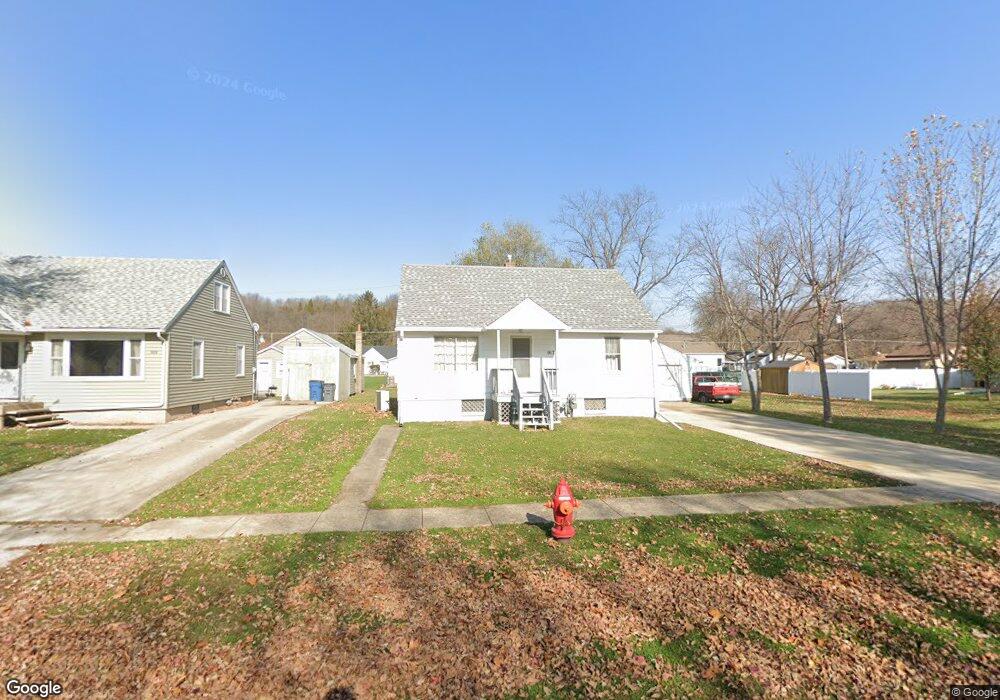
917 Magnolia St Marseilles, IL 61341
Estimated Value: $112,553 - $186,000
--
Bed
--
Bath
832
Sq Ft
$162/Sq Ft
Est. Value
About This Home
This home is located at 917 Magnolia St, Marseilles, IL 61341 and is currently estimated at $134,388, approximately $161 per square foot. 917 Magnolia St is a home located in LaSalle County with nearby schools including Marseilles Elementary School and Ottawa Township High School.
Ownership History
Date
Name
Owned For
Owner Type
Purchase Details
Closed on
Jun 24, 2017
Sold by
Eiben Stephen G and Eiben Debra M
Bought by
Eiben Stephen G and Eiben Debra M
Current Estimated Value
Purchase Details
Closed on
Sep 3, 2010
Sold by
Eiben Jeffrey and Eiben Douglas
Bought by
Eiben Debra M and Eiben Stephen G
Home Financials for this Owner
Home Financials are based on the most recent Mortgage that was taken out on this home.
Original Mortgage
$50,000
Interest Rate
4.82%
Mortgage Type
New Conventional
Purchase Details
Closed on
Sep 17, 2009
Sold by
Eiben Velma
Bought by
Eiben Jeffrey and Eiben Douglas
Create a Home Valuation Report for This Property
The Home Valuation Report is an in-depth analysis detailing your home's value as well as a comparison with similar homes in the area
Home Values in the Area
Average Home Value in this Area
Purchase History
| Date | Buyer | Sale Price | Title Company |
|---|---|---|---|
| Eiben Stephen G | -- | -- | |
| Eiben Debra M | $60,000 | First American Title Company | |
| Eiben Jeffrey | -- | None Available |
Source: Public Records
Mortgage History
| Date | Status | Borrower | Loan Amount |
|---|---|---|---|
| Previous Owner | Eiben Debra M | $50,000 |
Source: Public Records
Tax History Compared to Growth
Tax History
| Year | Tax Paid | Tax Assessment Tax Assessment Total Assessment is a certain percentage of the fair market value that is determined by local assessors to be the total taxable value of land and additions on the property. | Land | Improvement |
|---|---|---|---|---|
| 2024 | $3,062 | $37,493 | $5,916 | $31,577 |
| 2023 | $1,777 | $29,560 | $5,325 | $24,235 |
| 2022 | $1,798 | $27,866 | $5,020 | $22,846 |
| 2021 | $1,741 | $26,244 | $4,728 | $21,516 |
| 2020 | $2,180 | $25,276 | $4,554 | $20,722 |
| 2019 | $2,109 | $24,793 | $4,467 | $20,326 |
| 2018 | $2,108 | $24,205 | $4,361 | $19,844 |
| 2017 | $1,003 | $23,631 | $4,258 | $19,373 |
| 2016 | $1,003 | $23,248 | $4,189 | $19,059 |
| 2015 | $2,000 | $23,006 | $4,145 | $18,861 |
| 2012 | -- | $21,241 | $3,827 | $17,414 |
Source: Public Records
Map
Nearby Homes
- 927 Clark St
- 1019-1021 Bluff Place
- 1026 Catalpa St
- 1028 Catalpa St
- 827 Canal St
- 622 Clark St
- 414 W Bluff St
- 532 1st St
- 269 Clark St
- 640 Rutland St
- 1129 Rutland St
- 330 E Bluff St
- 401 Scott St
- 454 Washington St
- 2872 E 2339th Rd
- 521 Broadway St
- 2665 E Rt 6
- 1037 Carter St
- 901-903 Colorado St
- 893-895 Colorado St