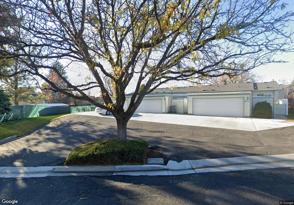
917 N 400 W Unit C American Fork, UT 84003
Estimated Value: $384,276 - $447,000
5
Beds
2
Baths
2,622
Sq Ft
$157/Sq Ft
Est. Value
About This Home
This home is located at 917 N 400 W Unit C, American Fork, UT 84003 and is currently estimated at $411,819, approximately $157 per square foot. 917 N 400 W Unit C is a home located in Utah County with nearby schools including Shelley Elementary School, American Fork Junior High School, and American Fork High School.
Ownership History
Date
Name
Owned For
Owner Type
Purchase Details
Closed on
Dec 5, 2013
Sold by
Ellexson Sandra Lee
Bought by
Ellexson Sandra Lee
Current Estimated Value
Purchase Details
Closed on
Nov 8, 2013
Sold by
Thompson Christopher K
Bought by
Ellexson Sandra Lee
Purchase Details
Closed on
Jun 10, 2004
Sold by
Fortress Investments Llc
Bought by
Thompson Christopher K
Home Financials for this Owner
Home Financials are based on the most recent Mortgage that was taken out on this home.
Original Mortgage
$104,400
Interest Rate
5.99%
Mortgage Type
Balloon
Purchase Details
Closed on
Aug 4, 2003
Sold by
Whitehead Cherie
Bought by
Smith Charles
Create a Home Valuation Report for This Property
The Home Valuation Report is an in-depth analysis detailing your home's value as well as a comparison with similar homes in the area
Home Values in the Area
Average Home Value in this Area
Purchase History
| Date | Buyer | Sale Price | Title Company |
|---|---|---|---|
| Ellexson Sandra Lee | -- | United Title Services | |
| Ellexson Sandra Lee | -- | United Title Services | |
| Thompson Christopher K | -- | Title West Title Company | |
| Smith Charles | -- | -- |
Source: Public Records
Mortgage History
| Date | Status | Borrower | Loan Amount |
|---|---|---|---|
| Previous Owner | Thompson Christopher K | $104,400 |
Source: Public Records
Tax History Compared to Growth
Tax History
| Year | Tax Paid | Tax Assessment Tax Assessment Total Assessment is a certain percentage of the fair market value that is determined by local assessors to be the total taxable value of land and additions on the property. | Land | Improvement |
|---|---|---|---|---|
| 2025 | $1,781 | $195,690 | $52,300 | $303,500 |
| 2024 | $1,724 | $197,890 | $0 | $0 |
| 2023 | $1,724 | $203,115 | $0 | $0 |
| 2022 | $1,833 | $213,125 | $0 | $0 |
| 2021 | $1,502 | $272,800 | $40,900 | $231,900 |
| 2020 | $1,404 | $247,200 | $37,100 | $210,100 |
| 2019 | $983 | $179,100 | $26,900 | $152,200 |
| 2018 | $1,028 | $179,100 | $26,900 | $152,200 |
| 2017 | $1,048 | $98,505 | $0 | $0 |
| 2016 | $1,071 | $93,500 | $0 | $0 |
| 2015 | $1,062 | $88,000 | $0 | $0 |
| 2014 | $1,076 | $88,000 | $0 | $0 |
Source: Public Records
Map
Nearby Homes
- 914 N 400 W Unit A
- 3889 W 950 Cir N Unit 366
- 987 N 410 W
- 984 N 300 W
- 471 W 1040 N
- 602 W 860 N
- 344 W 1080 N
- 425 W 1120 N
- 796 N 200 W
- 782 N 200 W
- 641 N 420 W
- 540 N 300 W
- 822 W 800 St N Unit LOT319
- 962 N 780 St W Unit 508
- 974 N 780 St W Unit 509
- 916 N 780 St W Unit 501
- 822 N 860 W Unit 317
- 10238 N 6530 W Unit 15
- 1051 N 390 E Unit 103
- 6079 W Whisper Ln Unit 404
- 917 N 400 W
- 917 N 400 W Unit A
- 917 N 400 W
- 917 N 400 W Unit B
- 951 N 420 W
- 953 N 420 W
- 412 W 900 N
- 961 N 400 W Unit D
- 961 N 400 W
- 961 N 400 W Unit B
- 961 N 400 W Unit A
- 961 N 400 W
- 961 N 400 W Unit C
- 961 N 400 W Unit E
- 406 W 900 N
- 960 N 400 W
- 914 N 400 W
- 914 N 400 W Unit C
- 914 N 400 W Unit B
- 967 N 420 W