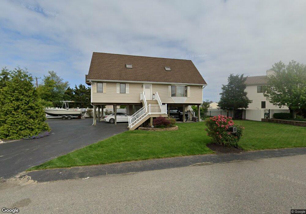
917 Shenandoah Dr Forked River, NJ 08731
Lacey Township NeighborhoodEstimated Value: $819,274 - $927,000
4
Beds
2
Baths
1,967
Sq Ft
$440/Sq Ft
Est. Value
About This Home
This home is located at 917 Shenandoah Dr, Forked River, NJ 08731 and is currently estimated at $865,069, approximately $439 per square foot. 917 Shenandoah Dr is a home located in Ocean County with nearby schools including Lacey Township High School.
Ownership History
Date
Name
Owned For
Owner Type
Purchase Details
Closed on
Nov 19, 1999
Sold by
Sandsjo William K and Sandsjo Gail
Bought by
Smith Craig and Smith Laura A
Current Estimated Value
Home Financials for this Owner
Home Financials are based on the most recent Mortgage that was taken out on this home.
Original Mortgage
$200,000
Outstanding Balance
$61,572
Interest Rate
7.86%
Estimated Equity
$803,497
Create a Home Valuation Report for This Property
The Home Valuation Report is an in-depth analysis detailing your home's value as well as a comparison with similar homes in the area
Home Values in the Area
Average Home Value in this Area
Purchase History
| Date | Buyer | Sale Price | Title Company |
|---|---|---|---|
| Smith Craig | $215,000 | -- |
Source: Public Records
Mortgage History
| Date | Status | Borrower | Loan Amount |
|---|---|---|---|
| Open | Smith Craig | $200,000 |
Source: Public Records
Tax History Compared to Growth
Tax History
| Year | Tax Paid | Tax Assessment Tax Assessment Total Assessment is a certain percentage of the fair market value that is determined by local assessors to be the total taxable value of land and additions on the property. | Land | Improvement |
|---|---|---|---|---|
| 2025 | $10,440 | $412,000 | $192,000 | $220,000 |
| 2024 | $9,760 | $412,000 | $192,000 | $220,000 |
| 2023 | $9,324 | $412,000 | $192,000 | $220,000 |
| 2022 | $9,324 | $412,000 | $192,000 | $220,000 |
| 2021 | $9,167 | $412,000 | $192,000 | $220,000 |
| 2020 | $8,874 | $412,000 | $192,000 | $220,000 |
| 2019 | $8,718 | $412,000 | $192,000 | $220,000 |
| 2018 | $8,615 | $412,000 | $192,000 | $220,000 |
| 2017 | $8,417 | $412,000 | $192,000 | $220,000 |
| 2016 | $8,384 | $412,000 | $192,000 | $220,000 |
| 2015 | $8,009 | $412,000 | $192,000 | $220,000 |
| 2014 | $8,354 | $485,700 | $277,000 | $208,700 |
Source: Public Records
Map
Nearby Homes
- 709 Richmond Dr
- 607 Ranger Dr
- 813 Tiller Dr
- 1011 Neosho Dr
- 823 Forepeak Dr
- 416 Irons St
- 836 Spar Dr
- 814 Ensign Dr
- 308 Pine Forest Ln
- 318 Riviera Dr
- 107 Fernwood Ln
- 111 Greenwood Ln
- 877 Sunrise Blvd
- 207 Sunset Dr
- 119 Driftwood Ln
- 507 Laurelwood Dr
- 241 Juniper Ln
- 502 Teakwood Dr
- 28 Bayberry Dr
- 320 Cedar Dr
- 903 Montauk Dr
- 915 Shenandoah Dr
- 905 Montauk Dr
- 916 Shenandoah Dr
- 904 Shenandoah Dr
- 918 Montauk Dr
- 905 Shenandoah Dr
- 903 Shenandoah Dr
- 907 Montauk Dr
- 902 Capstan Dr
- 906 Shenandoah Dr
- 909 Montauk Dr
- 904 Capstan Dr
- 920 Montauk Dr
- 914 Shenandoah Dr
- 728 Nautilus Blvd
- 726 Nautilus Blvd
- 906 Capstan Dr
- 911 Montauk Dr
- 908 Shenandoah Dr