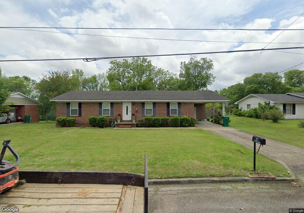
917 Taylor St Tupelo, MI 38801
Lee Acres NeighborhoodEstimated Value: $144,000 - $179,779
3
Beds
2
Baths
1,595
Sq Ft
$103/Sq Ft
Est. Value
About This Home
This home is located at 917 Taylor St, Tupelo, MI 38801 and is currently estimated at $164,195, approximately $102 per square foot. 917 Taylor St is a home located in Lee County with nearby schools including Lawndale Elementary School, Parkway Elementary School, and Tupelo Middle School.
Ownership History
Date
Name
Owned For
Owner Type
Purchase Details
Closed on
Apr 13, 2020
Bought by
Hill Demetrees G
Current Estimated Value
Home Financials for this Owner
Home Financials are based on the most recent Mortgage that was taken out on this home.
Original Mortgage
$105,061
Outstanding Balance
$92,600
Interest Rate
3.25%
Mortgage Type
FHA
Estimated Equity
$71,595
Purchase Details
Closed on
Oct 9, 2013
Sold by
Howard Jon and Howard Kayla
Bought by
Webber Deborah Y
Home Financials for this Owner
Home Financials are based on the most recent Mortgage that was taken out on this home.
Original Mortgage
$40,000
Interest Rate
3.58%
Create a Home Valuation Report for This Property
The Home Valuation Report is an in-depth analysis detailing your home's value as well as a comparison with similar homes in the area
Home Values in the Area
Average Home Value in this Area
Purchase History
| Date | Buyer | Sale Price | Title Company |
|---|---|---|---|
| Hill Demetrees G | $107,000 | -- | |
| Hill Demetrees G | -- | None Available | |
| Webber Deborah Y | -- | -- |
Source: Public Records
Mortgage History
| Date | Status | Borrower | Loan Amount |
|---|---|---|---|
| Open | Hill Demetrees G | $105,061 | |
| Previous Owner | Hill Demetrees G | $93,541 | |
| Previous Owner | Webber Deborah Y | $40,000 |
Source: Public Records
Tax History Compared to Growth
Tax History
| Year | Tax Paid | Tax Assessment Tax Assessment Total Assessment is a certain percentage of the fair market value that is determined by local assessors to be the total taxable value of land and additions on the property. | Land | Improvement |
|---|---|---|---|---|
| 2025 | $1,293 | $9,508 | $0 | $0 |
| 2024 | $1,293 | $9,508 | $0 | $0 |
| 2023 | $1,163 | $8,687 | $0 | $0 |
| 2022 | $863 | $8,687 | $0 | $0 |
| 2021 | $863 | $8,687 | $0 | $0 |
| 2020 | $1,163 | $8,687 | $0 | $0 |
| 2019 | $86 | $8,140 | $0 | $0 |
| 2018 | $86 | $8,140 | $0 | $0 |
| 2017 | $85 | $8,140 | $0 | $0 |
| 2016 | $85 | $8,140 | $0 | $0 |
| 2015 | -- | $7,456 | $0 | $0 |
| 2014 | -- | $7,416 | $0 | $0 |
Source: Public Records
Map
Nearby Homes
- 1304 Kennedy Dr
- 1303 Van Buren Ave
- 920 Eisenhower Dr
- 1501 Fillmore Dr
- 1005 Lawndale Dr
- 1015 Taft St
- 504 Willett St
- Lot 1 Dunbarton Place
- 2284 Kimbrough Ave
- 2006 Fillmore Dr
- 911 Rockefeller Ave
- 2010 Lawndale Dr
- 0 Medical Park Cir
- 2102 Fillmore Dr
- 210 S Highland Dr
- 404 Smith St
- 400 Smith St
- 1913 Pheasant Run
- 19 ac W Eason Blvd
- 1603 Boggan Dr