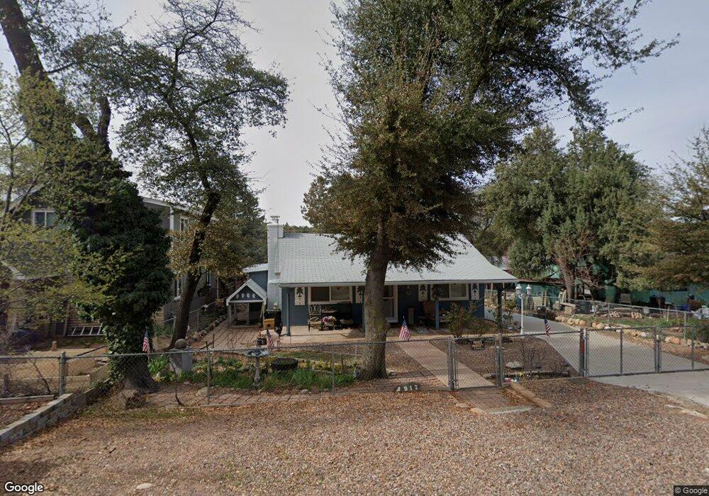
917 W Colt Dr Payson, AZ 85541
Estimated Value: $229,000 - $282,000
2
Beds
1
Bath
722
Sq Ft
$364/Sq Ft
Est. Value
About This Home
This home is located at 917 W Colt Dr, Payson, AZ 85541 and is currently estimated at $262,829, approximately $364 per square foot. 917 W Colt Dr is a home located in Gila County with nearby schools including Julia Randall Elementary School, Payson Elementary School, and Rim Country Middle School.
Ownership History
Date
Name
Owned For
Owner Type
Purchase Details
Closed on
Mar 13, 2018
Sold by
Jeppesen Steven K
Bought by
Pine Linda S
Current Estimated Value
Purchase Details
Closed on
Jun 15, 2006
Sold by
Hennis Margaret I
Bought by
Pike Linda S and Jeppesen Steven K
Create a Home Valuation Report for This Property
The Home Valuation Report is an in-depth analysis detailing your home's value as well as a comparison with similar homes in the area
Purchase History
| Date | Buyer | Sale Price | Title Company |
|---|---|---|---|
| Pine Linda S | -- | None Available | |
| Pike Linda S | $147,000 | First American Title |
Source: Public Records
Tax History
| Year | Tax Paid | Tax Assessment Tax Assessment Total Assessment is a certain percentage of the fair market value that is determined by local assessors to be the total taxable value of land and additions on the property. | Land | Improvement |
|---|---|---|---|---|
| 2026 | $1,486 | $19,444 | $5,135 | $14,309 |
| 2025 | $1,486 | -- | -- | -- |
| 2024 | $1,386 | $17,366 | $2,969 | $14,397 |
| 2023 | $1,386 | $15,341 | $3,080 | $12,261 |
| 2022 | $1,343 | $11,598 | $3,080 | $8,518 |
| 2021 | $1,261 | $11,598 | $3,080 | $8,518 |
| 2020 | $1,212 | $0 | $0 | $0 |
| 2019 | $1,176 | $0 | $0 | $0 |
| 2018 | $1,107 | $0 | $0 | $0 |
| 2017 | $1,032 | $0 | $0 | $0 |
| 2016 | $1,010 | $0 | $0 | $0 |
| 2015 | $983 | $0 | $0 | $0 |
Source: Public Records
Map
Nearby Homes
- 713 W Bridle Path Ln
- 703 W Colt Cir
- 609 W Barnum Cir
- 401 W Houston Mesa Rd
- 305 W Ash Creek Ct
- 303 W Cody Cir
- 1608 N Mclane Rd
- 0 Arizona 87 Unit 29
- 1101 N Falconcrest Dr Unit 14
- 1101 N Falconcrest Dr
- 1112 N Monte Rosa Ln
- 618 W St Moritz Dr
- 605 W St Moritz Dr
- 1000 N Falconcrest Dr
- 1200 W Airport Rd
- 1200 W Airport Rd Unit 96F-I
- 620 W St Moritz Dr
- 1015 N Monarch Dr
- 1012 N Monarch Dr
- 1501 N Beeline Hwy Unit 71
- 915 W Colt Dr
- 1001 W Colt Dr
- 913 W Colt Dr
- 1002 W Bridle Path Ln
- 918 W Colt Dr
- 1012 W Colt Dr
- 914 W Bridle Path Ln
- 2100 N Carrell Cir
- 911 W Colt Dr
- 1010 W Bridle Path Ln
- 1004 W Bridle Path Ln
- 2100 N Fleitz Cir
- 2102 N Carrell Cir
- 909 W Colt Dr
- 2105 N Fleitz Cir
- 2105 N Fleitz Cir Unit 75
- 2106 N Fleitz Cir
- 2103 N Fleitz Cir
- 713 W Colt Dr
- 1003 W Bridle Path Ln
Your Personal Tour Guide
Ask me questions while you tour the home.