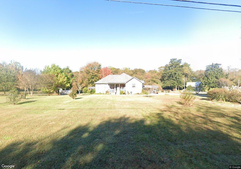
9171 Highway 18 W Concord, GA 30206
Estimated Value: $231,000 - $389,000
--
Bed
1
Bath
1,511
Sq Ft
$211/Sq Ft
Est. Value
About This Home
This home is located at 9171 Highway 18 W, Concord, GA 30206 and is currently estimated at $318,942, approximately $211 per square foot. 9171 Highway 18 W is a home located in Pike County with nearby schools including Pike County Primary School, Pike County Elementary School, and Pike County Middle School.
Ownership History
Date
Name
Owned For
Owner Type
Purchase Details
Closed on
Oct 29, 2007
Sold by
Jones Beth Coleman
Bought by
Diastole Investments Lllp
Current Estimated Value
Purchase Details
Closed on
May 3, 2002
Sold by
Bassham Karen A
Bought by
Brooks Ann S
Purchase Details
Closed on
Aug 1, 1995
Sold by
Thomas Loyd and Thomas Cherry
Bought by
Bassham Karen A
Purchase Details
Closed on
Oct 29, 1993
Sold by
Thomas Loyd
Bought by
Thomas Loyd and Thomas Cherry
Create a Home Valuation Report for This Property
The Home Valuation Report is an in-depth analysis detailing your home's value as well as a comparison with similar homes in the area
Home Values in the Area
Average Home Value in this Area
Purchase History
| Date | Buyer | Sale Price | Title Company |
|---|---|---|---|
| Diastole Investments Lllp | -- | -- | |
| Brooks Ann S | $32,800 | -- | |
| Bassham Karen A | $27,000 | -- | |
| Thomas Loyd | -- | -- | |
| Thomas Loyd | $30,000 | -- |
Source: Public Records
Tax History Compared to Growth
Tax History
| Year | Tax Paid | Tax Assessment Tax Assessment Total Assessment is a certain percentage of the fair market value that is determined by local assessors to be the total taxable value of land and additions on the property. | Land | Improvement |
|---|---|---|---|---|
| 2024 | $2,095 | $106,783 | $30,429 | $76,354 |
| 2023 | $3,043 | $106,783 | $30,429 | $76,354 |
| 2022 | $2,316 | $81,710 | $30,429 | $51,281 |
| 2021 | $1,838 | $63,096 | $11,815 | $51,281 |
| 2020 | $1,859 | $63,096 | $11,815 | $51,281 |
| 2019 | $1,634 | $49,239 | $11,815 | $37,424 |
| 2018 | $1,636 | $49,239 | $11,815 | $37,424 |
| 2017 | $1,622 | $49,239 | $11,815 | $37,424 |
| 2016 | $1,506 | $49,239 | $11,815 | $37,424 |
| 2015 | $1,433 | $49,239 | $11,815 | $37,424 |
| 2014 | $1,453 | $49,239 | $11,815 | $37,424 |
| 2013 | -- | $48,829 | $11,815 | $37,014 |
Source: Public Records
Map
Nearby Homes
- L-8 Strickland Rd
- 10000 Highway 18 W
- LOT 12 Flint Farms Dr
- 184 Flint Farms Dr
- 243 Flint Farms Dr
- 126 Flint Farms Dr
- TRACT 2 Bates Rd (56 99acs)
- LOT 11 Flint Farms Dr
- TRACT 5 Bates Rd (13 98acs)
- TRACT 1 Bates Rd (14 05acs)
- 0 W Fossett Rd Unit 10629253
- 1337 Green St
- 764 Bates Rd (228 96acs)
- TRACT 6 & 7 Bates Rd (47 4acs)
- 3.39 ACRES Caldwell Bridge Rd
- 2246 Concord Rd
- 0 West Rd Unit 10536330
- 0 West Rd Unit 10541322
- 1579 Bates Rd
- 0 Collier Rd Unit 25031854
- 9081 Highway 18 W
- 9170 Highway 18 W
- 96 Eppinger Bridge Rd
- 9244 Highway 18 W
- 9244 Highway 18 W
- 9244 Georgia 18
- 250 Strickland Rd
- 190 Eppinger Bridge Rd
- 9280 Highway 18 W
- 23.18 AC. Eppinger Bridge Rd
- 2 Strickland Rd
- 8989 Georgia 18
- 8989 Highway 18 W
- 22 Old Flat Shoals Rd
- 470 Harris St
- 9334 Highway 18 W
- 300 Eppinger Bridge Rd
- 270 Strickland Rd
- 441 Harris St
- 350 Eppinger Bridge Rd