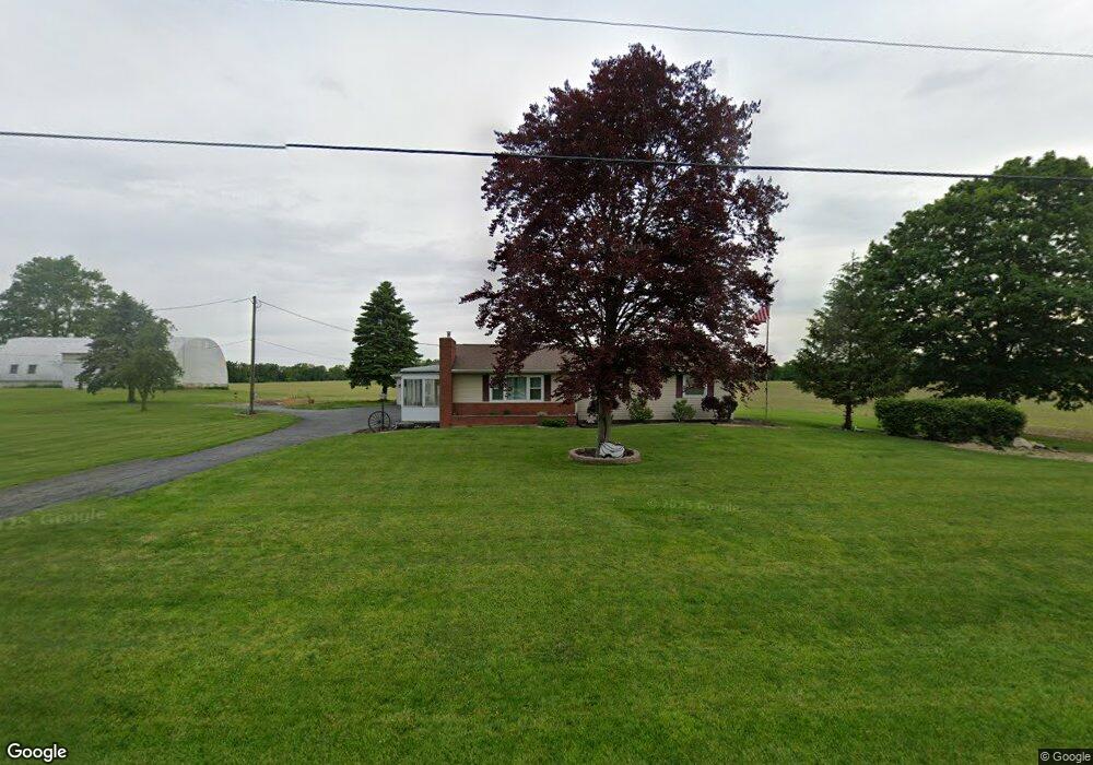
9172 W Us Route 224 Findlay, OH 45840
Estimated Value: $273,000 - $313,000
3
Beds
2
Baths
1,736
Sq Ft
$170/Sq Ft
Est. Value
About This Home
This home is located at 9172 W Us Route 224, Findlay, OH 45840 and is currently estimated at $295,264, approximately $170 per square foot. 9172 W Us Route 224 is a home located in Hancock County with nearby schools including Liberty-Benton Elementary School, Liberty-Benton Middle School, and Liberty-Benton High School.
Ownership History
Date
Name
Owned For
Owner Type
Purchase Details
Closed on
Jul 27, 2012
Sold by
Kocher Cleora J and Lazarow Darlene K
Bought by
Sutherland Michael S and Sutherland Kelly R
Current Estimated Value
Home Financials for this Owner
Home Financials are based on the most recent Mortgage that was taken out on this home.
Original Mortgage
$115,900
Interest Rate
3.73%
Mortgage Type
New Conventional
Create a Home Valuation Report for This Property
The Home Valuation Report is an in-depth analysis detailing your home's value as well as a comparison with similar homes in the area
Home Values in the Area
Average Home Value in this Area
Purchase History
| Date | Buyer | Sale Price | Title Company |
|---|---|---|---|
| Sutherland Michael S | $122,000 | Attorney |
Source: Public Records
Mortgage History
| Date | Status | Borrower | Loan Amount |
|---|---|---|---|
| Closed | Sutherland Michael S | $115,900 |
Source: Public Records
Tax History Compared to Growth
Tax History
| Year | Tax Paid | Tax Assessment Tax Assessment Total Assessment is a certain percentage of the fair market value that is determined by local assessors to be the total taxable value of land and additions on the property. | Land | Improvement |
|---|---|---|---|---|
| 2024 | $2,395 | $64,400 | $7,830 | $56,570 |
| 2023 | $2,338 | $64,400 | $7,830 | $56,570 |
| 2022 | $2,315 | $64,400 | $7,830 | $56,570 |
| 2021 | $1,756 | $43,100 | $6,800 | $36,300 |
| 2020 | $1,771 | $43,100 | $6,800 | $36,300 |
| 2019 | $1,699 | $43,100 | $6,800 | $36,300 |
| 2018 | $1,386 | $38,790 | $5,670 | $33,120 |
| 2017 | $1,430 | $38,790 | $5,670 | $33,120 |
| 2016 | $1,388 | $38,550 | $5,670 | $32,880 |
| 2015 | $1,437 | $39,220 | $5,670 | $33,550 |
| 2014 | $1,450 | $39,220 | $5,670 | $33,550 |
| 2012 | $1,388 | $35,910 | $5,670 | $30,240 |
Source: Public Records
Map
Nearby Homes
- 8922 Township Road 94
- 9960 W Us Route 224
- 0 County Road 140
- 8179 Hazelwood Dr
- 0 County Road 95 Unit 6097574
- 8256 Silverwood Dr
- 0 County Road 223
- 6535 Silver Lake Dr
- 7780 Township Road 89
- 2201 W Main Cross St
- 9307 W State Route 12
- 2014 W Sandusky St
- 425 Nevada Ln
- 9220 Colonel Dr
- 1405 Cypress Lake
- 3106 Saddlebrook
- 9307 Hiegel Dr
- 925 W Melrose Ave
- 3018 Gleneagle Dr
- 9653 Early Dr
- 9172 U S R 224
- 9172 U S 224
- 9172 W Us Route 224
- 9773 U S 224
- 9133 Township Road 94
- 9550 W Us Route 224
- 9197 Township Road 94
- 9147 Township Road 94
- 9257 Township Road 94
- 9623 W Us Route 224
- 9303 Township Road 94
- 7037 County Road 139
- 8701 W Us Route 224
- 9367 Township Road 94
- 8730 W Us Route 224
- 9407 Township Road 94
- 9100 Township Road 94
- 8658 W Us Route 224
- 8658 U S 224
- 9250 Township Road 94