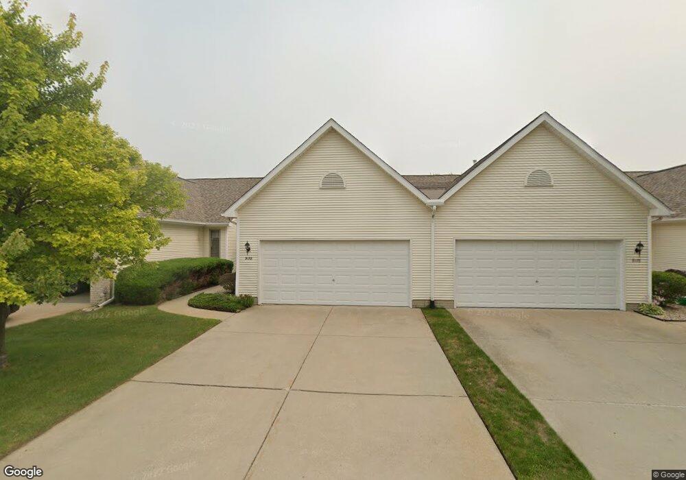
9178 Emily Dr Unit 146 Davison, MI 48423
Estimated Value: $207,051 - $248,000
Studio
--
Bath
1,246
Sq Ft
$188/Sq Ft
Est. Value
About This Home
This home is located at 9178 Emily Dr Unit 146, Davison, MI 48423 and is currently estimated at $234,263, approximately $188 per square foot. 9178 Emily Dr Unit 146 is a home located in Genesee County with nearby schools including Thomson Elementary School, Gates Elementary School, and Hill Elementary School.
Ownership History
Date
Name
Owned For
Owner Type
Purchase Details
Closed on
Aug 7, 2024
Sold by
Fearnley Jerry L and Fearnley Linda G
Bought by
Fearnley Jerry L and Fearnley Linda G
Current Estimated Value
Purchase Details
Closed on
Aug 9, 2017
Sold by
Fearnley Jerry L and Fearnley Robert J
Bought by
Fearnley Jerry L and Fearnley Linda G
Purchase Details
Closed on
Jul 8, 2003
Sold by
Fearnley Robert J and Fearnley Betty Lou
Bought by
Fearnley Robert J and Fearnley Jerry L
Purchase Details
Closed on
Feb 18, 2000
Sold by
T L Corp
Bought by
Fearnley Robert J and Fearnley Betty Lou
Create a Home Valuation Report for This Property
The Home Valuation Report is an in-depth analysis detailing your home's value as well as a comparison with similar homes in the area
Home Values in the Area
Average Home Value in this Area
Purchase History
| Date | Buyer | Sale Price | Title Company |
|---|---|---|---|
| Fearnley Jerry L | -- | None Listed On Document | |
| Fearnley Jerry L | -- | None Listed On Document | |
| Fearnley Jerry L | -- | None Available | |
| Fearnley Robert J | -- | -- | |
| Fearnley Robert J | $113,830 | Sargents Title Company |
Source: Public Records
Tax History
| Year | Tax Paid | Tax Assessment Tax Assessment Total Assessment is a certain percentage of the fair market value that is determined by local assessors to be the total taxable value of land and additions on the property. | Land | Improvement |
|---|---|---|---|---|
| 2025 | $2,382 | $92,000 | $0 | $0 |
| 2024 | $648 | $85,300 | $0 | $0 |
| 2023 | $618 | $79,800 | $0 | $0 |
| 2022 | $2,140 | $71,200 | $0 | $0 |
| 2021 | $2,123 | $64,900 | $0 | $0 |
| 2020 | $565 | $68,900 | $0 | $0 |
| 2019 | $556 | $63,100 | $0 | $0 |
| 2018 | $1,803 | $58,400 | $0 | $0 |
| 2017 | $1,732 | $58,400 | $0 | $0 |
| 2016 | $1,701 | $57,000 | $0 | $0 |
| 2015 | -- | $52,700 | $0 | $0 |
| 2012 | -- | $45,700 | $45,700 | $0 |
Source: Public Records
Map
Nearby Homes
- 9166 Emily Dr Unit 150
- 1137 Canary Dr Unit 187
- 9177 Nicole Ln
- 1136 Jenna Dr Unit 207
- 00 Lapeer Rd
- 9390 Rayna Dr
- 1120 Crystal Wood Dr
- 0 Lapeer Rd Unit G50047586
- 1084 Linda Dr
- 9469 Parkwood N Unit 2B
- 0000 S State Rd
- 00 E Lippincott Blvd
- 2053 Golfcrest Dr Unit 1240
- VL Palmer Dr
- VL Fairway Dr
- 514 Tamarac Dr
- Vl Fairway Dr
- VL Cal Dr
- 334 E Clark St Unit 340 344
- Vl Cal Dr
- 9176 Emily Dr Unit 147
- 9180 Emily Dr Unit 145
- 9174 Emily Dr Unit 148
- 9192 Emily Dr Unit 144
- 9168 Emily Dr Unit 149
- 1141 Canary Dr Unit 189
- 9185 Nicole Ln
- 9194 Emily Dr Unit 143
- 9183 Nicole Ln
- 1139 Canary Dr Unit 188
- 9189 Nicole Ln
- 9196 Emily Dr Unit 142
- 9191 Nicole Ln Unit 104
- 9198 Emily Dr Unit 141
- 9162 Emily Dr Unit 152
- 1148 Jenna Dr Unit 203
- 1135 Canary Dr Unit 186
- 9179 Nicole Ln Unit 108
- 1146 Jenna Dr Unit 204
- 9195 Emily Dr Unit 139
Your Personal Tour Guide
Ask me questions while you tour the home.