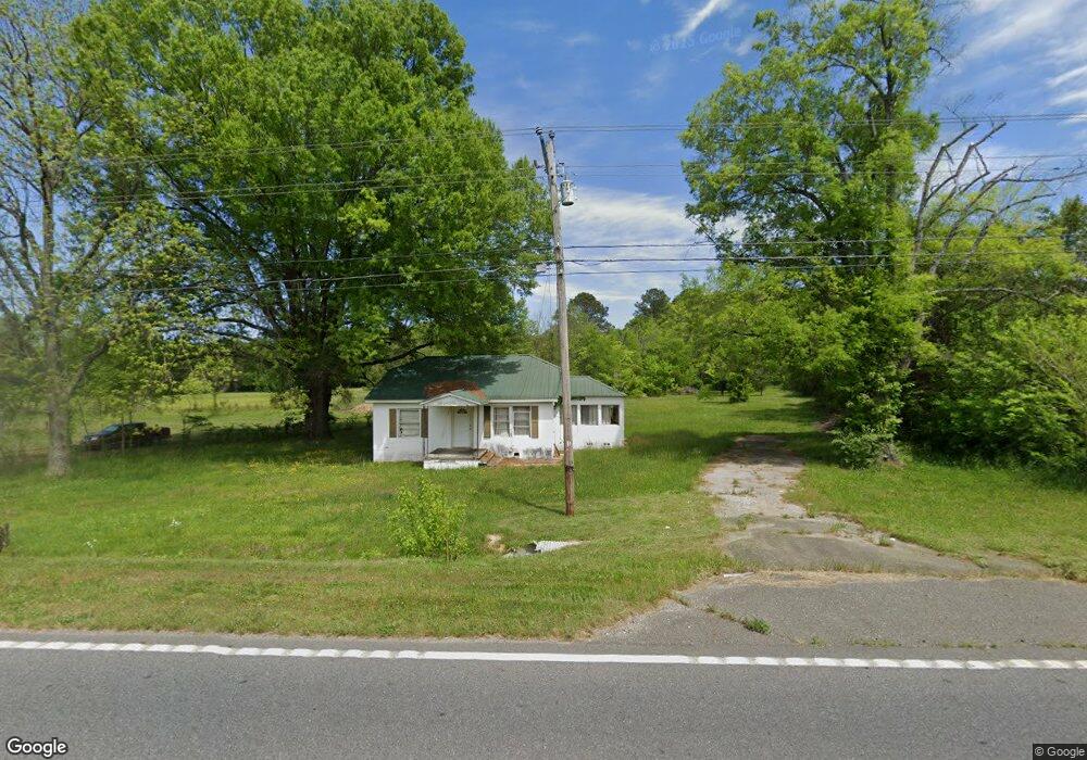
9178 N Highway 27 Rock Spring, GA 30739
Rock Spring NeighborhoodEstimated Value: $125,154 - $208,000
--
Bed
1
Bath
1,128
Sq Ft
$160/Sq Ft
Est. Value
About This Home
This home is located at 9178 N Highway 27, Rock Spring, GA 30739 and is currently estimated at $180,539, approximately $160 per square foot. 9178 N Highway 27 is a home located in Walker County with nearby schools including Lafayette High School, Oakwood Christian Academy, and Alice M Daley Adventist School.
Ownership History
Date
Name
Owned For
Owner Type
Purchase Details
Closed on
Dec 14, 2015
Sold by
Mark M
Bought by
Cargle Wendy Marie
Current Estimated Value
Purchase Details
Closed on
Apr 19, 2011
Sold by
Justice Sandra
Bought by
Chalker Mark M
Purchase Details
Closed on
Feb 23, 2001
Sold by
Mitchell Tiny R
Bought by
Justice Sandra and Diane Wallin
Purchase Details
Closed on
Dec 6, 1999
Sold by
Mitchell Paul E
Bought by
Mitchell Tiny R
Purchase Details
Closed on
Jan 1, 1972
Bought by
Mitchell Paul E
Create a Home Valuation Report for This Property
The Home Valuation Report is an in-depth analysis detailing your home's value as well as a comparison with similar homes in the area
Home Values in the Area
Average Home Value in this Area
Purchase History
| Date | Buyer | Sale Price | Title Company |
|---|---|---|---|
| Cargle Wendy Marie | -- | -- | |
| Chalker Mark M | -- | -- | |
| Justice Sandra | -- | -- | |
| Mitchell Tiny R | -- | -- | |
| Mitchell Paul E | -- | -- |
Source: Public Records
Tax History Compared to Growth
Tax History
| Year | Tax Paid | Tax Assessment Tax Assessment Total Assessment is a certain percentage of the fair market value that is determined by local assessors to be the total taxable value of land and additions on the property. | Land | Improvement |
|---|---|---|---|---|
| 2024 | $895 | $36,299 | $8,569 | $27,730 |
| 2023 | $842 | $33,008 | $6,801 | $26,207 |
| 2022 | $805 | $29,795 | $5,599 | $24,196 |
| 2021 | $662 | $21,335 | $5,599 | $15,736 |
| 2020 | $633 | $19,487 | $5,599 | $13,888 |
| 2019 | $643 | $19,487 | $5,599 | $13,888 |
| 2018 | $516 | $19,487 | $5,599 | $13,888 |
| 2017 | $696 | $19,487 | $5,599 | $13,888 |
| 2016 | $667 | $21,953 | $8,065 | $13,888 |
| 2015 | $581 | $17,324 | $7,320 | $10,004 |
| 2014 | $502 | $17,324 | $7,320 | $10,004 |
| 2013 | -- | $17,323 | $7,320 | $10,003 |
Source: Public Records
Map
Nearby Homes
- 1476 Arnold Rd
- 1121 Arnold Rd
- 918 Old Lafayette Rd
- 1902 Long Hollow Rd
- 195 Honeysuckle Dr
- 788 Long Hollow Rd
- 59 Honeysuckle Dr
- 70 Deer Ridge Ln
- 103 Deer Ridge Ln
- 514 Ginger Lake Dr
- 954 Goodson Cir
- 200 Hunting Ridge Cir
- 36 Pheonix Cir
- 124 Fieldstone Commons
- 294 E Long Hollow Rd
- 183 Long Hollow Rd
- 285 Cooper Rd
- 28 Cobblestone Trail
- 386 Twelve Oaks Dr
- 269 Quartz Dr
- 9228 N Highway 27
- 9228-A Highway N 27
- 9228 N Highway 27
- 9270 N Highway 27
- 9266 N Highway 27
- 9246 N Highway 27
- 9270 Us Highway 27
- 32 Kay Dr
- 1234 Arnold Rd
- 36 Kay Dr
- 1337 Arnold Rd
- 1319 Arnold Rd
- 1263 Arnold Rd
- 1351 Arnold Rd
- 1351 Arnold Rd
- 1476 Hwy 27 N
- 1395 Arnold Rd
- 9334 N Highway 27
- 1224 Arnold Rd
- 1229 Arnold Rd