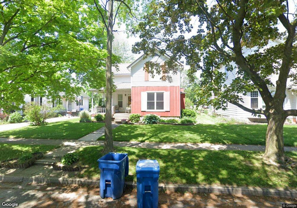
918 Ewing St Fremont, OH 43420
Estimated Value: $150,000 - $174,000
3
Beds
2
Baths
1,559
Sq Ft
$104/Sq Ft
Est. Value
About This Home
This home is located at 918 Ewing St, Fremont, OH 43420 and is currently estimated at $162,715, approximately $104 per square foot. 918 Ewing St is a home located in Sandusky County with nearby schools including Fremont Ross High School, St. Joseph School, and Bishop Hoffman Catholic School - This is St Joe's School now.
Ownership History
Date
Name
Owned For
Owner Type
Purchase Details
Closed on
Oct 23, 1996
Sold by
Wiberg Bjorn
Bought by
Woughter Gary R and Woughter Margaret K
Current Estimated Value
Home Financials for this Owner
Home Financials are based on the most recent Mortgage that was taken out on this home.
Original Mortgage
$78,375
Outstanding Balance
$7,343
Interest Rate
8.32%
Mortgage Type
New Conventional
Estimated Equity
$155,372
Purchase Details
Closed on
May 1, 1990
Bought by
Woughter Gary R and Woughter Margaret K
Create a Home Valuation Report for This Property
The Home Valuation Report is an in-depth analysis detailing your home's value as well as a comparison with similar homes in the area
Home Values in the Area
Average Home Value in this Area
Purchase History
| Date | Buyer | Sale Price | Title Company |
|---|---|---|---|
| Woughter Gary R | $82,500 | -- | |
| Woughter Gary R | $68,500 | -- |
Source: Public Records
Mortgage History
| Date | Status | Borrower | Loan Amount |
|---|---|---|---|
| Open | Woughter Gary R | $78,375 |
Source: Public Records
Tax History Compared to Growth
Tax History
| Year | Tax Paid | Tax Assessment Tax Assessment Total Assessment is a certain percentage of the fair market value that is determined by local assessors to be the total taxable value of land and additions on the property. | Land | Improvement |
|---|---|---|---|---|
| 2024 | $1,627 | $44,210 | $8,930 | $35,280 |
| 2023 | $1,627 | $35,070 | $7,070 | $28,000 |
| 2022 | $1,357 | $35,070 | $7,070 | $28,000 |
| 2021 | $1,401 | $35,070 | $7,070 | $28,000 |
| 2020 | $1,265 | $31,190 | $7,070 | $24,120 |
| 2019 | $1,263 | $31,190 | $7,070 | $24,120 |
| 2018 | $1,244 | $31,190 | $7,070 | $24,120 |
| 2017 | $1,222 | $30,030 | $7,070 | $22,960 |
| 2016 | $1,072 | $30,030 | $7,070 | $22,960 |
| 2015 | $1,054 | $30,030 | $7,070 | $22,960 |
| 2014 | $1,109 | $30,140 | $7,110 | $23,030 |
| 2013 | $1,085 | $30,140 | $7,110 | $23,030 |
Source: Public Records
Map
Nearby Homes
- 1037 Buckland Ave
- 1015 Hayes Ave
- 619 Hayes Ave
- 616 S Wood St
- 815 South St
- 1009 Napoleon St
- 1028 June St
- 1342 Mcpherson Blvd
- 515 S Arch St
- 625 Bush Place
- 1611 Mcpherson Blvd
- 427 N Clover St
- 501 Jackson St Unit 50
- 905 Twinn St
- 1013 Whittlesey St
- 516 N Front St
- 208 E State St
- 880 Cleveland Ave
- 1485 Autumn Woods Dr
- 224 Sandusky Ave Unit 226
- 922 Ewing St
- 912 Ewing St
- 317 Whittlesey St
- 321 Whittlesey St
- 910 Ewing St
- 316 S Wayne St
- 322 N Wayne St
- 917 Birchard Ave
- 921 Birchard Ave
- 911 Birchard Ave
- 927 Birchard Ave
- 308 S Wayne St
- 326 Whittlesey St
- 1003 Buckland Ave
- 0 S Wayne St
- 400 Whittlesey St
- 1001 Buckland Ave Unit 10
- 1015 Buckland Ave
- 328 Whittlesey St
- 903 Birchard Ave