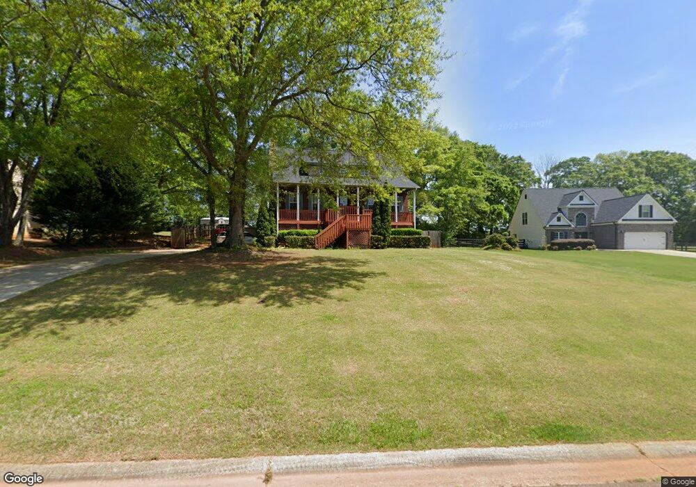
918 Mckendree Ln Bethlehem, GA 30620
Estimated Value: $340,794 - $370,000
--
Bed
4
Baths
1,701
Sq Ft
$211/Sq Ft
Est. Value
About This Home
This home is located at 918 Mckendree Ln, Bethlehem, GA 30620 and is currently estimated at $358,949, approximately $211 per square foot. 918 Mckendree Ln is a home located in Barrow County with nearby schools including Bethlehem Elementary School, Haymon-Morris Middle School, and Apalachee High School.
Ownership History
Date
Name
Owned For
Owner Type
Purchase Details
Closed on
Aug 18, 2004
Sold by
Mckendree Llc
Bought by
Castles & Kingdoms Homes Inc
Current Estimated Value
Purchase Details
Closed on
Mar 10, 2004
Bought by
Mckendree Llc
Create a Home Valuation Report for This Property
The Home Valuation Report is an in-depth analysis detailing your home's value as well as a comparison with similar homes in the area
Home Values in the Area
Average Home Value in this Area
Purchase History
| Date | Buyer | Sale Price | Title Company |
|---|---|---|---|
| Castles & Kingdoms Homes Inc | $38,500 | -- | |
| Mckendree Llc | -- | -- |
Source: Public Records
Tax History Compared to Growth
Tax History
| Year | Tax Paid | Tax Assessment Tax Assessment Total Assessment is a certain percentage of the fair market value that is determined by local assessors to be the total taxable value of land and additions on the property. | Land | Improvement |
|---|---|---|---|---|
| 2024 | $2,588 | $104,256 | $21,600 | $82,656 |
| 2023 | $2,183 | $104,656 | $21,600 | $83,056 |
| 2022 | $2,661 | $93,334 | $21,600 | $71,734 |
| 2021 | $2,422 | $80,374 | $17,200 | $63,174 |
| 2020 | $2,423 | $80,374 | $17,200 | $63,174 |
| 2019 | $2,464 | $80,374 | $17,200 | $63,174 |
| 2018 | $2,264 | $74,667 | $17,200 | $57,467 |
| 2017 | $1,726 | $59,288 | $17,200 | $42,088 |
| 2016 | $1,711 | $57,682 | $17,200 | $40,482 |
| 2015 | $1,732 | $58,128 | $17,200 | $40,928 |
| 2014 | $1,474 | $49,017 | $7,644 | $41,373 |
| 2013 | -- | $46,382 | $7,644 | $38,738 |
Source: Public Records
Map
Nearby Homes
- 0 Jb Owens Unit 7552902
- 0 Jb Owens Unit 7552891
- 0 Jb Owens Unit LOT 2 - 2.09 ACRES
- 0 Jb Owens Unit LOT 3 - 2.01 ACRES
- 190 Lokeys Ln
- 1071 Covenant Ct
- 763 Moss Side Dr
- 3153 Lowell Rd
- 468 Grand Oaks Ave
- 222 Lynn Rd
- 1101 Ravenwood Dr
- 758 Clarence Edwards Rd
- 220 Carl Bethlehem Rd SW
- 637 Sleeping Meadow Ln
- 0 Tanners Bridge Cir Unit 10536031
- 755 Harry McCarty Rd
- 303 Ron Dr
- 575 Mackinaw Dr
- 103 Camp Ct
- 1188 Carl-Bethlehem Rd
- 916 Mckendree Ln
- 920 Mckendree Ln
- 265 Lokeys Cir
- 164 Lokeys Cir
- 242 Lokeys Cir
- 280 Lokeys Cir
- 145 Lokeys Cir
- 106 Lokeys Cir
- 214 Lokeys Cir
- 128 Lokeys Cir
- 262 Lokeys Cir
- 196 Lokeys Cir
- 167 Lokeys Cir Unit 11
- 187 Lokeys Cir Unit 12
- 131 Lokeys Ln Unit 3
- 105 Lokeys Cir Unit 8
- 283 Lokeys Cir Unit 17
- 914 Mckendree Ln
- 922 Mckendree Ln
- 300 Mckendree Ct