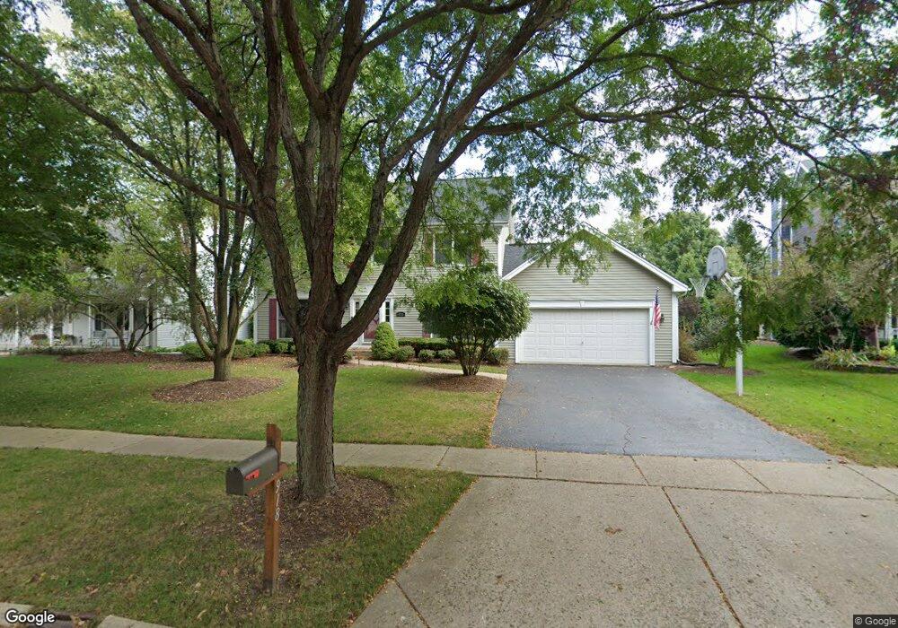
918 Pember Cir Unit 2 West Dundee, IL 60118
Estimated Value: $442,774 - $482,000
4
Beds
3
Baths
2,346
Sq Ft
$199/Sq Ft
Est. Value
About This Home
This home is located at 918 Pember Cir Unit 2, West Dundee, IL 60118 and is currently estimated at $465,944, approximately $198 per square foot. 918 Pember Cir Unit 2 is a home located in Kane County with nearby schools including Dundee Highlands Elementary School, Dundee Middle School, and West Prairie Middle School.
Ownership History
Date
Name
Owned For
Owner Type
Purchase Details
Closed on
Nov 10, 2017
Sold by
Curatti Steven B and Curatti Lisa Anne
Bought by
Bauers Patrick R and Bauers Kirsten A
Current Estimated Value
Home Financials for this Owner
Home Financials are based on the most recent Mortgage that was taken out on this home.
Original Mortgage
$274,500
Outstanding Balance
$230,139
Interest Rate
3.87%
Mortgage Type
New Conventional
Estimated Equity
$235,805
Purchase Details
Closed on
Jul 9, 1998
Sold by
Neal Gary M and Neal Jenny M
Bought by
Curatti Steven B and Curatti Lisa Anne
Home Financials for this Owner
Home Financials are based on the most recent Mortgage that was taken out on this home.
Original Mortgage
$195,300
Interest Rate
6.68%
Create a Home Valuation Report for This Property
The Home Valuation Report is an in-depth analysis detailing your home's value as well as a comparison with similar homes in the area
Home Values in the Area
Average Home Value in this Area
Purchase History
| Date | Buyer | Sale Price | Title Company |
|---|---|---|---|
| Bauers Patrick R | $305,000 | None Available | |
| Curatti Steven B | $217,000 | -- |
Source: Public Records
Mortgage History
| Date | Status | Borrower | Loan Amount |
|---|---|---|---|
| Open | Bauers Patrick R | $274,500 | |
| Previous Owner | Curatti Steven B | $195,300 |
Source: Public Records
Tax History Compared to Growth
Tax History
| Year | Tax Paid | Tax Assessment Tax Assessment Total Assessment is a certain percentage of the fair market value that is determined by local assessors to be the total taxable value of land and additions on the property. | Land | Improvement |
|---|---|---|---|---|
| 2024 | $9,546 | $127,258 | $25,730 | $101,528 |
| 2023 | $8,949 | $114,502 | $23,151 | $91,351 |
| 2022 | $9,259 | $111,099 | $23,151 | $87,948 |
| 2021 | $8,936 | $104,899 | $21,859 | $83,040 |
| 2020 | $8,772 | $102,541 | $21,368 | $81,173 |
| 2019 | $8,491 | $97,343 | $20,285 | $77,058 |
| 2018 | $8,275 | $92,760 | $19,883 | $72,877 |
| 2017 | $7,880 | $86,773 | $18,600 | $68,173 |
| 2016 | $7,949 | $83,212 | $23,811 | $59,401 |
| 2015 | -- | $77,973 | $22,312 | $55,661 |
| 2014 | -- | $75,820 | $21,696 | $54,124 |
| 2013 | -- | $78,141 | $22,360 | $55,781 |
Source: Public Records
Map
Nearby Homes
- 812 Lindsay Ln
- 822 Lindsay Ln
- 814 Lindsay Ln
- 816 Lindsay Ln
- 813 Lindsay Ln
- 825 Lindsay Ln
- 818 Lindsay Ln
- Marianne Plan at Hickory Glen
- Charlotte Plan at Hickory Glen
- 1023 Shagbark Ln
- 1031 Shagbark Ln
- 1715 W Main St
- 1601 Higgins Rd
- 215 Sharon Dr
- 325 Sharon Dr
- 104 Thorobred Ln
- 1 S Lincoln Ave
- 2742 Connolly Ln
- 17N448 Il Route 31
- 2857 Bristol Ct
- 912 Pember Cir
- 922 Pember Cir
- 2038 Spaulding Ave
- 2024 Spaulding Ave
- 2046 Spaulding Ave
- 936 Pember Cir
- 2014 Spaulding Ave
- 913 Pember Cir Unit 2
- 921 Pember Cir
- 904 Pember Cir
- 2054 Spaulding Ave
- 2006 Spaulding Ave
- 948 Pember Cir
- 2068 Spaulding Ave
- 939 Pember Cir
- 2011 Kittridge Dr
- 2015 Spaulding Ct Unit 2
- 901 Pember Cir
- 2047 Spaulding Ct
- 2110 Spaulding Ave