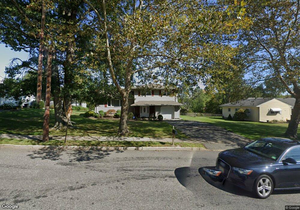
918 Vail Rd Parsippany, NJ 07054
Estimated Value: $614,551 - $756,000
Studio
--
Bath
1,952
Sq Ft
$358/Sq Ft
Est. Value
About This Home
This home is located at 918 Vail Rd, Parsippany, NJ 07054 and is currently estimated at $698,888, approximately $358 per square foot. 918 Vail Rd is a home located in Morris County with nearby schools including Rockaway Meadow School, Central Middle School, and Parsippany High School.
Ownership History
Date
Name
Owned For
Owner Type
Purchase Details
Closed on
Aug 30, 2022
Sold by
Petrillo Joan F
Bought by
Petrillo Jodi A
Current Estimated Value
Purchase Details
Closed on
Aug 29, 2022
Sold by
Jodi A Petrillo Trust
Bought by
Petrillo Jodi A and Petrillo Joan F
Purchase Details
Closed on
Jan 8, 2011
Sold by
Petrillo Jodi A and Petrillo Joan F
Bought by
Daidone Deborah A
Purchase Details
Closed on
Sep 28, 2005
Sold by
Petrillo John
Bought by
Loan Petrillo and Petrillo Jodi
Create a Home Valuation Report for This Property
The Home Valuation Report is an in-depth analysis detailing your home's value as well as a comparison with similar homes in the area
Home Values in the Area
Average Home Value in this Area
Purchase History
| Date | Buyer | Sale Price | Title Company |
|---|---|---|---|
| Petrillo Jodi A | -- | -- | |
| Petrillo Jodi A | -- | -- | |
| Petrillo Jodi A | -- | None Listed On Document | |
| Daidone Deborah A | -- | None Available | |
| Loan Petrillo | -- | -- |
Source: Public Records
Tax History
| Year | Tax Paid | Tax Assessment Tax Assessment Total Assessment is a certain percentage of the fair market value that is determined by local assessors to be the total taxable value of land and additions on the property. | Land | Improvement |
|---|---|---|---|---|
| 2025 | $11,237 | $326,000 | $172,400 | $153,600 |
| 2024 | $11,025 | $326,000 | $172,400 | $153,600 |
Source: Public Records
Map
Nearby Homes
- 15 Ridge Rd
- 14 Crescent Dr
- 25 Wenonah Ave
- 122 Lake Shore Dr
- 53 Ute Ave
- 12 Carlson Place
- 30 Madison Ave
- 32 Lake Shore Dr
- 61 Minnehaha Blvd
- 1 Vail Rd
- 49 Navajo Ave
- 229 Edwards Rd
- 104 N Beverwyck Rd Unit 7
- 8 New England Dr
- 255 Knoll Rd
- 263 Lake Shore Dr
- 5 Vincent Dr
- 34 Hoffman Ave
- 74 Longview Ave
- 20 Sandra Dr