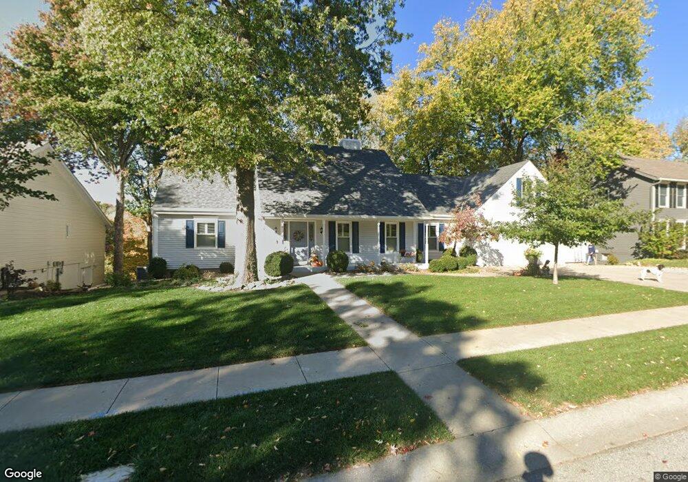
918 Wildbriar Dr Liberty, MO 64068
Estimated Value: $492,000 - $577,000
4
Beds
4
Baths
2,988
Sq Ft
$174/Sq Ft
Est. Value
About This Home
This home is located at 918 Wildbriar Dr, Liberty, MO 64068 and is currently estimated at $520,750, approximately $174 per square foot. 918 Wildbriar Dr is a home located in Clay County with nearby schools including Lewis And Clark Elementary School, Heritage Middle School, and Liberty North High School.
Ownership History
Date
Name
Owned For
Owner Type
Purchase Details
Closed on
Feb 23, 1999
Sold by
Ann Kobbermann Thomas W
Bought by
Fitch Ronald Gene and Fitch Diana L
Current Estimated Value
Home Financials for this Owner
Home Financials are based on the most recent Mortgage that was taken out on this home.
Original Mortgage
$200,000
Outstanding Balance
$46,668
Interest Rate
6.83%
Estimated Equity
$474,082
Create a Home Valuation Report for This Property
The Home Valuation Report is an in-depth analysis detailing your home's value as well as a comparison with similar homes in the area
Home Values in the Area
Average Home Value in this Area
Purchase History
| Date | Buyer | Sale Price | Title Company |
|---|---|---|---|
| Fitch Ronald Gene | -- | United Title Company |
Source: Public Records
Mortgage History
| Date | Status | Borrower | Loan Amount |
|---|---|---|---|
| Open | Fitch Ronald Gene | $200,000 |
Source: Public Records
Tax History Compared to Growth
Tax History
| Year | Tax Paid | Tax Assessment Tax Assessment Total Assessment is a certain percentage of the fair market value that is determined by local assessors to be the total taxable value of land and additions on the property. | Land | Improvement |
|---|---|---|---|---|
| 2025 | $5,471 | $77,840 | -- | -- |
| 2024 | $5,471 | $71,140 | -- | -- |
| 2023 | $5,564 | $71,140 | $0 | $0 |
| 2022 | $5,049 | $63,730 | $0 | $0 |
| 2021 | $5,009 | $63,726 | $7,942 | $55,784 |
| 2020 | $4,531 | $54,130 | $0 | $0 |
| 2019 | $4,530 | $54,131 | $7,942 | $46,189 |
| 2018 | $4,401 | $51,640 | $0 | $0 |
| 2017 | $4,168 | $51,640 | $7,940 | $43,700 |
| 2016 | $4,168 | $49,360 | $7,940 | $41,420 |
| 2015 | $4,169 | $49,360 | $7,940 | $41,420 |
| 2014 | $4,068 | $47,780 | $7,940 | $39,840 |
Source: Public Records
Map
Nearby Homes
- 900 Wildbriar Dr
- 1107 Wildbriar Dr
- 1484 Hemlock Dr
- 1487 Spruce Dr
- 527 Lancelot Dr
- 523 Lancelot Dr
- 1304 Nashua Rd
- 417 Locust St
- 1207 Linden Rd
- 1208 Linden Rd
- 815 Kings Ridge
- 1575 Oakwood Ln
- 1541 N Withers Rd
- 1548 Timber Ridge Dr
- 1014 N Forest Ln
- 907 N Forest Ln
- 1408 Telford Dr
- 194 Camelot Dr
- 9623 NE 89th St
- 1963 Harvest Rd
- 1000 Wildbriar Dr
- 1006 Wildbriar Dr
- 919 Wildbriar Dr
- 906 Wildbriar Dr
- 913 Wildbriar Dr
- 1001 Wildbriar Dr
- 907 Wildbriar Dr
- 1012 Wildbriar Dr
- 1007 Wildbriar Dr
- 901 Wildbriar Dr
- 1015 Wildbriar Dr
- 1019 Wildbriar Dr
- 1120 Wildbriar Ct
- 1497 Hemlock Ct
- 1101 Wildbriar Dr
- 1495 Hemlock Ct
- 1192 Lake Rd
- 1493 Hemlock Ct
- 608 Spruce Ave
- 1194 Lake Rd