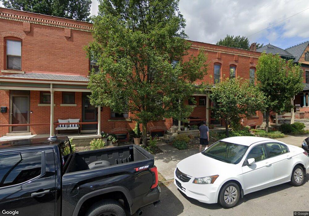
919 Dennison Ave Unit 919 Columbus, OH 43201
Victorian Village NeighborhoodEstimated Value: $278,000 - $372,000
2
Beds
1
Bath
1,064
Sq Ft
$297/Sq Ft
Est. Value
About This Home
This home is located at 919 Dennison Ave Unit 919, Columbus, OH 43201 and is currently estimated at $316,385, approximately $297 per square foot. 919 Dennison Ave Unit 919 is a home located in Franklin County with nearby schools including Hubbard Elementary School, Dominion Middle School, and Whetstone High School.
Ownership History
Date
Name
Owned For
Owner Type
Purchase Details
Closed on
Jul 17, 2003
Sold by
Dennison Associates
Bought by
Bednarczyk Stanley A
Current Estimated Value
Home Financials for this Owner
Home Financials are based on the most recent Mortgage that was taken out on this home.
Original Mortgage
$149,900
Outstanding Balance
$59,107
Interest Rate
4.75%
Mortgage Type
Purchase Money Mortgage
Estimated Equity
$257,278
Create a Home Valuation Report for This Property
The Home Valuation Report is an in-depth analysis detailing your home's value as well as a comparison with similar homes in the area
Home Values in the Area
Average Home Value in this Area
Purchase History
| Date | Buyer | Sale Price | Title Company |
|---|---|---|---|
| Bednarczyk Stanley A | $149,900 | Amerititle Agency Inc |
Source: Public Records
Mortgage History
| Date | Status | Borrower | Loan Amount |
|---|---|---|---|
| Open | Bednarczyk Stanley A | $149,900 |
Source: Public Records
Tax History
| Year | Tax Paid | Tax Assessment Tax Assessment Total Assessment is a certain percentage of the fair market value that is determined by local assessors to be the total taxable value of land and additions on the property. | Land | Improvement |
|---|---|---|---|---|
| 2025 | $4,507 | $100,430 | $22,760 | $77,670 |
| 2024 | $4,507 | $100,430 | $22,760 | $77,670 |
| 2023 | $4,450 | $100,415 | $22,750 | $77,665 |
| 2022 | $3,560 | $68,650 | $13,800 | $54,850 |
| 2021 | $3,567 | $68,650 | $13,800 | $54,850 |
| 2020 | $3,571 | $68,650 | $13,800 | $54,850 |
| 2019 | $3,964 | $65,350 | $13,130 | $52,220 |
| 2018 | $3,830 | $65,350 | $13,130 | $52,220 |
| 2017 | $3,962 | $65,350 | $13,130 | $52,220 |
| 2016 | $4,081 | $61,610 | $12,710 | $48,900 |
| 2015 | $3,705 | $61,610 | $12,710 | $48,900 |
| 2014 | $3,714 | $61,610 | $12,710 | $48,900 |
| 2013 | $1,551 | $52,150 | $11,550 | $40,600 |
Source: Public Records
Map
Nearby Homes
- 915 Dennison Ave Unit 915
- 213 Wilber Ave
- 998 Ewing Aly Unit 998
- 936 1/2 Neil Ave
- 981 Highland St
- 1025 Hunter Ave
- 252 W Hubbard Ave Unit 252
- 1029 Hunter Ave
- 1015 Highland St
- 1016 Neil Ave
- 1018 Neil Ave
- 792 Highland St
- 130 Buttles Ave
- 11 W 1st Ave Unit B
- 845 N High St Unit 407
- 845 N High St Unit 404
- 845 N High St Unit 501 & 502
- 319 W 2nd Ave Unit 319
- 1098 Highland St
- 994 Harrison Ave
- 917 Dennison Ave Unit 917
- 921 Dennison Ave Unit 921
- 178 W 1st Ave
- 172 W 1st Ave Unit 172
- 923 Dennison Ave Unit 923
- 174 W 1st Ave
- 182 W 1st Ave
- 925 Dennison Ave Unit 925
- 927 Dennison Ave
- 190 W 1st Ave
- 935 Dennison Ave Unit 935
- 194 W 1st Ave Unit 196
- 937 Dennison Ave
- 895 Dennison Ave
- 926 Dennison Ave Unit 926
- 187 W 1st Ave Unit 187
- 932 Dennison Ave Unit 934
- 150 W 1st Ave
- 891 Dennison Ave Unit 891
- 189 W 1st Ave
Your Personal Tour Guide
Ask me questions while you tour the home.