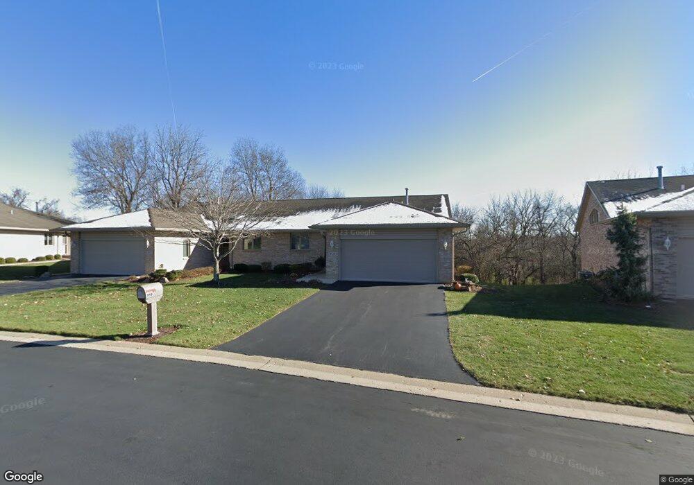
919 High Point Dr Unit 302B Rockton, IL 61072
Estimated Value: $289,000 - $328,000
3
Beds
3
Baths
1,504
Sq Ft
$201/Sq Ft
Est. Value
About This Home
This home is located at 919 High Point Dr Unit 302B, Rockton, IL 61072 and is currently estimated at $302,539, approximately $201 per square foot. 919 High Point Dr Unit 302B is a home located in Winnebago County with nearby schools including Rockton Elementary School, Whitman Post Elementary School, and Stephen Mack Middle School.
Ownership History
Date
Name
Owned For
Owner Type
Purchase Details
Closed on
Dec 7, 2023
Sold by
Kosinski Patricia W
Bought by
Patricia W Kosinski Revocable Trust and Kosinski
Current Estimated Value
Purchase Details
Closed on
Dec 5, 2023
Sold by
Kosinski Patricia W
Bought by
Patricia W Kosinski Revocable Trust and Kosinski
Create a Home Valuation Report for This Property
The Home Valuation Report is an in-depth analysis detailing your home's value as well as a comparison with similar homes in the area
Home Values in the Area
Average Home Value in this Area
Purchase History
| Date | Buyer | Sale Price | Title Company |
|---|---|---|---|
| Patricia W Kosinski Revocable Trust | -- | None Listed On Document | |
| Patricia W Kosinski Revocable Trust | -- | None Listed On Document | |
| Patricia W Kosinski Revocable Trust | -- | None Listed On Document | |
| Patricia W Kosinski Revocable Trust | -- | None Listed On Document |
Source: Public Records
Tax History Compared to Growth
Tax History
| Year | Tax Paid | Tax Assessment Tax Assessment Total Assessment is a certain percentage of the fair market value that is determined by local assessors to be the total taxable value of land and additions on the property. | Land | Improvement |
|---|---|---|---|---|
| 2024 | $6,059 | $85,775 | $11,429 | $74,346 |
| 2023 | $5,734 | $76,483 | $10,191 | $66,292 |
| 2022 | $5,412 | $69,873 | $9,310 | $60,563 |
| 2021 | $5,108 | $65,387 | $8,712 | $56,675 |
| 2020 | $5,016 | $63,310 | $8,435 | $54,875 |
| 2019 | $4,905 | $60,986 | $8,125 | $52,861 |
| 2018 | $4,725 | $58,126 | $7,744 | $50,382 |
| 2017 | $4,566 | $55,714 | $7,423 | $48,291 |
| 2016 | $4,822 | $58,828 | $7,180 | $51,648 |
| 2015 | $2,379 | $57,483 | $7,016 | $50,467 |
| 2014 | $4,680 | $57,483 | $7,016 | $50,467 |
Source: Public Records
Map
Nearby Homes
- 913 High Point Dr Unit 303A
- 328 Harwich Place
- 202-4 Kirkstone Place Unit 204 Kirkstone Place
- 117 Strawbridge Dr
- 12029 Granite Ct
- xxx N Main
- 141 E River St
- 226 S Blackhawk Blvd
- 11847 River Hills Pkwy
- 11577 Old River Rd
- 0000 N Main Rd
- 202 N Bridge St
- 328 E Union St
- 367 Timothy Turn
- 11350 Lemon Grass Ln
- 11373 Valerian Way
- 11364 Valerian Way
- 218 Shore Ln
- 1531 Torch Pine Dr
- 144 Bristlewood Ct
- 922 High Point Dr Unit 287A
- 931 High Point Dr
- 923 High Point Dr
- 970 Falcon Point Place Unit 307A
- 920 High Point Dr Unit 287B
- 917 High Point Dr Unit 302A
- 934 High Point Dr Unit 290A
- 955 High Point Dr Unit 293B
- 953 High Point Dr Unit 293A
- 918 High Point Dr
- 921 High Point Dr
- 935 High Point Dr Unit 298B
- 933 High Point Dr
- 936 High Point Dr
- 938 High Point Dr
- 968 Falcon Point Place
- 964 Falcon Point Place Unit 306B
- 966 Falcon Point Place Unit 306A
- 907 High Point Dr Unit 305B
- 905 High Point Dr