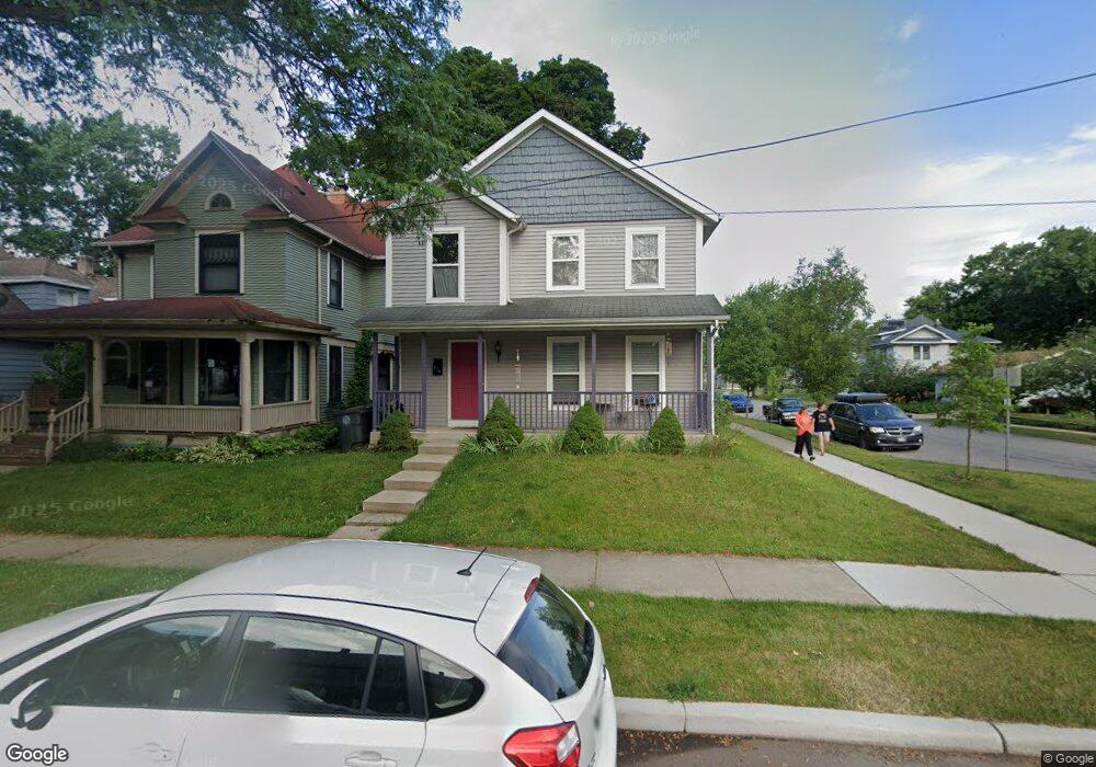
919 Leland Ave South Bend, IN 46616
Near Northwest NeighborhoodEstimated Value: $197,000 - $297,100
3
Beds
3
Baths
1,560
Sq Ft
$161/Sq Ft
Est. Value
About This Home
This home is located at 919 Leland Ave, South Bend, IN 46616 and is currently estimated at $251,525, approximately $161 per square foot. 919 Leland Ave is a home located in St. Joseph County with nearby schools including Muessel Primary Center, Clay Intermediate Center, and Jefferson Intermediate Traditional School.
Ownership History
Date
Name
Owned For
Owner Type
Purchase Details
Closed on
Aug 4, 2020
Sold by
Louise Mccollester Andrea
Bought by
Mccollester Andrea Louise and Mccollester Spencer G
Current Estimated Value
Purchase Details
Closed on
Dec 28, 2004
Sold by
Weiss Homes Inc
Bought by
Mccollester Andrea Louise
Home Financials for this Owner
Home Financials are based on the most recent Mortgage that was taken out on this home.
Original Mortgage
$71,500
Interest Rate
5.78%
Mortgage Type
New Conventional
Create a Home Valuation Report for This Property
The Home Valuation Report is an in-depth analysis detailing your home's value as well as a comparison with similar homes in the area
Home Values in the Area
Average Home Value in this Area
Purchase History
| Date | Buyer | Sale Price | Title Company |
|---|---|---|---|
| Mccollester Andrea Louise | -- | Tuesley Hall Konopa Llp | |
| Mccollester Andrea Louise | -- | None Available |
Source: Public Records
Mortgage History
| Date | Status | Borrower | Loan Amount |
|---|---|---|---|
| Previous Owner | Mccollester Andrea Louise | $71,500 |
Source: Public Records
Tax History Compared to Growth
Tax History
| Year | Tax Paid | Tax Assessment Tax Assessment Total Assessment is a certain percentage of the fair market value that is determined by local assessors to be the total taxable value of land and additions on the property. | Land | Improvement |
|---|---|---|---|---|
| 2024 | $3,464 | $288,400 | $12,300 | $276,100 |
| 2023 | $2,953 | $249,000 | $12,300 | $236,700 |
| 2022 | $2,691 | $223,800 | $12,300 | $211,500 |
| 2021 | $2,536 | $208,100 | $13,900 | $194,200 |
| 2020 | $1,848 | $153,500 | $10,200 | $143,300 |
| 2019 | $1,716 | $167,300 | $22,300 | $145,000 |
| 2018 | $1,634 | $137,100 | $8,800 | $128,300 |
| 2017 | $1,333 | $109,800 | $6,900 | $102,900 |
| 2016 | $1,369 | $110,900 | $6,900 | $104,000 |
| 2014 | $952 | $82,800 | $6,900 | $75,900 |
Source: Public Records
Map
Nearby Homes
- 918 Leland Ave Unit 918 & 920 Leland Ave
- 836 Forest Ave
- 1040 Woodward Ave
- 1052 Portage Ave
- 212 Marquette Ave
- 1116 Allen St
- 745 Allen St
- 715 Blaine Ave
- 1201 Allen St
- 1428 Marigold Way Unit 111
- 1026 N Michigan St
- 0.3 Acres W Marion St
- 1111 Lindsey St
- 211 W Marion St
- 414 N William St
- 611 Blaine Ave
- 1102 Diamond Ave
- 1253 Diamond Ave
- 1209 Poplar St
- 901 Lawndale St
- 917 Leland Ave
- 913 Leland Ave
- 610 California Ave
- 609 California Ave
- 612 California Ave
- 1003 Riverside Dr
- 911 Leland Ave
- 918 Leland Ave
- 611 California Ave
- 605 Rex St
- 1007 Riverside Dr
- 914 Leland Ave
- 622 California Ave
- 984 Riverside Dr
- 905 Leland Ave
- 613 California Ave Unit 615
- 975 Riverside Dr
- 1017 Riverside Dr
- 615 Rex St
- 910 Leland Ave