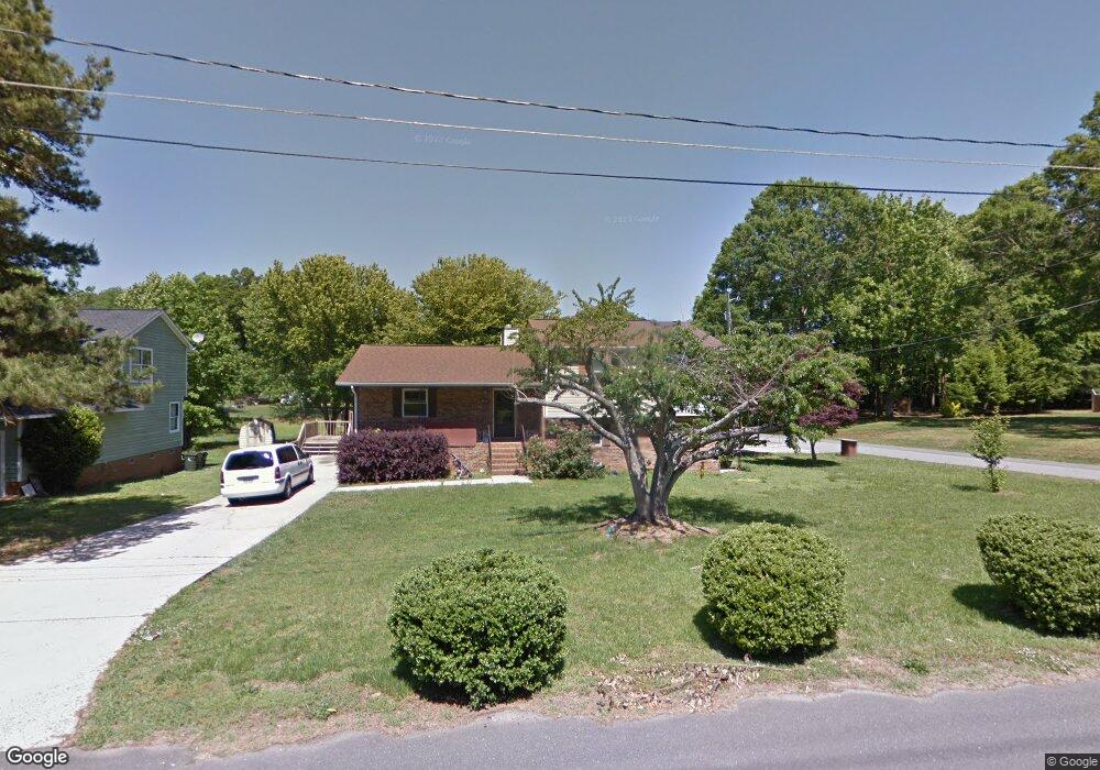
919 Memory Ln Unit A Monroe, NC 28112
Estimated Value: $174,000 - $385,000
8
Beds
4
Baths
1,461
Sq Ft
$200/Sq Ft
Est. Value
About This Home
This home is located at 919 Memory Ln Unit A, Monroe, NC 28112 and is currently estimated at $292,449, approximately $200 per square foot. 919 Memory Ln Unit A is a home located in Union County with nearby schools including Walter Bickett Elementary School, Monroe Middle School, and Monroe High School.
Ownership History
Date
Name
Owned For
Owner Type
Purchase Details
Closed on
Nov 17, 1998
Sold by
Duncan Donald E and Duncan Teresa H
Bought by
Wells Cheri
Current Estimated Value
Home Financials for this Owner
Home Financials are based on the most recent Mortgage that was taken out on this home.
Original Mortgage
$113,033
Outstanding Balance
$23,248
Interest Rate
6.47%
Mortgage Type
FHA
Estimated Equity
$269,201
Purchase Details
Closed on
May 22, 1996
Sold by
Duncan Donald E and Wife Teresa H
Bought by
Duncan Donald E and Wife Teresa H
Create a Home Valuation Report for This Property
The Home Valuation Report is an in-depth analysis detailing your home's value as well as a comparison with similar homes in the area
Purchase History
| Date | Buyer | Sale Price | Title Company |
|---|---|---|---|
| Wells Cheri | $115,000 | -- | |
| Duncan Donald E | $105,500 | -- |
Source: Public Records
Mortgage History
| Date | Status | Borrower | Loan Amount |
|---|---|---|---|
| Open | Wells Cheri | $113,033 |
Source: Public Records
Tax History
| Year | Tax Paid | Tax Assessment Tax Assessment Total Assessment is a certain percentage of the fair market value that is determined by local assessors to be the total taxable value of land and additions on the property. | Land | Improvement |
|---|---|---|---|---|
| 2025 | $3,203 | $366,400 | $0 | $0 |
| 2024 | $2,372 | $217,500 | $13,200 | $204,300 |
| 2023 | $2,094 | $192,000 | $13,200 | $178,800 |
| 2022 | $2,094 | $192,000 | $13,200 | $178,800 |
| 2021 | $2,094 | $192,000 | $13,200 | $178,800 |
| 2020 | $1,569 | $116,500 | $15,400 | $101,100 |
| 2019 | $1,569 | $116,500 | $15,400 | $101,100 |
| 2018 | $718 | $116,500 | $15,400 | $101,100 |
| 2017 | $1,593 | $116,500 | $15,400 | $101,100 |
| 2016 | $1,576 | $116,500 | $15,400 | $101,100 |
| 2015 | $905 | $116,500 | $15,400 | $101,100 |
| 2014 | $1,728 | $141,670 | $19,180 | $122,490 |
Source: Public Records
Map
Nearby Homes
- 1003 Oak Hill Dr Unit 24
- 1100 Lucille Ave
- 1104 Oak Hill Dr
- 415 Magnolia Dr
- 114 S Branch St
- 1008 Parker St
- 1022 Parker St
- 1103 W Franklin St
- 203 S Washington St
- 903 W Franklin St
- 925 Southridge Dr
- 111 S Washington St
- 0 Simpson Cir
- 1508 Marion St
- 302 N Johnson St
- 0 Labon St
- 620 Hunley St
- 1562 Secrest Commons Dr
- 406 S Church St
- 1554 Secrest Commons Dr
- 913 Memory Ln
- 1210 Harvard St
- 907 Memory Ln
- 1206 Harvard St
- 901 Memory Ln Unit A
- 901 Memory Ln
- 900 Memory Ln
- 1001 Memory Ln
- 1207 Lancaster Ave
- 1202 Harvard St
- 1207 Harvard St
- 1107 Lancaster Ave
- 1000 Memory Ln
- 1301 Lancaster Ave
- 1203 Harvard St
- 1110 Harvard St
- 1105 Lancaster Ave
- 1301 Harvard St
- 1122 Ann St
- 1120 Ann St
Your Personal Tour Guide
Ask me questions while you tour the home.