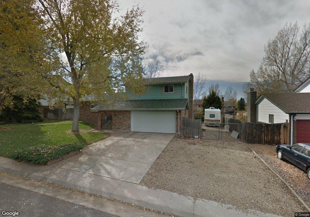
919 Mercury Cir Lone Tree, CO 80124
Estimated Value: $566,909 - $585,000
3
Beds
3
Baths
1,776
Sq Ft
$324/Sq Ft
Est. Value
About This Home
This home is located at 919 Mercury Cir, Lone Tree, CO 80124 and is currently estimated at $575,955, approximately $324 per square foot. 919 Mercury Cir is a home located in Douglas County with nearby schools including Acres Green Elementary School, Cresthill Middle School, and Highlands Ranch High School.
Ownership History
Date
Name
Owned For
Owner Type
Purchase Details
Closed on
Oct 19, 1992
Sold by
Mcinerney Michael K
Bought by
Kurapkat Michael T and Kurapkat Patricia L
Current Estimated Value
Purchase Details
Closed on
Oct 11, 1988
Sold by
Mcinerney Sandra K
Bought by
Mcinerney Michael K
Purchase Details
Closed on
Sep 30, 1985
Sold by
Elkins John and Elkins Terry
Bought by
Mcinerney Michael K and Mcinerney Sandra K
Purchase Details
Closed on
Feb 25, 1982
Sold by
Frankas Dennis J and Frankas Kathleen A
Bought by
Elkins John and Elkins Terry
Create a Home Valuation Report for This Property
The Home Valuation Report is an in-depth analysis detailing your home's value as well as a comparison with similar homes in the area
Home Values in the Area
Average Home Value in this Area
Purchase History
| Date | Buyer | Sale Price | Title Company |
|---|---|---|---|
| Kurapkat Michael T | $113,500 | -- | |
| Mcinerney Michael K | -- | -- | |
| Mcinerney Michael K | $94,500 | -- | |
| Elkins John | $92,000 | -- |
Source: Public Records
Tax History Compared to Growth
Tax History
| Year | Tax Paid | Tax Assessment Tax Assessment Total Assessment is a certain percentage of the fair market value that is determined by local assessors to be the total taxable value of land and additions on the property. | Land | Improvement |
|---|---|---|---|---|
| 2024 | $2,743 | $40,270 | $7,930 | $32,340 |
| 2023 | $2,771 | $40,270 | $7,930 | $32,340 |
| 2022 | $1,847 | $27,690 | $6,730 | $20,960 |
| 2021 | $1,920 | $27,690 | $6,730 | $20,960 |
| 2020 | $1,793 | $26,990 | $6,350 | $20,640 |
| 2019 | $1,799 | $26,990 | $6,350 | $20,640 |
| 2018 | $1,931 | $22,810 | $5,530 | $17,280 |
| 2017 | $1,963 | $22,810 | $5,530 | $17,280 |
| 2016 | $1,742 | $19,820 | $3,890 | $15,930 |
| 2015 | $1,781 | $19,820 | $3,890 | $15,930 |
| 2014 | $1,598 | $16,650 | $3,980 | $12,670 |
Source: Public Records
Map
Nearby Homes
- 789 Hamal Dr
- 979 Mercury Cir
- 7057 Chestnut Hill St
- 202 Helena Cir
- 13134 Deneb Dr
- 7041 Chestnut Hill Trail
- 426 Jupiter Dr
- 7971 Arrowhead Ct
- 13678 Omega Cir
- 9275 Erminedale Dr
- 8049 Sweet Water Rd
- 336 Aquarius Ct
- 7804 Silverweed Way
- 8159 Lodgepole Trail
- 250 Jupiter Dr
- 9416 Kemper Dr
- 7107 Mountain Brush Cir
- 13483 Achilles Dr
- 9412 La Quinta Way
- 383 Helena Cir
- 925 Mercury Cir
- 13256 Peacock Dr
- 13266 Peacock Dr
- 909 Mercury Cir
- 924 Mercury Cir
- 929 Mercury Cir
- 918 Mercury Cir
- 13236 Peacock Dr
- 928 Mercury Cir
- 914 Mercury Cir
- 13286 Peacock Dr
- 905 Mercury Cir
- 935 Mercury Cir
- 934 Mercury Cir
- 13245 Peacock Dr
- 13226 Peacock Dr
- 13255 Peacock Dr
- 13235 Peacock Dr
- 13327 Rigel Dr
- 13317 Rigel Dr