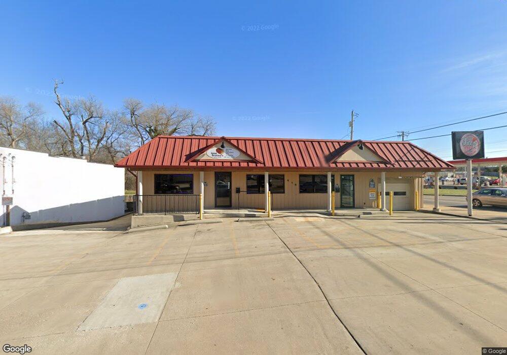
919 S Main St Mansfield, OH 44907
Estimated Value: $327,915
Studio
--
Bath
4,204
Sq Ft
$78/Sq Ft
Est. Value
About This Home
This home is located at 919 S Main St, Mansfield, OH 44907 and is currently estimated at $327,915, approximately $78 per square foot. 919 S Main St is a home located in Richland County with nearby schools including Madison High School, St. Peter's Elementary/Montessori School, and Mansfield Christian School.
Ownership History
Date
Name
Owned For
Owner Type
Purchase Details
Closed on
Oct 14, 2009
Sold by
Schneider Curtis A and Arnold Leonard R
Bought by
Mansfield Southside Properties Llc
Current Estimated Value
Purchase Details
Closed on
Feb 16, 2000
Sold by
Berggren Donna
Bought by
Arnold Leonard R and Arnold Angeline J
Purchase Details
Closed on
Dec 5, 1994
Sold by
Berggren Donna
Bought by
Arnold Leonard R and Arnold Angeline J
Purchase Details
Closed on
Aug 29, 1990
Create a Home Valuation Report for This Property
The Home Valuation Report is an in-depth analysis detailing your home's value as well as a comparison with similar homes in the area
Home Values in the Area
Average Home Value in this Area
Purchase History
| Date | Buyer | Sale Price | Title Company |
|---|---|---|---|
| Mansfield Southside Properties Llc | $45,000 | Chicago Title | |
| Arnold Leonard R | $140,000 | -- | |
| Arnold Leonard R | $140,000 | -- | |
| -- | $100,000 | -- |
Source: Public Records
Mortgage History
| Date | Status | Borrower | Loan Amount |
|---|---|---|---|
| Closed | Arnold Leonard R | $0 |
Source: Public Records
Tax History
| Year | Tax Paid | Tax Assessment Tax Assessment Total Assessment is a certain percentage of the fair market value that is determined by local assessors to be the total taxable value of land and additions on the property. | Land | Improvement |
|---|---|---|---|---|
| 2024 | $1,460 | $18,640 | $7,910 | $10,730 |
| 2023 | $1,460 | $18,640 | $7,910 | $10,730 |
| 2022 | $1,407 | $17,780 | $7,190 | $10,590 |
| 2021 | $1,403 | $17,780 | $7,190 | $10,590 |
| 2020 | $1,410 | $17,780 | $7,190 | $10,590 |
| 2019 | $1,417 | $17,780 | $7,190 | $10,590 |
| 2018 | $1,421 | $17,780 | $7,190 | $10,590 |
| 2017 | $1,400 | $17,780 | $7,190 | $10,590 |
| 2016 | $1,218 | $15,750 | $7,190 | $8,560 |
| 2015 | $1,203 | $15,750 | $7,190 | $8,560 |
| 2014 | $1,202 | $15,750 | $7,190 | $8,560 |
| 2012 | $1,057 | $15,750 | $7,190 | $8,560 |
Source: Public Records
Map
Nearby Homes
- 33 Rambleside Dr
- 104 Elmridge Rd
- 101 Chilton Ave
- 1179 Burkwood Rd
- 65 Logan Rd
- 0 Lexington Ave Unit 224009661
- 716 Mansfield Washington Rd
- 794 Mansfield Washington Rd
- 470 Lexington Ave
- 466 Lexington Ave
- 456 Lexington Ave
- 430 Beethoven St
- 400 James Ave
- 575 Crescent Rd
- 0 George Ave
- 519 S Diamond St
- 377 S Main St
- 27 Dunbilt Ct
- 219 Lexington Ave
- 810 Lexington Ave
- 911 S Main St
- 15 E Cook Rd
- 0 W Cook Rd Unit 747293
- 0 W Cook Rd Unit 3938819
- 0 W Cook Rd Unit 225001803
- 0 W Cook Rd Unit 502368
- 0 W Cook Rd Unit 500540
- 0 W Cook Rd Unit 9038166
- 0 W Cook Rd Unit 9044734
- 0 W Cook Rd Unit 9045321
- 0 W Cook Rd Unit 9054873
- 0 W Cook Rd Unit 217032912
- 0 W Cook Rd Unit 20180002
- 0 W Cook Rd Unit 20190713
- 0 W Cook Rd Unit 219036512
- 0 W Cook Rd Unit 219028922
- 907 S Main St
- 27 E Cook Rd
- 895 S Main St
- 31 E Cook Rd