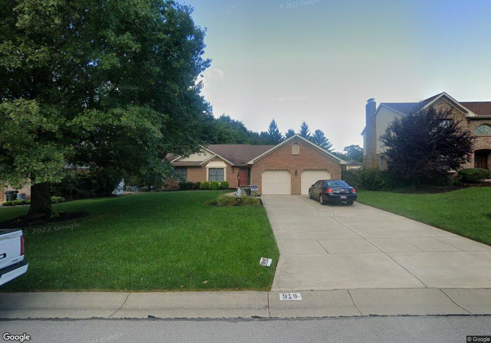
919 Sundance Dr Cincinnati, OH 45233
Cotillion Village NeighborhoodEstimated Value: $371,973 - $417,000
3
Beds
2
Baths
1,933
Sq Ft
$203/Sq Ft
Est. Value
About This Home
This home is located at 919 Sundance Dr, Cincinnati, OH 45233 and is currently estimated at $391,743, approximately $202 per square foot. 919 Sundance Dr is a home located in Hamilton County with nearby schools including John Foster Dulles Elementary School, Rapid Run Middle School, and Oak Hills High School.
Ownership History
Date
Name
Owned For
Owner Type
Purchase Details
Closed on
Feb 29, 2008
Sold by
Spencer Nora R and Spencer Richard H
Bought by
Gilday Neal E and Gilday Carolyn M
Current Estimated Value
Home Financials for this Owner
Home Financials are based on the most recent Mortgage that was taken out on this home.
Original Mortgage
$60,000
Interest Rate
5.51%
Mortgage Type
Unknown
Purchase Details
Closed on
May 17, 2004
Sold by
Cain Paul T and Cain Carroll Patricia Ann
Bought by
Spencer Richard H and Spencer Nora R
Home Financials for this Owner
Home Financials are based on the most recent Mortgage that was taken out on this home.
Original Mortgage
$100,000
Interest Rate
5.91%
Mortgage Type
Unknown
Create a Home Valuation Report for This Property
The Home Valuation Report is an in-depth analysis detailing your home's value as well as a comparison with similar homes in the area
Home Values in the Area
Average Home Value in this Area
Purchase History
| Date | Buyer | Sale Price | Title Company |
|---|---|---|---|
| Gilday Neal E | $210,000 | Advanced Land Title Agency | |
| Spencer Richard H | $215,000 | Advanced Land Title Agency L |
Source: Public Records
Mortgage History
| Date | Status | Borrower | Loan Amount |
|---|---|---|---|
| Closed | Gilday Neal E | $60,000 | |
| Previous Owner | Spencer Richard H | $100,000 |
Source: Public Records
Tax History Compared to Growth
Tax History
| Year | Tax Paid | Tax Assessment Tax Assessment Total Assessment is a certain percentage of the fair market value that is determined by local assessors to be the total taxable value of land and additions on the property. | Land | Improvement |
|---|---|---|---|---|
| 2024 | $6,603 | $113,981 | $17,395 | $96,586 |
| 2023 | $6,623 | $113,981 | $17,395 | $96,586 |
| 2022 | $5,363 | $82,075 | $19,901 | $62,174 |
| 2021 | $5,252 | $82,075 | $19,901 | $62,174 |
| 2020 | $5,327 | $82,075 | $19,901 | $62,174 |
| 2019 | $5,751 | $79,685 | $19,320 | $60,365 |
| 2018 | $5,757 | $79,685 | $19,320 | $60,365 |
| 2017 | $5,197 | $79,685 | $19,320 | $60,365 |
| 2016 | $4,556 | $69,944 | $17,675 | $52,269 |
| 2015 | $4,562 | $69,944 | $17,675 | $52,269 |
| 2014 | $4,567 | $69,944 | $17,675 | $52,269 |
| 2013 | $4,255 | $69,251 | $17,500 | $51,751 |
Source: Public Records
Map
Nearby Homes
- 6474 Simon Dr
- 1118 Timbervalley Ct
- 837 Martini Rd
- 665 Fox Trails Way
- 6278 Gardenlake Ct
- 6226 Rapid Run Rd
- 1259 Wexford Ln
- 6164 Hillside Ave
- 241 Monitor Ave
- 133 Meridian St
- 127 Meridian St
- 400 Parkview Cir
- 174 Twain Ave
- 6730 Daniels Walk
- 6723 Daniels Walk
- 6725 Daniels Walk
- 6516 Parkland Ave
- 6631 Home City Ave
- 6713 Daniels Walk
- 2196 Quail Run Farm Ln
- 905 Sundance Dr
- 933 Sundance Dr
- 6621 Cassidy Ct
- 6620 Chaparal Ct
- 947 Sundance Dr
- 6628 Chaparal Ct
- 912 Sundance Dr
- 926 Sundance Dr
- 6629 Cassidy Ct
- 898 Sundance Dr
- 6628 Chaparral Ct
- 940 Sundance Dr
- 6636 Chaparal Ct
- 884 Sundance Dr
- 6637 Cassidy Ct
- 954 Sundance Dr
- 867 Sundance Dr
- 870 Sundance Dr
- 6612 Cassidy Ct
- 6620 Cassidy Ct